
| Memorials | : | 4391 |
| Location | : | Rifle, Garfield County, USA |
| Phone | : | 970-665-6484 |
| Coordinate | : | 39.5381012, -107.7742004 |
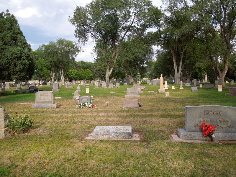
| Description | : | Located next to Saint Mary's Catholic Church. The cemetery was here long before the church was built. Burials range from the early 1890s through the present. Some burials predate the official establishment of the cemetery. There is an information shed at the NE corner of the cemetery with index books and plot maps to help find specific grave sites. |
frequently asked questions (FAQ):
-
Where is Rose Hill Cemetery?
Rose Hill Cemetery is located at 777 Birch Ave Rifle, Garfield County ,Colorado , 81650USA.
-
Rose Hill Cemetery cemetery's updated grave count on graveviews.com?
4385 memorials
-
Where are the coordinates of the Rose Hill Cemetery?
Latitude: 39.5381012
Longitude: -107.7742004


Nearby Cemetories:
1. Skyline Cemetery
Silt, Garfield County, USA
Coordinate: 39.5520060, -107.6575300
2. Rulison Cemetery
Rulison, Garfield County, USA
Coordinate: 39.4768000, -107.9357000
3. Union Divide Creek Cemetery
Silt, Garfield County, USA
Coordinate: 39.4508018, -107.6200027
4. Highland Cemetery
New Castle, Garfield County, USA
Coordinate: 39.5875015, -107.5192032
5. Battlement Cemetery
Parachute, Garfield County, USA
Coordinate: 39.4380989, -108.0291977
6. Russey-Hurlburt Cemetery
Parachute, Garfield County, USA
Coordinate: 39.4522018, -108.0575027
7. Blackman Ranch Cemetery
Collbran, Mesa County, USA
Coordinate: 39.2647420, -107.8554350
8. Clover Cemetery
Collbran, Mesa County, USA
Coordinate: 39.2550011, -107.9227982
9. Cedar Crest Cemetery
Collbran, Mesa County, USA
Coordinate: 39.2369003, -107.9589005
10. Farnum Holt Columbarium
Glenwood Springs, Garfield County, USA
Coordinate: 39.5469640, -107.3299900
11. Pioneer Cemetery
Glenwood Springs, Garfield County, USA
Coordinate: 39.5392000, -107.3192000
12. Rosebud Cemetery
Glenwood Springs, Garfield County, USA
Coordinate: 39.5168991, -107.3189011
13. Eagalite Cemetery
Plateau City, Mesa County, USA
Coordinate: 39.2228012, -107.9894028
14. DeBeque Cemetery
Mesa County, USA
Coordinate: 39.3374060, -108.2138900
15. Marion Cemetery
Garfield County, USA
Coordinate: 39.3689003, -107.3047028
16. Molina Cemetery
Molina, Mesa County, USA
Coordinate: 39.1886000, -108.0629000
17. Evergreen Cemetery
Carbondale, Garfield County, USA
Coordinate: 39.4077988, -107.2155991
18. Fisher Cemetery
Carbondale, Garfield County, USA
Coordinate: 39.4791985, -107.1911011
19. Mesa Cemetery
Mesa, Mesa County, USA
Coordinate: 39.1685982, -108.1188965
20. Hillcrest Cemetery
Carbondale, Garfield County, USA
Coordinate: 39.3922005, -107.1936035
21. Highland Cemetery
Meeker, Rio Blanco County, USA
Coordinate: 40.0311012, -107.9111023
22. Camp on White River Cemetery
Meeker, Rio Blanco County, USA
Coordinate: 40.0380100, -107.9131000
23. Black Sulphur Cemetery
Meeker, Rio Blanco County, USA
Coordinate: 39.8600800, -108.3109500
24. Miller Hill Cemetery
Rio Blanco County, USA
Coordinate: 39.8847008, -108.2906036