
| Memorials | : | 1 |
| Location | : | Canyonville, Douglas County, USA |
| Coordinate | : | 42.9358900, -123.2813100 |
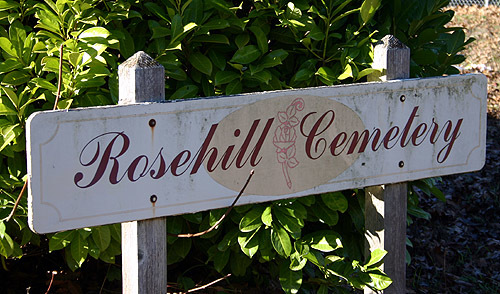
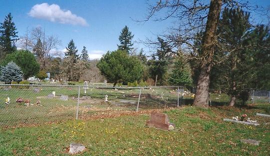
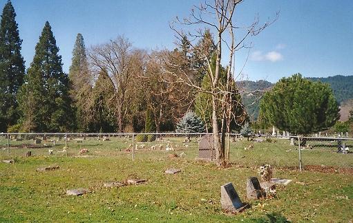
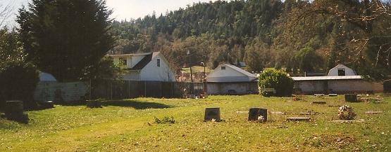
| Description | : | There are 3 cemeteries adjacent to one another next to the Seven Feathers Casino in Canyonville, Douglas Co., Oregon: IOOF, Masonic & Rosehill. There are separate cemetery listings for each on Findagrave although the locals refer to the Masonic & IOOF cemeteries as "Canyonville Cemetery". The Masonic listings are under "Canyonville Cemetery". Rosehill Cemetery is right next to the Masonic Cemetery with its own entrance and signage. It is very small. A fence separates it from the Masonic cemetery. The Rosehill Cemetery was created & owned by the Canyonville Bible Academy, now known as Canyonville Christian Academy. |
frequently asked questions (FAQ):
-
Where is Rosehill Cemetery?
Rosehill Cemetery is located at Stage Coach Road & Catalpa Lane Canyonville, Douglas County ,Oregon ,USA.
-
Rosehill Cemetery cemetery's updated grave count on graveviews.com?
1 memorials
-
Where are the coordinates of the Rosehill Cemetery?
Latitude: 42.9358900
Longitude: -123.2813100
Nearby Cemetories:
1. Canyonville Cemetery
Canyonville, Douglas County, USA
Coordinate: 42.9366989, -123.2806015
2. Pioneer Cemetery
Canyonville, Douglas County, USA
Coordinate: 42.9258230, -123.2808530
3. Briggs Cemetery
Canyonville, Douglas County, USA
Coordinate: 42.9493420, -123.3131450
4. Yokum Cemetery
Douglas County, USA
Coordinate: 42.9431800, -123.3410100
5. Riddle Cemetery
Riddle, Douglas County, USA
Coordinate: 42.9486008, -123.3764038
6. Pioneer Cemetery
Myrtle Creek, Douglas County, USA
Coordinate: 43.0186005, -123.2949982
7. Dumont Cemetery
Days Creek, Douglas County, USA
Coordinate: 42.9768700, -123.1812660
8. Myrtle Creek IOOF Cemetery
Myrtle Creek, Douglas County, USA
Coordinate: 43.0332985, -123.2818985
9. Bland Mountain Cemetery
Douglas County, USA
Coordinate: 42.9528008, -123.1271973
10. Bryant Cemetery
Douglas County, USA
Coordinate: 43.0381012, -123.1738968
11. Helgeson Family Cemetery
Myrtle Creek, Douglas County, USA
Coordinate: 43.0616300, -123.3562280
12. Lavadoure Cemetery
Douglas County, USA
Coordinate: 42.9444008, -123.0931015
13. Burnett Cemetery
Douglas County, USA
Coordinate: 43.0694008, -123.3591995
14. Quines Creek Cemetery
Douglas County, USA
Coordinate: 42.7896996, -123.2683029
15. Gilham Cemetery
Azalea, Douglas County, USA
Coordinate: 42.7812280, -123.2959130
16. Willis Creek Cemetery
Dillard, Douglas County, USA
Coordinate: 43.0630989, -123.4036026
17. Wilson Family Cemetery
Glendale, Douglas County, USA
Coordinate: 42.7753400, -123.3159800
18. Stephens Cemetery
Myrtle Creek, Douglas County, USA
Coordinate: 43.0401000, -123.0826400
19. Letitia Cemetery
Douglas County, USA
Coordinate: 43.0402985, -123.0819016
20. Mountain Grove Cemetery
Glendale, Douglas County, USA
Coordinate: 42.7545710, -123.3265090
21. Civil Bend Cemetery
Winston, Douglas County, USA
Coordinate: 43.1180992, -123.4163971
22. Thomas Cemetery
Green, Douglas County, USA
Coordinate: 43.1433300, -123.3056300
23. Winston Family Cemetery
Winston, Douglas County, USA
Coordinate: 43.1313000, -123.3973000
24. Cox Cemetery
Douglas County, USA
Coordinate: 43.1171989, -123.4357986