
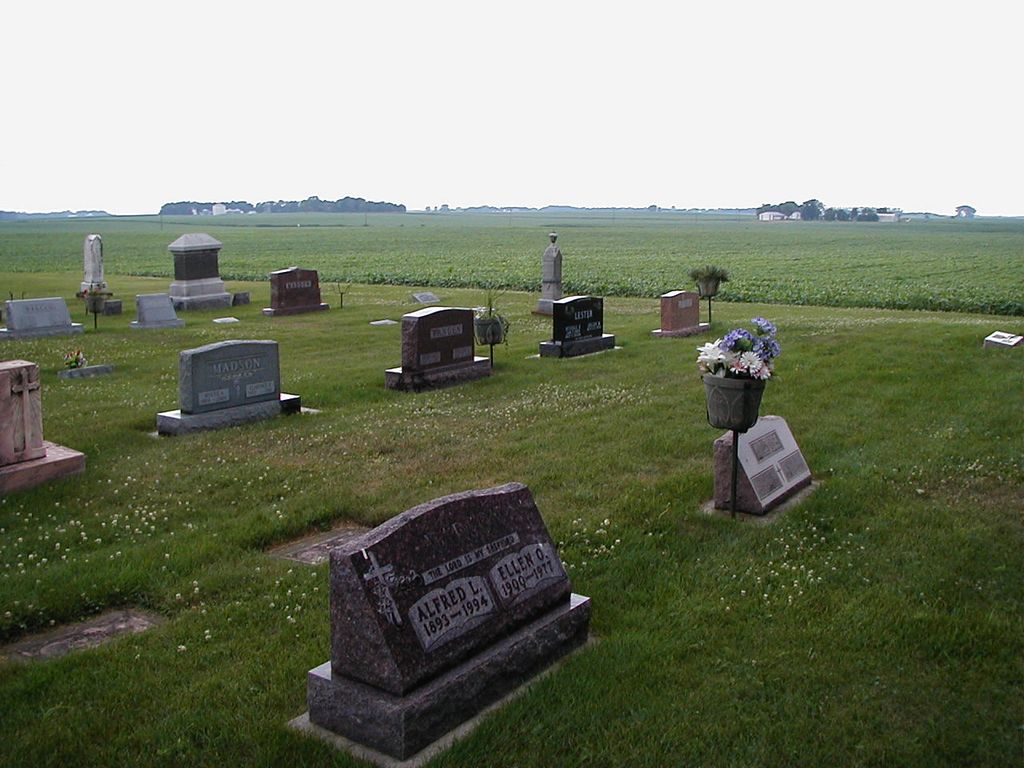
| Memorials | : | 1 |
| Location | : | Madelia, Watonwan County, USA |
| Coordinate | : | 44.0005608, -94.5152817 |
frequently asked questions (FAQ):
-
Where is Rosendale Pioneer Cemetery?
Rosendale Pioneer Cemetery is located at Madelia, Watonwan County ,Minnesota ,USA.
-
Rosendale Pioneer Cemetery cemetery's updated grave count on graveviews.com?
1 memorials
-
Where are the coordinates of the Rosendale Pioneer Cemetery?
Latitude: 44.0005608
Longitude: -94.5152817
Nearby Cemetories:
1. Riverdale Township Cemetery
Grogan, Watonwan County, USA
Coordinate: 44.0523350, -94.5496900
2. First Evangelical Lutheran Church Cemetery
Madelia, Watonwan County, USA
Coordinate: 44.0569000, -94.4608000
3. Calvary Cemetery
Saint James, Watonwan County, USA
Coordinate: 43.9853410, -94.6098590
4. Faith Lutheran Cemetery
Madelia, Watonwan County, USA
Coordinate: 44.0514000, -94.4403000
5. Trinity Lutheran Cemetery
Madelia, Watonwan County, USA
Coordinate: 44.0514000, -94.4403000
6. LaSalle Lutheran Cemetery
La Salle, Watonwan County, USA
Coordinate: 44.0688896, -94.5733337
7. Mount Hope Cemetery
Saint James, Watonwan County, USA
Coordinate: 43.9632988, -94.6203003
8. Riverside Cemetery
Madelia, Watonwan County, USA
Coordinate: 44.0469017, -94.4052963
9. Calvary Cemetery
Madelia, Watonwan County, USA
Coordinate: 44.0485992, -94.3981018
10. Lambs Cemetery
South Branch, Watonwan County, USA
Coordinate: 43.9131540, -94.5862980
11. Zion Lutheran Church Cemetery
Lewisville, Watonwan County, USA
Coordinate: 43.9207993, -94.4135971
12. Trinity Fieldon Evangelical Lutheran Cemetery
Lewisville, Watonwan County, USA
Coordinate: 43.9636002, -94.3694000
13. East Sveadahl Cemetery
Saint James, Watonwan County, USA
Coordinate: 44.0486107, -94.6602783
14. Antrim Public Cemetery
Lewisville, Watonwan County, USA
Coordinate: 43.9056015, -94.4178009
15. Saint Johns Lutheran Church Cemetery
South Branch Township, Watonwan County, USA
Coordinate: 43.8847330, -94.5480700
16. Zion Evangelical Lutheran Cemetery
Blue Earth County, USA
Coordinate: 43.9491997, -94.3494034
17. Lake Hanska Lutheran Cemetery
Hanska, Brown County, USA
Coordinate: 44.1316986, -94.5132980
18. Linden Lutheran Church Cemetery
Brown County, USA
Coordinate: 44.1234400, -94.4277000
19. Mount Pisquah Cemetery
Hanska, Brown County, USA
Coordinate: 44.1431007, -94.4819031
20. Zion Lutheran Cemetery
Hanska, Brown County, USA
Coordinate: 44.1492004, -94.5053024
21. Saint Johns Lutheran Cemetery
Watonwan County, USA
Coordinate: 43.8630981, -94.4282990
22. Ridge Lawn Cemetery
Truman, Martin County, USA
Coordinate: 43.8619003, -94.4306030
23. Lincoln Lutheran Cemetery
Lincoln, Blue Earth County, USA
Coordinate: 44.0943000, -94.3446600
24. James Gail Cemetery
Blue Earth County, USA
Coordinate: 44.0588989, -94.3147964