
| Memorials | : | 0 |
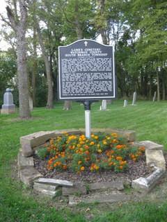
| Location | : | South Branch, Watonwan County, USA |
| Coordinate | : | 43.9131540, -94.5862980 |
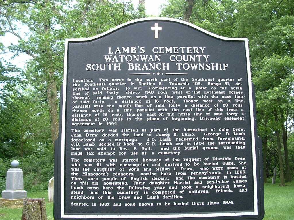
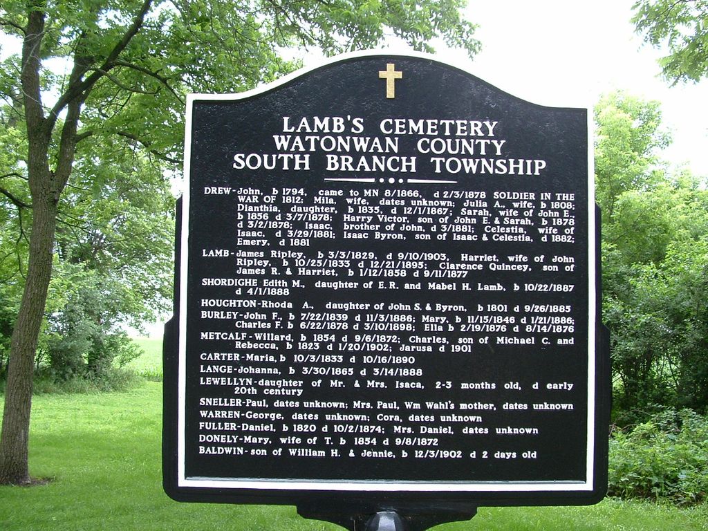
| Description | : | This cemetery has been restored after being almost forgotten. The headstones may have been rearranged. A sign says that those buried there include Rhoda Houghton daughter of John and Byron (sic); Charles, son of Michael and Rebecca Metcalf born 1823 died 1902; Jerusha Metcalf died 1901; Daniel Fuller born 1820 died 1874 and Mrs. Daniel Fuller. There were lots of hungry mosquitoes at this cemetery. |
frequently asked questions (FAQ):
-
Where is Lambs Cemetery?
Lambs Cemetery is located at South Branch, Watonwan County ,Minnesota ,USA.
-
Lambs Cemetery cemetery's updated grave count on graveviews.com?
0 memorials
-
Where are the coordinates of the Lambs Cemetery?
Latitude: 43.9131540
Longitude: -94.5862980
Nearby Cemetories:
1. Saint Johns Lutheran Church Cemetery
South Branch Township, Watonwan County, USA
Coordinate: 43.8847330, -94.5480700
2. Mount Hope Cemetery
Saint James, Watonwan County, USA
Coordinate: 43.9632988, -94.6203003
3. Calvary Cemetery
Saint James, Watonwan County, USA
Coordinate: 43.9853410, -94.6098590
4. Long Lake Lutheran Cemetery
Saint James, Watonwan County, USA
Coordinate: 43.8875008, -94.6897202
5. Immanuel Lutheran Cemetery
Ormsby, Martin County, USA
Coordinate: 43.8196678, -94.6341705
6. Kansas Lake Lutheran Cemetery
Butterfield, Watonwan County, USA
Coordinate: 43.9062119, -94.7254868
7. Rosendale Pioneer Cemetery
Madelia, Watonwan County, USA
Coordinate: 44.0005608, -94.5152817
8. Waverly Lutheran Cemetery
Trimont, Martin County, USA
Coordinate: 43.8044395, -94.6058273
9. Antrim Public Cemetery
Lewisville, Watonwan County, USA
Coordinate: 43.9056015, -94.4178009
10. Ridge Lawn Cemetery
Truman, Martin County, USA
Coordinate: 43.8619003, -94.4306030
11. Saint Johns Lutheran Cemetery
Watonwan County, USA
Coordinate: 43.8630981, -94.4282990
12. Zion Lutheran Church Cemetery
Lewisville, Watonwan County, USA
Coordinate: 43.9207993, -94.4135971
13. Zion Lutheran Cemetery
Odin, Watonwan County, USA
Coordinate: 43.8630981, -94.7506027
14. Saint Pauls Lutheran Cemetery
Truman, Martin County, USA
Coordinate: 43.8485985, -94.4291992
15. Riverdale Township Cemetery
Grogan, Watonwan County, USA
Coordinate: 44.0523350, -94.5496900
16. East Sveadahl Cemetery
Saint James, Watonwan County, USA
Coordinate: 44.0486107, -94.6602783
17. Saint Olaf Cemetery
Martin County, USA
Coordinate: 43.8458290, -94.7736130
18. Saint Matthews Evangelical Lutheran Cemetery
Butterfield, Watonwan County, USA
Coordinate: 43.9489100, -94.7899800
19. Butterfield City Cemetery
Butterfield, Watonwan County, USA
Coordinate: 43.9489600, -94.7909400
20. North Star Cemetery
Martin County, USA
Coordinate: 43.7599983, -94.5721970
21. Cedar Lake Cemetery
Trimont, Martin County, USA
Coordinate: 43.7977982, -94.7316971
22. LaSalle Lutheran Cemetery
La Salle, Watonwan County, USA
Coordinate: 44.0688896, -94.5733337
23. Trinity Fieldon Evangelical Lutheran Cemetery
Lewisville, Watonwan County, USA
Coordinate: 43.9636002, -94.3694000
24. Mennonite Church of Butterfield Cemetery
Watonwan County, USA
Coordinate: 43.9752990, -94.7986450