
| Memorials | : | 1 |
| Location | : | Berryville, Clarke County, USA |
| Coordinate | : | 39.1800550, -77.9138230 |
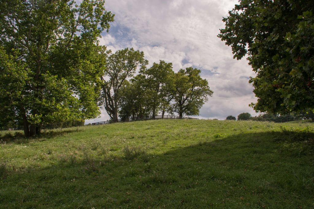
| Description | : | Cemetery is located on a private property named Runnymeade Farm on Shepherd's Mill Rd. in Berryville, Virginia. Please inform the resident that you would like to visit the grave locations upon visiting. As you enter the main gate, on the left hand side of the road there is the remnants of an old barn foundation. The old barn foundation is close to where the original log cabin was built. Directly across the driveway from the old barn foundations, on the next hill, is the Runnymeade Cemetery. It sits underneath the trees. Cemetery at times has been referred to as "overgrown". Many... Read More |
frequently asked questions (FAQ):
-
Where is Runnymeade Cemetery?
Runnymeade Cemetery is located at 3838 Shepherds Mill Rd. Berryville, Clarke County ,Virginia , 22611USA.
-
Runnymeade Cemetery cemetery's updated grave count on graveviews.com?
0 memorials
-
Where are the coordinates of the Runnymeade Cemetery?
Latitude: 39.1800550
Longitude: -77.9138230
Nearby Cemetories:
1. Lewis Muse Graveyard
Rippon, Jefferson County, USA
Coordinate: 39.1811590, -77.8905340
2. Wickliffe Episcopal Church Cemetery
Wickliffe, Clarke County, USA
Coordinate: 39.1662090, -77.8913630
3. Burns Family Cemetery
Franklintown, Jefferson County, USA
Coordinate: 39.2077485, -77.9308778
4. Locust Grove Cemetery
Franklintown, Jefferson County, USA
Coordinate: 39.2080990, -77.9307680
5. Old School Baptist Churchyard
Rippon, Jefferson County, USA
Coordinate: 39.2167850, -77.9073720
6. Roper Cemetery
Meyerstown, Jefferson County, USA
Coordinate: 39.1695730, -77.8602520
7. Cool Spring Catholic Cemetery
Berryville, Clarke County, USA
Coordinate: 39.1463500, -77.8761020
8. Holy Cross Abbey Cemetery
Berryville, Clarke County, USA
Coordinate: 39.1463380, -77.8761020
9. Myerstown Cemetery
Jefferson County, USA
Coordinate: 39.2065740, -77.8656560
10. Cool Spring Natural Cemetery
Berryville, Clarke County, USA
Coordinate: 39.1376970, -77.8847300
11. Lock Family Cemetery
Wheatland, Jefferson County, USA
Coordinate: 39.2273780, -77.8872300
12. Green Hill Cemetery
Berryville, Clarke County, USA
Coordinate: 39.1581001, -77.9768982
13. AME Church Cemetery
Berryville, Clarke County, USA
Coordinate: 39.1541940, -77.9803560
14. Duncan Memorial United Methodist Church Cemetery
Berryville, Clarke County, USA
Coordinate: 39.1492140, -77.9774040
15. Grace Episcopal Church Cemetery
Berryville, Clarke County, USA
Coordinate: 39.1524390, -77.9800680
16. Kabletown Churchyard
Kabletown, Jefferson County, USA
Coordinate: 39.2215881, -77.8597183
17. Thomas Blakemore Family Farm Cemetery
Berryville, Clarke County, USA
Coordinate: 39.1724620, -77.9900770
18. Berryville Baptist Church Cemetery
Berryville, Clarke County, USA
Coordinate: 39.1534060, -77.9826350
19. Milton Valley Cemetery
Berryville, Clarke County, USA
Coordinate: 39.1399994, -77.9792023
20. Quaker Cemetery
Charles Town, Jefferson County, USA
Coordinate: 39.2442586, -77.9017906
21. Bullskin Presbyterian Churchyard
Summit Point, Jefferson County, USA
Coordinate: 39.2372940, -77.9578650
22. Crums Cemetery
Berryville, Clarke County, USA
Coordinate: 39.2092018, -78.0018997
23. Jamestown Cemetery
Summit Point, Jefferson County, USA
Coordinate: 39.2346800, -77.9842300
24. Prosperity Baptist Church Cemetery
Summit Point, Jefferson County, USA
Coordinate: 39.2387730, -77.9843590