
| Memorials | : | 0 |
| Location | : | Sharonville, Hamilton County, USA |
| Coordinate | : | 39.2881670, -84.3953890 |
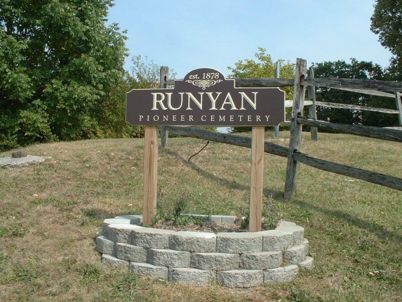
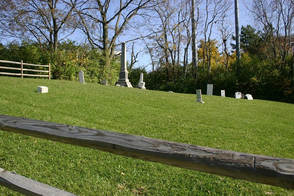
| Description | : | The cemetery is located on the southeast corner of the intersection of Lebanon Road (US 42) and I-275. The Runyan Cemetery was officially recorded as a cemetery on 16 February 1878, although it was being used as a burial ground before the deed was recorded. The Smeizer Cemetery is either the same as the Runyan Cemetery or immediately adjacent to it. No evidence of it as a separate burial ground exists. The cemetery is located in Sycamore Township, Hamilton County, Ohio, and is # 4754 (Runyan Cemetery / Smeizer Cemetery) in “Ohio Cemeteries 1803-2003”, compiled by the Ohio... Read More |
frequently asked questions (FAQ):
-
Where is Runyan Cemetery?
Runyan Cemetery is located at US Rte. 42 and I-275 Sharonville, Hamilton County ,Ohio , 45241USA.
-
Runyan Cemetery cemetery's updated grave count on graveviews.com?
0 memorials
-
Where are the coordinates of the Runyan Cemetery?
Latitude: 39.2881670
Longitude: -84.3953890
Nearby Cemetories:
1. Cummins Cemetery
Sharonville, Hamilton County, USA
Coordinate: 39.2815666, -84.4005814
2. Whallon Burial Ground (Defunct)
Gano, Butler County, USA
Coordinate: 39.2983610, -84.4096920
3. Coleman Cemetery
Sharonville, Hamilton County, USA
Coordinate: 39.2705879, -84.4042892
4. Sharonville Cemetery
Sharonville, Hamilton County, USA
Coordinate: 39.2683520, -84.4147250
5. Pisgah Cemetery
Pisgah, Butler County, USA
Coordinate: 39.3079180, -84.3696510
6. Crestview Presbyterian Church Memorial Garden
West Chester, Butler County, USA
Coordinate: 39.3130600, -84.3770980
7. Shuff - Myers Pioneer Cemetery
Sharonville, Hamilton County, USA
Coordinate: 39.2593010, -84.4004230
8. Rest Haven Memorial Park
Evendale, Hamilton County, USA
Coordinate: 39.2505989, -84.4005966
9. West Chester Cemetery
West Chester, Butler County, USA
Coordinate: 39.3256670, -84.4136560
10. Landmark Memorial Gardens
Glendale, Hamilton County, USA
Coordinate: 39.2607300, -84.4442300
11. Mill Creek Presbyterian Churchyard
Glendale, Hamilton County, USA
Coordinate: 39.2636604, -84.4506836
12. Tucker Station Cemetery
Glendale, Hamilton County, USA
Coordinate: 39.2621500, -84.4506080
13. Bethany Episcopal Day School Chapel Crypt
Glendale, Hamilton County, USA
Coordinate: 39.2657260, -84.4539850
14. Carpenters Run Pioneer Cemetery
Blue Ash, Hamilton County, USA
Coordinate: 39.2374600, -84.3962050
15. Oak Hill Cemetery
Glendale, Hamilton County, USA
Coordinate: 39.2797012, -84.4625015
16. Gate of Heaven Cemetery
Montgomery, Hamilton County, USA
Coordinate: 39.2630997, -84.3324966
17. Chapel of the Rose and Columbarium
Montgomery, Hamilton County, USA
Coordinate: 39.2473160, -84.3460530
18. Montgomery United Jewish Cemetery
Montgomery, Hamilton County, USA
Coordinate: 39.2441700, -84.3502800
19. Skillman Family Cemetery
Woodlawn, Hamilton County, USA
Coordinate: 39.2588654, -84.4576950
20. Christ Church Glendale Chapel Columbarium
Glendale, Hamilton County, USA
Coordinate: 39.2721430, -84.4660500
21. Hopewell Cemetery
Montgomery, Hamilton County, USA
Coordinate: 39.2439003, -84.3482971
22. Glenmary Mission Seminary Cemetery (Defunct)
Springdale, Hamilton County, USA
Coordinate: 39.2828320, -84.4706510
23. Holy Rood Catholic Cemetery
Glendale, Hamilton County, USA
Coordinate: 39.2760380, -84.4696950
24. Keltner Cemetery
Mason, Warren County, USA
Coordinate: 39.3372765, -84.3479385