
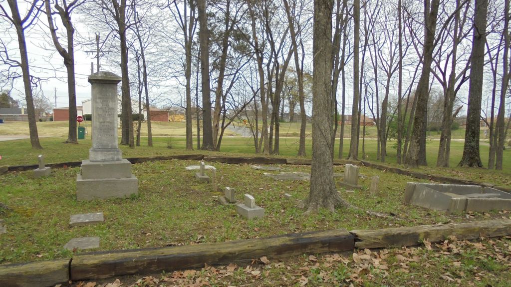
| Memorials | : | 0 |
| Location | : | Olive Branch, DeSoto County, USA |
| Coordinate | : | 34.9939480, -89.8425290 |
| Description | : | From the intersection of State Line Rd. & MS-305, in Olive Branch, travel west on State Line Rd. for 0.7 mi., turning south (left) onto Hunters Run Dr., going about 50 yd, to the cemetery, visible & adjacent to the roadway on the east (left) side. |
frequently asked questions (FAQ):
-
Where is Rutland Cemetery?
Rutland Cemetery is located at 9191 Hunters Run Drive Olive Branch, DeSoto County ,Mississippi , 38654USA.
-
Rutland Cemetery cemetery's updated grave count on graveviews.com?
0 memorials
-
Where are the coordinates of the Rutland Cemetery?
Latitude: 34.9939480
Longitude: -89.8425290
Nearby Cemetories:
1. Stateline Church of Christ Cemetery
Memphis, Shelby County, USA
Coordinate: 34.9952660, -89.8488580
2. Harrison Family Cemetery
Memphis, Shelby County, USA
Coordinate: 35.0063970, -89.8320990
3. All Saints Catholic Cemetery
Memphis, Shelby County, USA
Coordinate: 35.0063019, -89.8121033
4. Payne Cemetery
Olive Branch, DeSoto County, USA
Coordinate: 34.9625500, -89.8413910
5. New Sardis Baptist Church Cemetery
Memphis, Shelby County, USA
Coordinate: 35.0058170, -89.8053130
6. Cowan Cemetery
Olive Branch, DeSoto County, USA
Coordinate: 34.9735140, -89.8054940
7. Bethlehem Cemetery
Memphis, Shelby County, USA
Coordinate: 35.0071983, -89.8843994
8. Center Chapel Cemetery
Shelby County, USA
Coordinate: 34.9590000, -89.8580000
9. Memorial Park South Woods Cemetery
Memphis, Shelby County, USA
Coordinate: 35.0010986, -89.7960968
10. Pinecrest Pet Cemetery
Memphis, Shelby County, USA
Coordinate: 35.0070000, -89.7963028
11. Prospect Cemetery
Memphis, Shelby County, USA
Coordinate: 35.0341610, -89.8403370
12. New Fellowship Christian Church Cemetery
Olive Branch, DeSoto County, USA
Coordinate: 34.9888240, -89.8929070
13. Blocker Cemetery
Olive Branch, DeSoto County, USA
Coordinate: 34.9551680, -89.8226700
14. James Owen Gravesite
Olive Branch, DeSoto County, USA
Coordinate: 34.9580000, -89.8794000
15. Bass Family Cemetery
Olive Branch, DeSoto County, USA
Coordinate: 34.9398520, -89.8456470
16. Autumn Woods Memorial Park
Olive Branch, DeSoto County, USA
Coordinate: 34.9502460, -89.8824450
17. Mount Moriah Cemetery
Memphis, Shelby County, USA
Coordinate: 35.0502840, -89.8515080
18. Saint Paul Missionary Baptist Church Cemetery
Olive Branch, DeSoto County, USA
Coordinate: 34.9636130, -89.9017180
19. Jeremiah Church Cemetery
Olive Branch, DeSoto County, USA
Coordinate: 34.9619870, -89.9006690
20. Castleberry Cemetery
Olive Branch, DeSoto County, USA
Coordinate: 34.9881100, -89.7714840
21. Hickory Hill Missionary Baptist Church Cemetery
Memphis, Shelby County, USA
Coordinate: 35.0504220, -89.8632700
22. Polk Chapel Cemetery
Germantown, Shelby County, USA
Coordinate: 35.0214996, -89.7785034
23. Windstone Cemetery
Olive Branch, DeSoto County, USA
Coordinate: 34.9693360, -89.9086930
24. McKinney Family Cemetery
Collierville, Shelby County, USA
Coordinate: 35.0222000, -89.7727000