
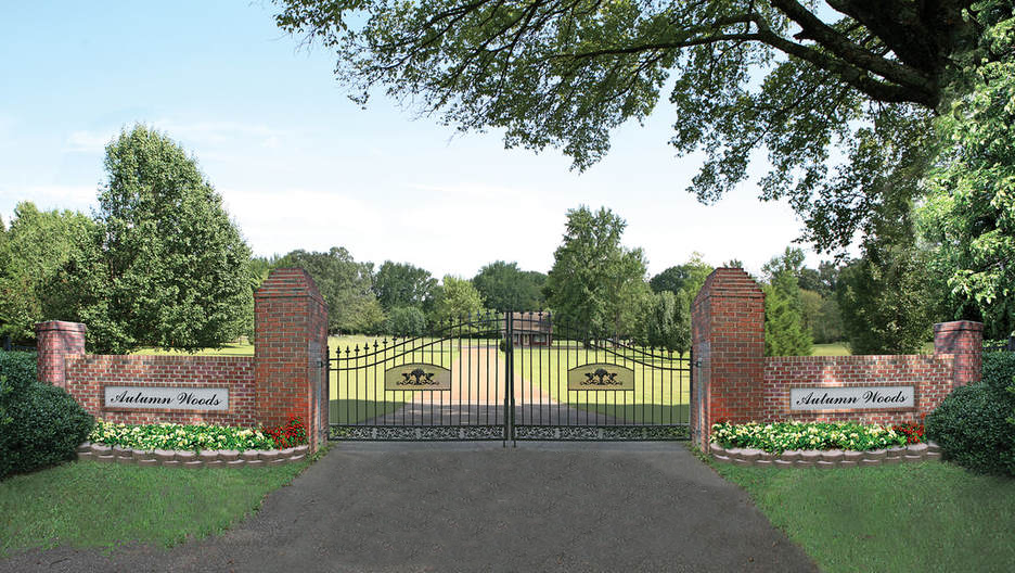
| Memorials | : | 0 |
| Location | : | Olive Branch, DeSoto County, USA |
| Coordinate | : | 34.9502460, -89.8824450 |
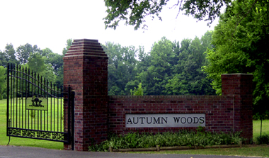
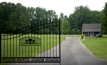
| Description | : | From the intersection of Goodman Rd/MS-302 & US-76, Olive Branch, travel west on Goodman Rd/MS-302 for 1.7 mi.; turning south (left) onto Davidson Rd., going 0.8 mi.; turning south (right) into the entrance gate & drive for this large 'deeded' cemetery, as notated on USGS topo maps. |
frequently asked questions (FAQ):
-
Where is Autumn Woods Memorial Park?
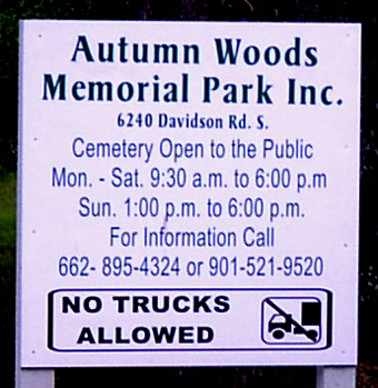
Autumn Woods Memorial Park is located at 6240 Davidson Road, Olive Branch, DeSoto County ,Mississippi , 38654USA.
-
Autumn Woods Memorial Park cemetery's updated grave count on graveviews.com?
0 memorials
-
Where are the coordinates of the Autumn Woods Memorial Park?
Latitude: 34.9502460
Longitude: -89.8824450
Nearby Cemetories:
1. James Owen Gravesite
Olive Branch, DeSoto County, USA
Coordinate: 34.9580000, -89.8794000
2. Jeremiah Church Cemetery
Olive Branch, DeSoto County, USA
Coordinate: 34.9619870, -89.9006690
3. Saint Paul Missionary Baptist Church Cemetery
Olive Branch, DeSoto County, USA
Coordinate: 34.9636130, -89.9017180
4. Center Chapel Cemetery
Shelby County, USA
Coordinate: 34.9590000, -89.8580000
5. Windstone Cemetery
Olive Branch, DeSoto County, USA
Coordinate: 34.9693360, -89.9086930
6. Bass Family Cemetery
Olive Branch, DeSoto County, USA
Coordinate: 34.9398520, -89.8456470
7. New Jeremiah #2 Memorial Garden
Pleasant Hill (Frees Corners), DeSoto County, USA
Coordinate: 34.9182330, -89.8841640
8. Pleasant Hill Community Cemetery
Pleasant Hill, DeSoto County, USA
Coordinate: 34.9184340, -89.8873670
9. Payne Cemetery
Olive Branch, DeSoto County, USA
Coordinate: 34.9625500, -89.8413910
10. New Fellowship Christian Church Cemetery
Olive Branch, DeSoto County, USA
Coordinate: 34.9888240, -89.8929070
11. Shiloh MB Church Cemetery
Southhaven, DeSoto County, USA
Coordinate: 34.9203610, -89.9195120
12. Blocker Cemetery
Olive Branch, DeSoto County, USA
Coordinate: 34.9551680, -89.8226700
13. Stateline Church of Christ Cemetery
Memphis, Shelby County, USA
Coordinate: 34.9952660, -89.8488580
14. Saint Timothy Episcopal Columbarium Gardens
Southaven, DeSoto County, USA
Coordinate: 34.9803500, -89.9377200
15. Rutland Cemetery
Olive Branch, DeSoto County, USA
Coordinate: 34.9939480, -89.8425290
16. Bridgforth Family Cemetery #1
Southhaven, DeSoto County, USA
Coordinate: 34.9106680, -89.9289170
17. Saint Matthews Cemetery
Pleasant Hill, DeSoto County, USA
Coordinate: 34.8940840, -89.8864740
18. Bethlehem Cemetery
Memphis, Shelby County, USA
Coordinate: 35.0071983, -89.8843994
19. Kelsey Cemetery
Olive Branch, DeSoto County, USA
Coordinate: 34.8936430, -89.8399090
20. Cowan Cemetery
Olive Branch, DeSoto County, USA
Coordinate: 34.9735140, -89.8054940
21. Bledsoe Family Cemetery
Southhaven, DeSoto County, USA
Coordinate: 34.9875700, -89.9534800
22. Harrison Family Cemetery
Memphis, Shelby County, USA
Coordinate: 35.0063970, -89.8320990
23. Burdette Church Cemetery
Capleville, Shelby County, USA
Coordinate: 35.0138970, -89.9200830
24. New Hope Baptist Church Cemetery
Southaven, DeSoto County, USA
Coordinate: 34.9322450, -89.9663540