
| Memorials | : | 0 |
| Location | : | Big Rapids, Mecosta County, USA |
| Phone | : | 231-796-5473 |
| Coordinate | : | 43.6946130, -85.4835020 |
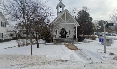
| Description | : | Columbarium is located there. |
frequently asked questions (FAQ):
-
Where is Saint Andrews Episcopal Church Columbarium?
Saint Andrews Episcopal Church Columbarium is located at 323 S. State Street Big Rapids, Mecosta County ,Michigan , 49307USA.
-
Saint Andrews Episcopal Church Columbarium cemetery's updated grave count on graveviews.com?
0 memorials
-
Where are the coordinates of the Saint Andrews Episcopal Church Columbarium?
Latitude: 43.6946130
Longitude: -85.4835020
Nearby Cemetories:
1. Highland View Cemetery
Big Rapids, Mecosta County, USA
Coordinate: 43.7032318, -85.4905319
2. Mount Carmel Cemetery
Big Rapids, Mecosta County, USA
Coordinate: 43.7146187, -85.5154572
3. Pine Plains Cemetery
Big Rapids, Mecosta County, USA
Coordinate: 43.6680984, -85.4436035
4. West Cemetery
Big Rapids, Mecosta County, USA
Coordinate: 43.7421989, -85.4978027
5. VanGilder Cemetery
Big Rapids Township, Mecosta County, USA
Coordinate: 43.7144508, -85.5587769
6. Ladner Cemetery
Stanwood, Mecosta County, USA
Coordinate: 43.6206017, -85.4918976
7. 160th Avenue South Cemetery
Big Rapids, Mecosta County, USA
Coordinate: 43.7436111, -85.4038889
8. Parkhill Cemetery
Paris, Mecosta County, USA
Coordinate: 43.7863998, -85.5282974
9. Hungerford Cemetery
Norwich Township, Newaygo County, USA
Coordinate: 43.6935997, -85.6231003
10. 21 Mile North Cemetery
Grant Center, Mecosta County, USA
Coordinate: 43.7710000, -85.3885000
11. 21 Mile South Cemetery
Grant Center, Mecosta County, USA
Coordinate: 43.7713000, -85.3875000
12. Davenport Cemetery
Barton Township, Newaygo County, USA
Coordinate: 43.7733330, -85.5819440
13. Saint Anne Cemetery
Paris, Mecosta County, USA
Coordinate: 43.7863693, -85.5591736
14. Fairview Cemetery
Mecosta Township, Mecosta County, USA
Coordinate: 43.5891991, -85.5335999
15. Rodney Cemetery
Rodney, Mecosta County, USA
Coordinate: 43.6703491, -85.3264923
16. Crapo Cemetery
Green Township, Mecosta County, USA
Coordinate: 43.8149986, -85.4888992
17. Stanwood Cemetery
Stanwood, Mecosta County, USA
Coordinate: 43.5769691, -85.4444885
18. Mecosta County Farm Cemetery
Mecosta Township, Mecosta County, USA
Coordinate: 43.5738200, -85.4447300
19. Martiny Township Cemetery
Martiny Township, Mecosta County, USA
Coordinate: 43.6852989, -85.3097000
20. Zions Cemetery
Mecosta Township, Mecosta County, USA
Coordinate: 43.5696983, -85.5100021
21. Olin Cemetery
Stanwood, Mecosta County, USA
Coordinate: 43.5879000, -85.3719500
22. Pegg Family Farm Burial Site
Barton Township, Newaygo County, USA
Coordinate: 43.8150950, -85.5735660
23. Goodwell Cemetery
Goodwell Township, Newaygo County, USA
Coordinate: 43.5992012, -85.6235962
24. Merrill Township Cemetery
Brohman, Newaygo County, USA
Coordinate: 43.6650000, -85.6770000