
| Memorials | : | 3 |
| Location | : | Mecosta Township, Mecosta County, USA |
| Coordinate | : | 43.5696983, -85.5100021 |
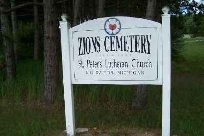
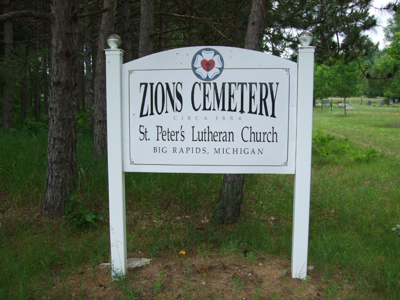
| Description | : | The cemetery is located on the east side of Old State Road at its intersection with 7 Mile Road. The U.S. Geological Survey (USGS) Geographic Names Information System (GNIS) feature ID for the cemetery is 1621491 (Saint Peters Cemetery). |
frequently asked questions (FAQ):
-
Where is Zions Cemetery?
Zions Cemetery is located at Old State Road Mecosta Township, Mecosta County ,Michigan , 49346USA.
-
Zions Cemetery cemetery's updated grave count on graveviews.com?
2 memorials
-
Where are the coordinates of the Zions Cemetery?
Latitude: 43.5696983
Longitude: -85.5100021


Nearby Cemetories:
1. Fairview Cemetery
Mecosta Township, Mecosta County, USA
Coordinate: 43.5891991, -85.5335999
2. Mecosta County Farm Cemetery
Mecosta Township, Mecosta County, USA
Coordinate: 43.5738200, -85.4447300
3. Stanwood Cemetery
Stanwood, Mecosta County, USA
Coordinate: 43.5769691, -85.4444885
4. West Aetna Cemetery
Aetna Township, Mecosta County, USA
Coordinate: 43.5367660, -85.5623060
5. Ladner Cemetery
Stanwood, Mecosta County, USA
Coordinate: 43.6206017, -85.4918976
6. Holt Cemetery
Morley, Mecosta County, USA
Coordinate: 43.5130997, -85.4332962
7. Quigley Cemetery
Deerfield Township, Mecosta County, USA
Coordinate: 43.5536003, -85.3930969
8. Aetna Township Cemetery
Morley, Mecosta County, USA
Coordinate: 43.4906006, -85.4597015
9. Goodwell Cemetery
Goodwell Township, Newaygo County, USA
Coordinate: 43.5992012, -85.6235962
10. Higbee Cemetery
Stanwood, Mecosta County, USA
Coordinate: 43.5394707, -85.3921890
11. Saint Apollonia Cemetery
Morley, Mecosta County, USA
Coordinate: 43.4907990, -85.4278030
12. Olin Cemetery
Stanwood, Mecosta County, USA
Coordinate: 43.5879000, -85.3719500
13. Pine Plains Cemetery
Big Rapids, Mecosta County, USA
Coordinate: 43.6680984, -85.4436035
14. Saint Andrews Episcopal Church Columbarium
Big Rapids, Mecosta County, USA
Coordinate: 43.6946130, -85.4835020
15. Boyd Cemetery
Morley, Mecosta County, USA
Coordinate: 43.4796982, -85.3818970
16. Stearns Prairie Cemetery
Croton Township, Newaygo County, USA
Coordinate: 43.4543991, -85.5980988
17. Highland View Cemetery
Big Rapids, Mecosta County, USA
Coordinate: 43.7032318, -85.4905319
18. Big Prairie-Everett Cemetery
Big Prairie, Newaygo County, USA
Coordinate: 43.5200005, -85.6836014
19. Culp Cemetery
Croton Township, Newaygo County, USA
Coordinate: 43.4537900, -85.6078400
20. Rustford Cemetery
Morley, Mecosta County, USA
Coordinate: 43.4972916, -85.3432999
21. Bouton Family Farm Burial Site
Reynolds Township, Montcalm County, USA
Coordinate: 43.4294960, -85.5555570
22. Mount Carmel Cemetery
Big Rapids, Mecosta County, USA
Coordinate: 43.7146187, -85.5154572
23. Hungerford Cemetery
Norwich Township, Newaygo County, USA
Coordinate: 43.6935997, -85.6231003
24. VanGilder Cemetery
Big Rapids Township, Mecosta County, USA
Coordinate: 43.7144508, -85.5587769