
| Memorials | : | 1 |
| Location | : | Stanley, Metropolitan Borough of Liverpool, England |
| Website | : | www.saintannestanley.co.uk/ |
| Coordinate | : | 53.4158800, -2.9238300 |
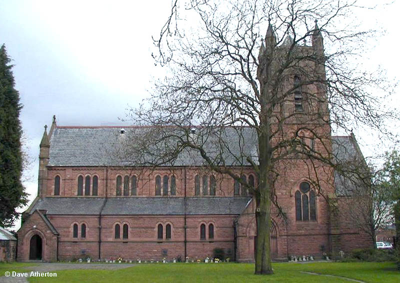
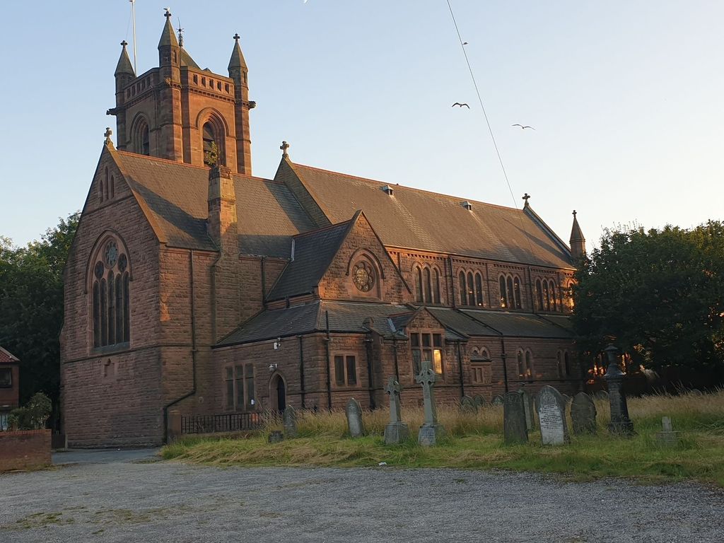
| Description | : | In 1830 the Liverpool and Manchester Railway opened and the district developed rapidly. Where St. Anne's Church now stands, was an iron foundry, standing back from the road. About this time the property was bought by Mr. Thomas Gardner, whose son, of the same name, was in Holy Orders, and married to the daughter of one Samuel Hilton, of Anfield. These two gentlemen, assisted by a grant from the Church Building Society, built the first Church in Stanley. Mr. Gardner (Senior) also built and furnished a house for his son at the east end of what had been the foundry... Read More |
frequently asked questions (FAQ):
-
Where is Saint Anne Churchyard?
Saint Anne Churchyard is located at Cheadle Avenue Stanley, Metropolitan Borough of Liverpool ,Merseyside , L13 3AEEngland.
-
Saint Anne Churchyard cemetery's updated grave count on graveviews.com?
1 memorials
-
Where are the coordinates of the Saint Anne Churchyard?
Latitude: 53.4158800
Longitude: -2.9238300
Nearby Cemetories:
1. Saint Oswald King & Martyr Catholic Churchyard
Old Swan, Metropolitan Borough of Liverpool, England
Coordinate: 53.4121650, -2.9146190
2. Green Lane Jewish Cemetery
Liverpool, Metropolitan Borough of Liverpool, England
Coordinate: 53.4234720, -2.9280170
3. Deane Road Cemetery
Liverpool, Metropolitan Borough of Liverpool, England
Coordinate: 53.4114570, -2.9460500
4. Broadgreen Jewish Cemetery
Liverpool, Metropolitan Borough of Liverpool, England
Coordinate: 53.4101320, -2.8977320
5. St. John the Evangelist Churchyard
Knotty Ash, Metropolitan Borough of Liverpool, England
Coordinate: 53.4160757, -2.8913708
6. St. Mary's Churchyard
Edge Hill, Metropolitan Borough of Liverpool, England
Coordinate: 53.4065000, -2.9561600
7. Holy Trinity Churchyard
Wavertree, Metropolitan Borough of Liverpool, England
Coordinate: 53.3946000, -2.9175700
8. Toxteth Park Cemetery
Toxteth, Metropolitan Borough of Liverpool, England
Coordinate: 53.3952960, -2.9396300
9. Liverpool Necropolis
Everton, Metropolitan Borough of Liverpool, England
Coordinate: 53.4146670, -2.9621830
10. Hunter Street Burial Ground
Liverpool, Metropolitan Borough of Liverpool, England
Coordinate: 53.3922470, -2.9348630
11. Quaker Burial Ground
Liverpool, Metropolitan Borough of Liverpool, England
Coordinate: 53.3922330, -2.9348120
12. Brunswick Chapel
Liverpool, Metropolitan Borough of Liverpool, England
Coordinate: 53.4111280, -2.9675500
13. Anfield Cemetery and Crematorium
Anfield, Metropolitan Borough of Liverpool, England
Coordinate: 53.4354680, -2.9578100
14. Metropolitan Cathedral of Christ the King
Liverpool, Metropolitan Borough of Liverpool, England
Coordinate: 53.4052820, -2.9685940
15. St Mary’s Parochial Cemetery
Liverpool, Metropolitan Borough of Liverpool, England
Coordinate: 53.4024370, -2.9672760
16. Yew Tree Roman Catholic Cemetery
West Derby, Metropolitan Borough of Liverpool, England
Coordinate: 53.4285700, -2.8790700
17. St. George Churchyard
Everton, Metropolitan Borough of Liverpool, England
Coordinate: 53.4252810, -2.9713940
18. Holy Trinity Churchyard
Liverpool, Metropolitan Borough of Liverpool, England
Coordinate: 53.4117490, -2.9759560
19. St. Andrew’s Churchyard
Liverpool, Metropolitan Borough of Liverpool, England
Coordinate: 53.4029730, -2.9726820
20. St Philip Graveyard
Liverpool, Metropolitan Borough of Liverpool, England
Coordinate: 53.4019240, -2.9719920
21. St. Anne's Churchyard
Liverpool, Metropolitan Borough of Liverpool, England
Coordinate: 53.4149050, -2.9782840
22. All Saints Churchyard
Childwall, Metropolitan Borough of Liverpool, England
Coordinate: 53.3952880, -2.8816030
23. Roscoe Memorial Gardens
Liverpool, Metropolitan Borough of Liverpool, England
Coordinate: 53.4044040, -2.9762180
24. Friends Burial Ground (Defunct)
Liverpool, Metropolitan Borough of Liverpool, England
Coordinate: 53.4111670, -2.9795830