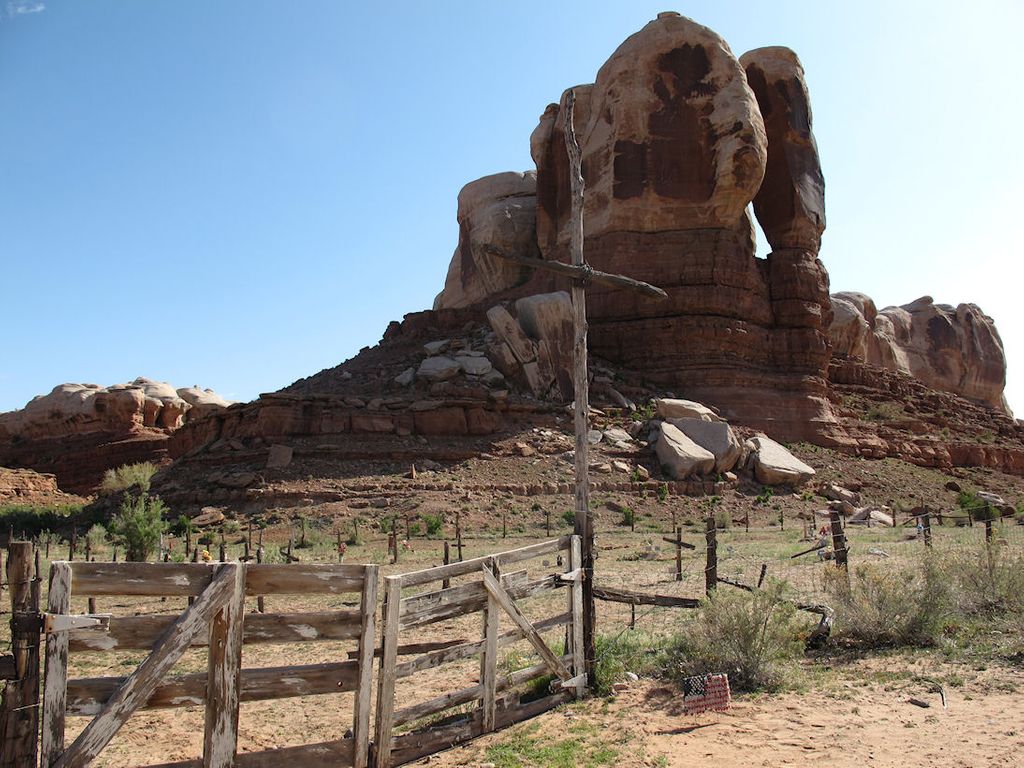
| Memorials | : | 0 |
| Location | : | Bluff, San Juan County, USA |
| Coordinate | : | 37.2852700, -109.5128500 |
| Description | : | Approx. 2 miles east of Bluff on Rt 163. 2 miles then left on dirt road. First burial was in 1945. Contact Saint Christopher's Episcopal Church. |
frequently asked questions (FAQ):
-
Where is Saint Christophers Cemetery?
Saint Christophers Cemetery is located at Bluff, San Juan County ,Utah , 84512USA.
-
Saint Christophers Cemetery cemetery's updated grave count on graveviews.com?
0 memorials
-
Where are the coordinates of the Saint Christophers Cemetery?
Latitude: 37.2852700
Longitude: -109.5128500
Nearby Cemetories:
1. Bluff Cemetery
Bluff, San Juan County, USA
Coordinate: 37.2877998, -109.5541992
2. White Rock Point Cemetery
Tselakai Dezza, San Juan County, USA
Coordinate: 37.2237010, -109.6055910
3. Montezuma Creek Cemetery
San Juan County, USA
Coordinate: 37.2623000, -109.3047000
4. White Mesa Village Cemetery
San Juan County, USA
Coordinate: 37.1630600, -109.2660900
5. Aneth Area Burials
Aneth, San Juan County, USA
Coordinate: 37.2321000, -109.2131000
6. Sunrise Cemetery
San Juan County, USA
Coordinate: 37.0650200, -109.3772200
7. Red Mesa Community Cemetery
San Juan County, USA
Coordinate: 37.0650200, -109.3771100
8. Mexican Water Community Cemetery
Mexican Water, Apache County, USA
Coordinate: 36.9710200, -109.6274600
9. Blanding City Cemetery
Blanding, San Juan County, USA
Coordinate: 37.6307983, -109.4682999
10. Tes Nes Iah Cemetery
Apache County, USA
Coordinate: 36.9434300, -109.7091300
11. Allen Canyon Ute Cemetery
Blanding, San Juan County, USA
Coordinate: 37.6595900, -109.6340300
12. Immanuel Mission Cemetery
Coyote Springs, Apache County, USA
Coordinate: 36.8033170, -109.3964770
13. Teec Nos Pos Cemetery
Teec Nos Pos, Apache County, USA
Coordinate: 36.9208890, -109.0867170
14. Harry Hopkins Gravesite
San Juan County, USA
Coordinate: 37.7830010, -109.4367980
15. Urado Cemetery
San Juan County, USA
Coordinate: 37.6459000, -109.0590000
16. Verdure Cemetery
Verdure, San Juan County, USA
Coordinate: 37.7837000, -109.3461000
17. McElmo Cemetery
Montezuma County, USA
Coordinate: 37.3374405, -108.8397980
18. Battlerock Cemetery
Montezuma County, USA
Coordinate: 37.3375000, -108.8395000
19. Cedar Point Cemetery
San Juan County, USA
Coordinate: 37.7057000, -109.0819000
20. Lamb Cemetery
Montezuma County, USA
Coordinate: 37.3418999, -108.8099976
21. Dennehotso Community Cemetery
Dennehotso, Apache County, USA
Coordinate: 36.8079090, -109.8884020
22. Sylvan Cemetery
Pleasant View, Montezuma County, USA
Coordinate: 37.5797005, -108.8850021
23. Mitchell Cemetery
Montezuma County, USA
Coordinate: 37.3401718, -108.7708893
24. Monticello City Cemetery
Monticello, San Juan County, USA
Coordinate: 37.8683014, -109.3300018

