
| Memorials | : | 0 |
| Location | : | Falls County, USA |
| Coordinate | : | 31.4582030, -96.8210670 |
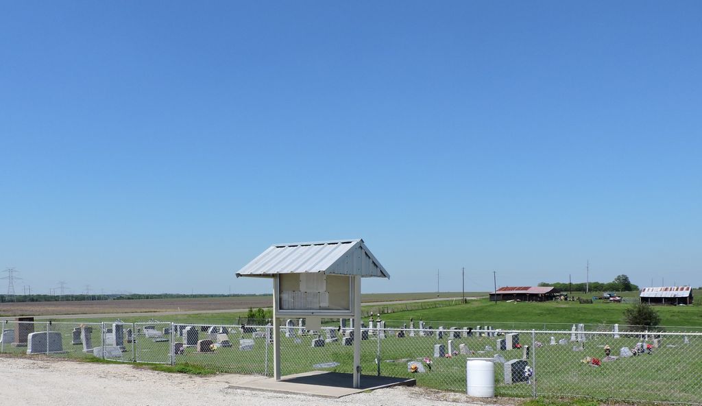
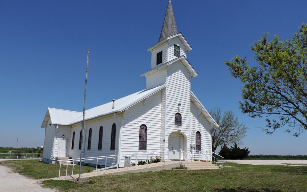
| Description | : | This rural graveyard is located adjacent to the church building. There is a stunning gazebo located behind the church building. The cemetery is fenced and has an information Kiosk with the burial names and locations on a map. The rows are labeled on the fence for easy location of burials. This is a small property but very clean and nicely laid out rows of headstones. There are no statues, trees or benches in the graveyard. There is room for expansion. From Riesel TX travel south on Hwy 6 turn left on FM 1240 and when you reach FM... Read More |
frequently asked questions (FAQ):
-
Where is Saint John's United Church of Christ Cemetery?
Saint John's United Church of Christ Cemetery is located at 298 Hwy. 2603 Falls County ,Texas , 76682USA.
-
Saint John's United Church of Christ Cemetery cemetery's updated grave count on graveviews.com?
0 memorials
-
Where are the coordinates of the Saint John's United Church of Christ Cemetery?
Latitude: 31.4582030
Longitude: -96.8210670

Nearby Cemetories:
1. Walker's Chapel Cemetery
Falls County, USA
Coordinate: 31.4671993, -96.8510971
2. Mettina Cemetery
Falls County, USA
Coordinate: 31.4657993, -96.7716980
3. Zion Cemetery
Falls County, USA
Coordinate: 31.4088950, -96.8353190
4. Trinity Lutheran Cemetery
Falls County, USA
Coordinate: 31.4513893, -96.8817825
5. Hope Cemetery
Falls County, USA
Coordinate: 31.4130993, -96.7872009
6. Criswell Cemetery
Falls County, USA
Coordinate: 31.4375801, -96.7536926
7. Perry United Methodist Cemetery
Marlin, Falls County, USA
Coordinate: 31.4339275, -96.8927383
8. Brushy Creek Cemetery
McClanahan, Falls County, USA
Coordinate: 31.3808170, -96.7709700
9. Smith-Jenkins Cemetery
Perry, Falls County, USA
Coordinate: 31.4541670, -96.9261110
10. Shady Grove Cemetery
Marlin, Falls County, USA
Coordinate: 31.3713210, -96.7769160
11. Evans Cemetery
Perry, Falls County, USA
Coordinate: 31.4213760, -96.9253470
12. Saint Paul Cemetery
Marlin, Falls County, USA
Coordinate: 31.3800907, -96.8946762
13. Battle Cemetery
McClanahan, Falls County, USA
Coordinate: 31.3574413, -96.8494364
14. McClanahan Cemetery
Marlin, Falls County, USA
Coordinate: 31.3546791, -96.8314285
15. Erskine Cemetery
Falls County, USA
Coordinate: 31.3980999, -96.7197037
16. Rice Cemetery
Perry, Falls County, USA
Coordinate: 31.4150800, -96.9395800
17. Taylor Chapel Cemetery
Marlin, Falls County, USA
Coordinate: 31.3330994, -96.8352966
18. Morgan Family Cemetery
Falls County, USA
Coordinate: 31.4091090, -96.9653190
19. Garrett Cemetery
Falls County, USA
Coordinate: 31.3539009, -96.7172012
20. Hillcrest Cemetery
Marlin, Falls County, USA
Coordinate: 31.3255997, -96.8681030
21. Sunset Community Cemetery
Falls County, USA
Coordinate: 31.4207993, -96.9875031
22. Stranger Cemetery
Stranger, Falls County, USA
Coordinate: 31.3255720, -96.7325230
23. Stranger Cemetery
Stranger, Falls County, USA
Coordinate: 31.3252106, -96.7257767
24. Rocky Hill Cemetery
Marlin, Falls County, USA
Coordinate: 31.3460790, -96.9496920