
| Memorials | : | 0 |
| Location | : | Falls County, USA |
| Coordinate | : | 31.4207993, -96.9875031 |
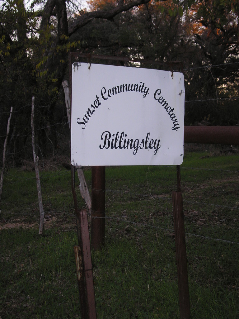
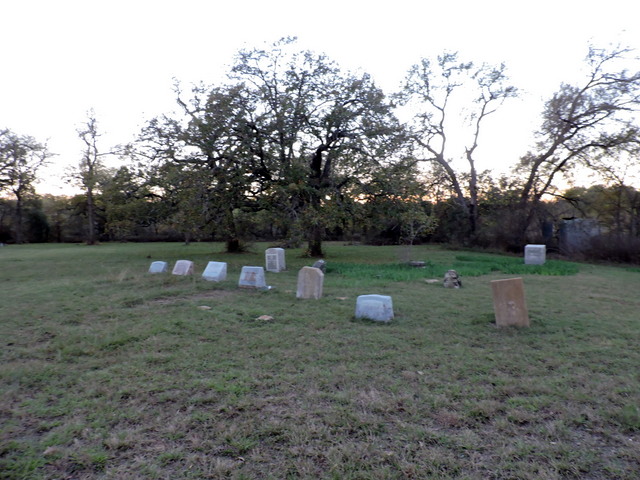
| Description | : | This is a very rural cemetery on the North side of Riesel Texas in Falls County . The gate is locked and the property is fenced. There is a sign at the road but the cemetery is not visible from the road. It is located 1/4 mile down a dirt road at the back of a cow pasture. Sunset is a sprawling cemetery with graves scattered through-out the land. There are very mature trees and lots of room for expansion. Directions: From Waco travel Hwy 6 south about 21 miles and turn West on Hwy 1860. Proceed and turn... Read More |
frequently asked questions (FAQ):
-
Where is Sunset Community Cemetery?
Sunset Community Cemetery is located at 478 County Road 108 Falls County ,Texas , 76682USA.
-
Sunset Community Cemetery cemetery's updated grave count on graveviews.com?
0 memorials
-
Where are the coordinates of the Sunset Community Cemetery?
Latitude: 31.4207993
Longitude: -96.9875031
Nearby Cemetories:
1. Morgan Family Cemetery
Falls County, USA
Coordinate: 31.4091090, -96.9653190
2. Rice Cemetery
Perry, Falls County, USA
Coordinate: 31.4150800, -96.9395800
3. Evans Cemetery
Perry, Falls County, USA
Coordinate: 31.4213760, -96.9253470
4. Cedar Grove Cemetery
Satin, Falls County, USA
Coordinate: 31.3639100, -97.0166200
5. Smith-Jenkins Cemetery
Perry, Falls County, USA
Coordinate: 31.4541670, -96.9261110
6. Gurley Cemetery
Golinda, Falls County, USA
Coordinate: 31.3748150, -97.0475770
7. Rocky Hill Cemetery
Marlin, Falls County, USA
Coordinate: 31.3460790, -96.9496920
8. Perry United Methodist Cemetery
Marlin, Falls County, USA
Coordinate: 31.4339275, -96.8927383
9. Saint Paul Cemetery
Marlin, Falls County, USA
Coordinate: 31.3800907, -96.8946762
10. Trinity Lutheran Cemetery
Falls County, USA
Coordinate: 31.4513893, -96.8817825
11. Walker's Chapel Cemetery
Falls County, USA
Coordinate: 31.4671993, -96.8510971
12. Cedar Valley Cemetery
Chilton, Falls County, USA
Coordinate: 31.2933826, -97.0012512
13. Scruggs Cemetery
Chilton, Falls County, USA
Coordinate: 31.2920060, -96.9929420
14. Zion Cemetery
Falls County, USA
Coordinate: 31.4088950, -96.8353190
15. Calvary Cemetery
Marlin, Falls County, USA
Coordinate: 31.3083000, -96.9056015
16. Battle Cemetery
McClanahan, Falls County, USA
Coordinate: 31.3574413, -96.8494364
17. Powell Tull Cemetery
Chilton, Falls County, USA
Coordinate: 31.2914010, -97.0284850
18. Evergreen Cemetery
Marlin, Falls County, USA
Coordinate: 31.3050003, -96.9057999
19. McGill Chapel Cemetery
Chilton, Falls County, USA
Coordinate: 31.2851660, -96.9769240
20. Guderian Cemetery
Golinda, Falls County, USA
Coordinate: 31.3507390, -97.1245290
21. Hillcrest Cemetery
Marlin, Falls County, USA
Coordinate: 31.3255997, -96.8681030
22. Saint John's United Church of Christ Cemetery
Falls County, USA
Coordinate: 31.4582030, -96.8210670
23. Chilton Cemetery
Chilton, Falls County, USA
Coordinate: 31.2896900, -97.0656586
24. Beulah Cemetery
Triangle, Falls County, USA
Coordinate: 31.2723300, -96.9855200