
| Memorials | : | 1 |
| Location | : | Crockerville, Benton County, USA |
| Coordinate | : | 38.4143982, -93.0847015 |
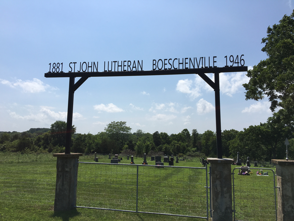
| Description | : | Site of a Lutheran church founded in 1881 but disbanded in 1946. Membership was transferred to Christ Lutheran in Stover, Mo. and only the cemetery remains. |
frequently asked questions (FAQ):
-
Where is Saint Johns Lutheran Cemetery?
Saint Johns Lutheran Cemetery is located at Crockerville, Benton County ,Missouri ,USA.
-
Saint Johns Lutheran Cemetery cemetery's updated grave count on graveviews.com?
1 memorials
-
Where are the coordinates of the Saint Johns Lutheran Cemetery?
Latitude: 38.4143982
Longitude: -93.0847015
Nearby Cemetories:
1. Anton Balke Cemetery
Benton County, USA
Coordinate: 38.3988600, -93.0983800
2. Bethlehem Cemetery
Benton County, USA
Coordinate: 38.4225600, -93.1137700
3. Haw Creek Cemetery
Benton County, USA
Coordinate: 38.4431400, -93.0961300
4. Pleasant Union Cemetery
Stover, Morgan County, USA
Coordinate: 38.3968400, -93.0479300
5. Saint Pauls Lutheran Cemetery Old
Stover, Morgan County, USA
Coordinate: 38.4315720, -93.0301132
6. Immanuel Lutheran Cemetery
Benton County, USA
Coordinate: 38.4308014, -93.1556015
7. Brauersville Immanuel Lutheran Cemetery
Cole Camp, Benton County, USA
Coordinate: 38.4677400, -93.1198600
8. Christ Lutheran Church Cemetery
Stover, Morgan County, USA
Coordinate: 38.4269485, -93.0041046
9. Frisch Cemetery
Morgan County, USA
Coordinate: 38.3460100, -93.0723400
10. Stover Cemetery
Stover, Morgan County, USA
Coordinate: 38.4363120, -92.9879810
11. Chaney Chapel Cemetery
Morgan County, USA
Coordinate: 38.3835983, -92.9910965
12. Saint Pauls Methodist Cemetery
Morgan County, USA
Coordinate: 38.3988991, -92.9822006
13. Holy Cross Cemetery First
Cole Camp, Benton County, USA
Coordinate: 38.5014100, -93.1120600
14. Lumpee Family Cemetery
Benton County, USA
Coordinate: 38.3233430, -93.0959130
15. Holy Cross Cemetery
Cole Camp, Benton County, USA
Coordinate: 38.5052986, -93.1007996
16. Mount Hulda Lutheran Cemetery
Cole Camp, Benton County, USA
Coordinate: 38.3612100, -93.1805000
17. Saints Peter and Paul Catholic Cemetery
Cole Camp, Benton County, USA
Coordinate: 38.4551200, -93.1979900
18. Cole Camp Cemetery Original
Cole Camp, Benton County, USA
Coordinate: 38.4585500, -93.2020500
19. Saint Pauls Lutheran Cemetery Original
Cole Camp, Benton County, USA
Coordinate: 38.4563300, -93.2036200
20. Big Buffalo Cemetery
Benton County, USA
Coordinate: 38.3116989, -93.0939026
21. Hinken Cemetery
Morgan County, USA
Coordinate: 38.4796982, -92.9796982
22. Saint Pauls Lutheran Cemetery
Cole Camp, Benton County, USA
Coordinate: 38.4681015, -93.2007980
23. Pyrmont Lutheran Cemetery LCMS
Pyrmont, Morgan County, USA
Coordinate: 38.5053900, -93.0154900
24. Cole Camp Memorial Cemetery
Cole Camp, Benton County, USA
Coordinate: 38.4692001, -93.2007980