
| Memorials | : | 60 |
| Location | : | Chester, Thayer County, USA |
| Coordinate | : | 40.0167007, -97.5942001 |
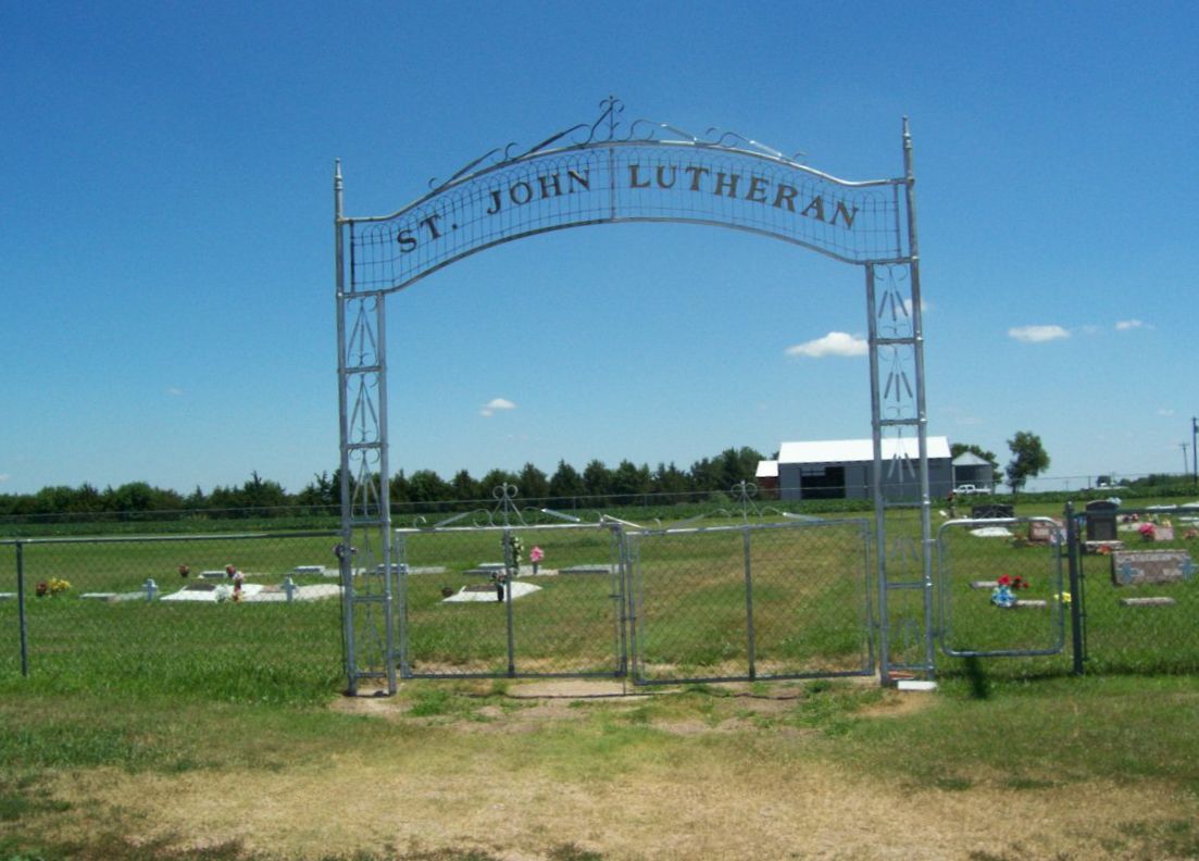
| Description | : | This cemetery is located 1 miles east of Chester, Nebraska on the north side of highway #8. It is affiliated with St. John Lutheran Church in Chester, Nebraska. |
frequently asked questions (FAQ):
-
Where is Saint Johns Lutheran Cemetery?
Saint Johns Lutheran Cemetery is located at 6100 Nebraska Highway 8 Chester, Thayer County ,Nebraska ,USA.
-
Saint Johns Lutheran Cemetery cemetery's updated grave count on graveviews.com?
59 memorials
-
Where are the coordinates of the Saint Johns Lutheran Cemetery?
Latitude: 40.0167007
Longitude: -97.5942001
Nearby Cemetories:
1. Chester Cemetery
Chester, Thayer County, USA
Coordinate: 40.0228004, -97.6121979
2. Shepard Cemetery
Liberty Township, Republic County, USA
Coordinate: 39.9643717, -97.6227674
3. Rose Creek Cemetery
Munden, Republic County, USA
Coordinate: 39.9468994, -97.5663986
4. Saint Paul Lutheran Cemetery - Stoddard
Chester, Thayer County, USA
Coordinate: 40.0760300, -97.6515300
5. Hubbell Cemetery
Rose Creek Township, Republic County, USA
Coordinate: 40.0000790, -97.5002770
6. Stephenson Cemetery
Liberty Township, Republic County, USA
Coordinate: 39.9281006, -97.6438980
7. Zion Lutheran Cemetery
Hubbell, Thayer County, USA
Coordinate: 40.0437400, -97.4629400
8. Ida Cemetery
Rose Creek Township, Republic County, USA
Coordinate: 39.9375000, -97.5000000
9. Dan Schafer Family Farm Cemetery
Hebron, Thayer County, USA
Coordinate: 40.1181500, -97.5437200
10. Liberty Cemetery
Liberty Township, Republic County, USA
Coordinate: 39.9441986, -97.7061005
11. Maple Grove Cemetery
Narka, Republic County, USA
Coordinate: 39.9728012, -97.4550018
12. Saint Mark Evangelical Lutheran Cemetery
Thayer County, USA
Coordinate: 40.1331500, -97.6205900
13. Spring Hill Cemetery
Belleville, Republic County, USA
Coordinate: 39.8996500, -97.6270900
14. Saint John's Lutheran Cemetery
Byron, Thayer County, USA
Coordinate: 40.0456600, -97.7463000
15. Williams Cemetery
Thayer County, USA
Coordinate: 40.0321999, -97.4349976
16. Bethel Cemetery
Munden, Republic County, USA
Coordinate: 39.9002550, -97.5311280
17. Saint Paul's Lutheran Cemetery
Byron, Thayer County, USA
Coordinate: 40.0161500, -97.7646000
18. Saint Josaphats Cemetery
Belleville, Republic County, USA
Coordinate: 39.8993988, -97.6903000
19. King David Fisher Gravesite
Hebron, Thayer County, USA
Coordinate: 40.1509440, -97.5438060
20. Washington Cemetery
Washington Township, Republic County, USA
Coordinate: 39.9510994, -97.7624969
21. Saint Paul's Lutheran Church Cemetery
Gilead, Thayer County, USA
Coordinate: 40.1108000, -97.4449000
22. Saint Georges Cemetery
Munden, Republic County, USA
Coordinate: 39.8711014, -97.5372009
23. Thayer County Poor Farm Cemetery
Hebron, Thayer County, USA
Coordinate: 40.1585900, -97.5173370
24. Letterman Cemetery
Deshler, Thayer County, USA
Coordinate: 40.1614500, -97.6708000