
| Memorials | : | 11 |
| Location | : | Cherryville, Gaston County, USA |
| Coordinate | : | 35.3814850, -81.3830032 |
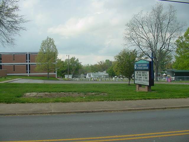
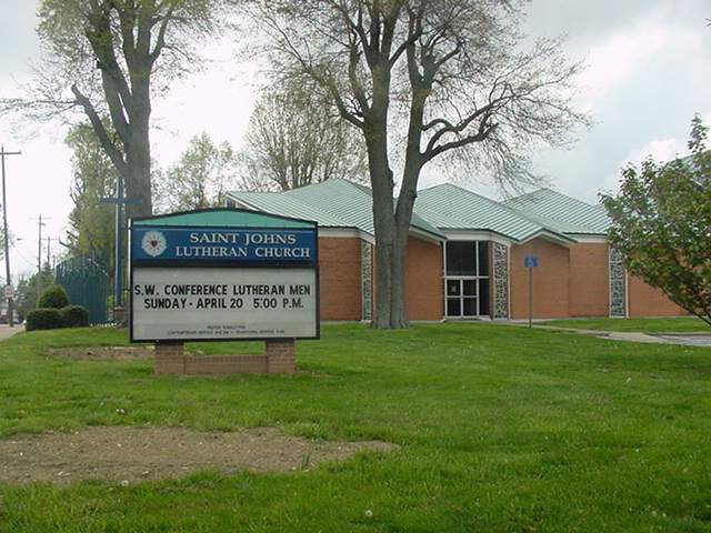
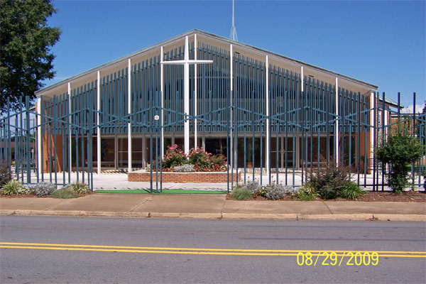
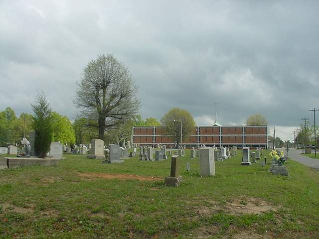
| Description | : | St. John's Lutheran Church was organized 1881 which is same year that town was incorporated. Church services began in a granary building owned by Henry Summitt located near the corner of present Oak and Main Street with 41 charter members. Later there was a frame building erected on property donated by Henry Summitt. The church was replaced with a brick structure in 1902 St. Johns Lutheran Church 310 W. Church St. Cherryville, NC 28021 |
frequently asked questions (FAQ):
-
Where is Saint Johns Lutheran Church Cemetery?
Saint Johns Lutheran Church Cemetery is located at Cherryville, Gaston County ,North Carolina ,USA.
-
Saint Johns Lutheran Church Cemetery cemetery's updated grave count on graveviews.com?
5 memorials
-
Where are the coordinates of the Saint Johns Lutheran Church Cemetery?
Latitude: 35.3814850
Longitude: -81.3830032
Nearby Cemetories:
1. Zion Hill Baptist Church Cemetery
Cherryville, Gaston County, USA
Coordinate: 35.3786087, -81.3791733
2. Cherryville City Memorial Cemetery
Cherryville, Gaston County, USA
Coordinate: 35.3834170, -81.3766790
3. Fairview Baptist Church Cemetery
Cherryville, Gaston County, USA
Coordinate: 35.3734000, -81.3770900
4. Rudisill Chapel Cemetery
Cherryville, Gaston County, USA
Coordinate: 35.3733600, -81.3771100
5. Mount Zion Baptist Church Cemetery
Cherryville, Gaston County, USA
Coordinate: 35.4118576, -81.4051285
6. Shady Grove Baptist Church Cemetery
Cherryville, Gaston County, USA
Coordinate: 35.3529114, -81.3531395
7. Samuel S. Black Family Cemetery
Cherryville, Gaston County, USA
Coordinate: 35.3626328, -81.3430710
8. Zion Hill Baptist Church Cemetery
Lincoln County, USA
Coordinate: 35.4200700, -81.3940700
9. Oak Grove A.M.E. Zion Church Cemetery
Cherryville, Gaston County, USA
Coordinate: 35.4064010, -81.4231970
10. Roberts Burial Ground
Gaston County, USA
Coordinate: 35.4132700, -81.3443700
11. Marys Grove United Methodist Church Cemetery
Cleveland County, USA
Coordinate: 35.3362045, -81.3819351
12. Beam Homestead Cemetery
Cherryville, Gaston County, USA
Coordinate: 35.3798700, -81.3246100
13. B.H. Greene Family Cemetery
Kings Mountain, Cleveland County, USA
Coordinate: 35.3304680, -81.3798900
14. Saint Marks Lutheran Church Cemetery
Cherryville, Gaston County, USA
Coordinate: 35.3806650, -81.3186760
15. Macedonia Missionary Baptist Church Cemetery
Waco, Cleveland County, USA
Coordinate: 35.3552600, -81.4393300
16. Capernium Church Cemetery
Waco, Cleveland County, USA
Coordinate: 35.3408462, -81.4255720
17. Antioch Methodist Cemetery
Cherryville, Gaston County, USA
Coordinate: 35.4129030, -81.3283620
18. Washington Missionary Baptist Cemetery
Waco, Cleveland County, USA
Coordinate: 35.3327713, -81.4216461
19. Arrowood Baptist Cemetery
Bessemer City, Gaston County, USA
Coordinate: 35.3620780, -81.3126440
20. Blessed Hope Baptist Church Cemetery
Waco, Cleveland County, USA
Coordinate: 35.3973800, -81.4583900
21. Bethlehem United Methodist Church
Lincolnton, Lincoln County, USA
Coordinate: 35.4257200, -81.4409600
22. Rudisill Graveyard
Gaston County, USA
Coordinate: 35.3864550, -81.3025720
23. Eaker Cemetery
Gaston County, USA
Coordinate: 35.4052220, -81.3061060
24. Saint Paul's United Methodist Church Cemetery
Waco, Cleveland County, USA
Coordinate: 35.3764877, -81.4655991