
| Memorials | : | 9 |
| Location | : | Wolfe Island, Frontenac County, Canada |
| Coordinate | : | 44.2085080, -76.2400620 |
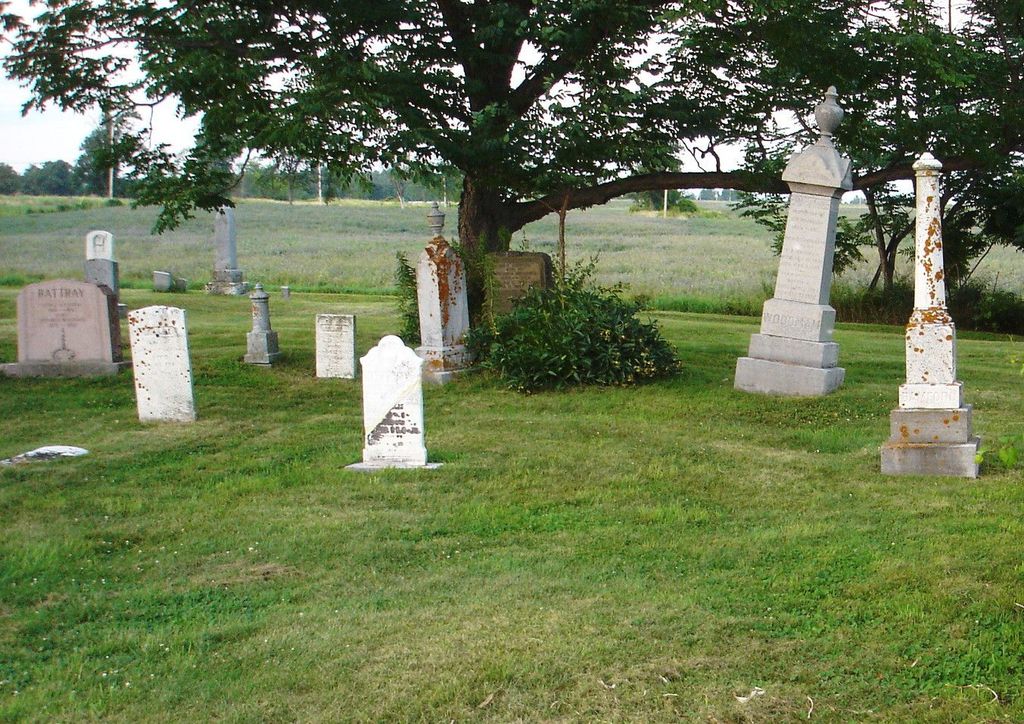
| Description | : | The Cemetery is located on the 17th line road. Lot 9;Concession 18. On Wolfe Island. The land was donated for the church and cemetery by the William Wells Bamford family. There is no longer a record of it. It is a few hundred feet from the St Lawrence River on the South side of the Island not far from the foot of the Island, sometimes has been refered to as the foot cemetery. The old church sit in front of the cemetery and was dedicated on March 15,1874 was constructed of wood and burnt to the ground on July 30,1957.... Read More |
frequently asked questions (FAQ):
-
Where is Saint Lawrence United Church Cemetery?
Saint Lawrence United Church Cemetery is located at Wolfe Island, Frontenac County ,Ontario ,Canada.
-
Saint Lawrence United Church Cemetery cemetery's updated grave count on graveviews.com?
9 memorials
-
Where are the coordinates of the Saint Lawrence United Church Cemetery?
Latitude: 44.2085080
Longitude: -76.2400620

Nearby Cemetories:
1. Dodge Bay Cemetery
Millen Bay, Jefferson County, USA
Coordinate: 44.1824100, -76.2273200
2. Sand Bay Cemetery
Cape Vincent, Jefferson County, USA
Coordinate: 44.1921997, -76.2078018
3. Christ Church Anglican Cemetery
Wolfe Island, Frontenac County, Canada
Coordinate: 44.2094400, -76.2812100
4. Saint Lawrence Union Cemetery
Cape Vincent, Jefferson County, USA
Coordinate: 44.1589012, -76.1952972
5. Saint Philomena's Cemetery
Howe Island, Frontenac County, Canada
Coordinate: 44.2672000, -76.2532200
6. Judd Cemetery
Jefferson County, USA
Coordinate: 44.1492004, -76.2964020
7. Saint Vincent de Paul Cemetery
Rosiere, Jefferson County, USA
Coordinate: 44.1223760, -76.2419410
8. Riverside Cemetery
Cape Vincent, Jefferson County, USA
Coordinate: 44.1375008, -76.3097000
9. New Saint Vincent de Paul Cemetery
Cape Vincent, Jefferson County, USA
Coordinate: 44.1342010, -76.3143997
10. Grindstone Island Cemetery
Clayton, Jefferson County, USA
Coordinate: 44.2808200, -76.1454000
11. Old Saint Vincent de Paul Cemetery
Rosiere, Jefferson County, USA
Coordinate: 44.1094017, -76.2572021
12. Eves Family Plot
Frontenac Islands, Frontenac County, Canada
Coordinate: 44.1891900, -76.3854100
13. Saint Johns Episcopal Church Cemetery
Cape Vincent, Jefferson County, USA
Coordinate: 44.1248100, -76.3351100
14. Three Mile Creek Cemetery
Clayton, Jefferson County, USA
Coordinate: 44.1533012, -76.1085968
15. Market Street Cemetery
Cape Vincent, Jefferson County, USA
Coordinate: 44.1222200, -76.3352900
16. Saint Vincent de Paul Catholic Church Cemetery
Cape Vincent, Jefferson County, USA
Coordinate: 44.1244400, -76.3391980
17. Harris Cemetery
Chaumont, Jefferson County, USA
Coordinate: 44.1156006, -76.1539001
18. Willowbank Cemetery
Gananoque, Leeds and Grenville United Counties, Canada
Coordinate: 44.3246994, -76.2173996
19. Clayton Village Cemetery
Clayton, Jefferson County, USA
Coordinate: 44.2268200, -76.0769100
20. Saint Mary's Cemetery
Clayton, Jefferson County, USA
Coordinate: 44.2261100, -76.0761400
21. Harder Cemetery
Jefferson County, USA
Coordinate: 44.0943985, -76.1911011
22. Milton Cemetery
King Pitt, Frontenac County, Canada
Coordinate: 44.2512240, -76.3984110
23. Grindstone Island Lower Cemetery
Clayton, Jefferson County, USA
Coordinate: 44.2928710, -76.1167250
24. Wolfe Island United Church Cemetery
Wolfe Island, Frontenac County, Canada
Coordinate: 44.1345100, -76.3769600