| Memorials | : | 5 |
| Location | : | Caledonia, Racine County, USA |
| Coordinate | : | 42.8082600, -87.9476100 |
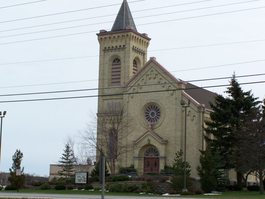
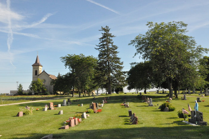
| Description | : | Saint Louis Cemetery is located on County Highway G, across the road from Saint Louis Catholic Church. It was established in the early 1850s. The original church building stood on the site of the cemetery from 1855 to 1857, and the cemetery was expanded after the church was moved. |
frequently asked questions (FAQ):
-
Where is Saint Louis Cemetery?
Saint Louis Cemetery is located at County Highway G Caledonia, Racine County ,Wisconsin , 53108USA.
-
Saint Louis Cemetery cemetery's updated grave count on graveviews.com?
5 memorials
-
Where are the coordinates of the Saint Louis Cemetery?
Latitude: 42.8082600
Longitude: -87.9476100
Nearby Cemetories:
1. Saint Nikola Serbian Orthodox Cemetery
Caledonia, Racine County, USA
Coordinate: 42.8336900, -87.9371800
2. Caledonia Memorial Park
Caledonia, Racine County, USA
Coordinate: 42.8072014, -87.8955994
3. Trinity Evangelical Lutheran Cemetery
Caledonia, Racine County, USA
Coordinate: 42.8283653, -87.8954620
4. Oak Grove Cemetery
Raymond, Racine County, USA
Coordinate: 42.8153000, -88.0113983
5. Saint Johns Cemetery
Oak Creek, Milwaukee County, USA
Coordinate: 42.8569641, -87.9499359
6. McPherson Cemetery
Raymond, Racine County, USA
Coordinate: 42.7855988, -88.0068970
7. Independent Cemetery
Oak Creek, Milwaukee County, USA
Coordinate: 42.8581009, -87.9483032
8. Trinity Cemetery
Raymond, Racine County, USA
Coordinate: 42.7631370, -87.9848410
9. Pilgrims Home Cemetery
Raymond, Racine County, USA
Coordinate: 42.7633700, -87.9854200
10. Oakwood Rest Cemetery
Oak Creek, Milwaukee County, USA
Coordinate: 42.8579500, -87.9178900
11. Pet Valhalla Cemetery
Franksville, Racine County, USA
Coordinate: 42.7545440, -87.9083540
12. Painesville Cemetery
Franklin, Milwaukee County, USA
Coordinate: 42.8728500, -87.9525200
13. Country Haven Cemetery
Caledonia, Racine County, USA
Coordinate: 42.7987010, -87.8487160
14. Bohemian National Cemetery
Caledonia, Racine County, USA
Coordinate: 42.7987700, -87.8474700
15. Historic Evangelical Lutheran Emanuel Cemetery
Oak Creek, Milwaukee County, USA
Coordinate: 42.8462400, -87.8542500
16. Holy Family Catholic Cemetery
Caledonia, Racine County, USA
Coordinate: 42.8011017, -87.8364029
17. Dutch Reformed Church Cemetery
Franklin, Milwaukee County, USA
Coordinate: 42.8724200, -88.0181300
18. Carman Family Cemetery
Franklin, Milwaukee County, USA
Coordinate: 42.8815100, -87.9991400
19. Salem Cemetery
Raymond, Racine County, USA
Coordinate: 42.8429200, -88.0516300
20. Yorkville Cemetery
Yorkville, Racine County, USA
Coordinate: 42.7410600, -88.0300900
21. Saint Matthews Cemetery
Oak Creek, Milwaukee County, USA
Coordinate: 42.8750000, -87.8638992
22. North Cape Lutheran Cemetery
North Cape, Racine County, USA
Coordinate: 42.7973500, -88.0715100
23. West Lawn Memorial Park
Mount Pleasant, Racine County, USA
Coordinate: 42.7235985, -87.8972015
24. Raymond Seventh-day Adventist Cemetery
Raymond, Racine County, USA
Coordinate: 42.7572900, -88.0531800


