
| Memorials | : | 0 |
| Location | : | Torver, South Lakeland District, England |
| Coordinate | : | 54.3390980, -3.1018010 |
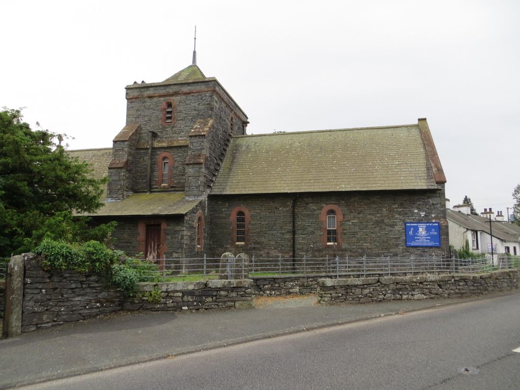
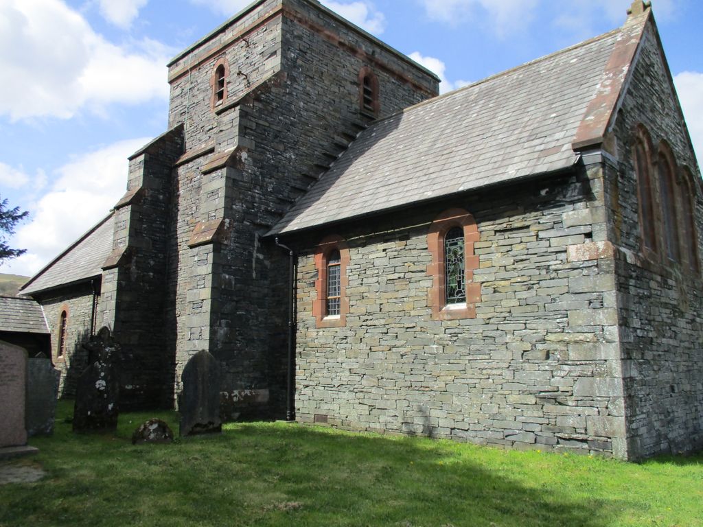
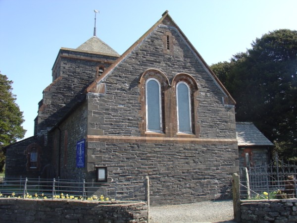
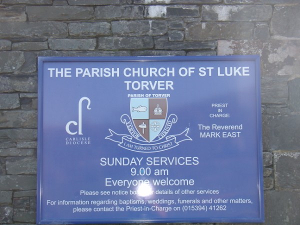
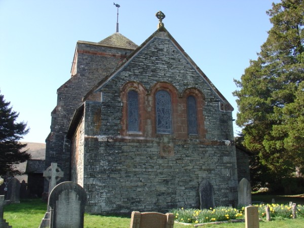
| Description | : | The Parish Church of St Luke is situated in the village of Torver on the A593 between Coniston and Broughton in Furness, Cumberland, England. |
frequently asked questions (FAQ):
-
Where is Saint Luke Churchyard?
Saint Luke Churchyard is located at Torver, South Lakeland District ,Cumbria ,England.
-
Saint Luke Churchyard cemetery's updated grave count on graveviews.com?
0 memorials
-
Where are the coordinates of the Saint Luke Churchyard?
Latitude: 54.3390980
Longitude: -3.1018010
Nearby Cemetories:
1. Sacred Heart RC Churchyard
Coniston, South Lakeland District, England
Coordinate: 54.3610700, -3.0795620
2. St Andrew Churchyard
Coniston, South Lakeland District, England
Coordinate: 54.3688390, -3.0751230
3. Coniston Graveyard
Coniston, South Lakeland District, England
Coordinate: 54.3694000, -3.0731000
4. All Saints Churchyard
Satterthwaite, South Lakeland District, England
Coordinate: 54.3227060, -3.0180820
5. Holy Trinity Church
Duddon, South Lakeland District, England
Coordinate: 54.3549054, -3.1877149
6. St. John the Baptist Churchyard
Blawith, South Lakeland District, England
Coordinate: 54.2855900, -3.0944110
7. St John the Evangelist
Woodland, South Lakeland District, England
Coordinate: 54.2919829, -3.1579023
8. Hawkshead Hill Baptist Church Cemetery
Hawkshead, South Lakeland District, England
Coordinate: 54.3799490, -3.0207400
9. St Paul Churchyard
Rusland, South Lakeland District, England
Coordinate: 54.2981410, -3.0180230
10. St. Michael's And All Angels Churchyard
Hawkshead, South Lakeland District, England
Coordinate: 54.3742210, -2.9988740
11. St Luke's Churchyard
Lowick, South Lakeland District, England
Coordinate: 54.2654390, -3.0916890
12. Society of Friends Burial Ground
Hawkshead, South Lakeland District, England
Coordinate: 54.3739240, -2.9889880
13. St. John the Baptist Churchyard
Ulpha, Copeland Borough, England
Coordinate: 54.3285020, -3.2349130
14. Ulpha Churchyard Extension
Ulpha, Copeland Borough, England
Coordinate: 54.3282170, -3.2350270
15. Holy Trinity Churchyard
Colton, South Lakeland District, England
Coordinate: 54.2655370, -3.0480430
16. St. Peter's Churchyard
Far Sawrey, South Lakeland District, England
Coordinate: 54.3480230, -2.9582610
17. St. Mary Magdalene Parish Churchyard
Broughton-in-Furness, South Lakeland District, England
Coordinate: 54.2761400, -3.2152660
18. Tottlebank Baptist Chapelyard
South Lakeland District, England
Coordinate: 54.2519210, -3.0534690
19. Saint Peter's Churchyard
Finsthwaite, South Lakeland District, England
Coordinate: 54.2820480, -2.9713530
20. Saint Margarets Churchyard
Low Wray, South Lakeland District, England
Coordinate: 54.3982680, -2.9688040
21. Langdale Cemetery
Chapel Stile, South Lakeland District, England
Coordinate: 54.4377600, -3.0500180
22. Bowness-on-Windermere Cemetery
Bowness-on-Windermere, South Lakeland District, England
Coordinate: 54.3584760, -2.9238880
23. Holy Trinity Churchyard
Chapel Stile, South Lakeland District, England
Coordinate: 54.4402700, -3.0486090
24. Holy Trinity Churchyard
Brathay, South Lakeland District, England
Coordinate: 54.4209960, -2.9845050