
| Memorials | : | 0 |
| Location | : | Whitegate, Cheshire West and Chester Unitary Authority, England |
| Coordinate | : | 53.2199680, -2.5572330 |
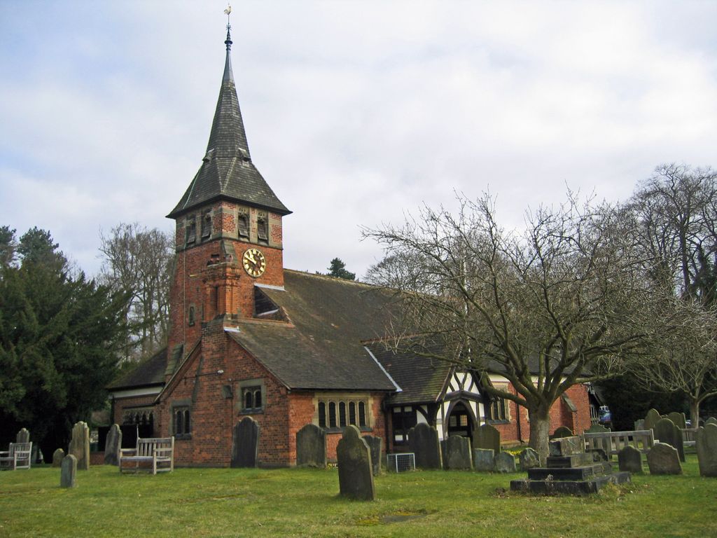
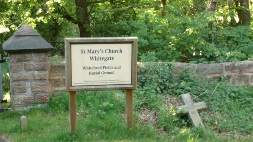
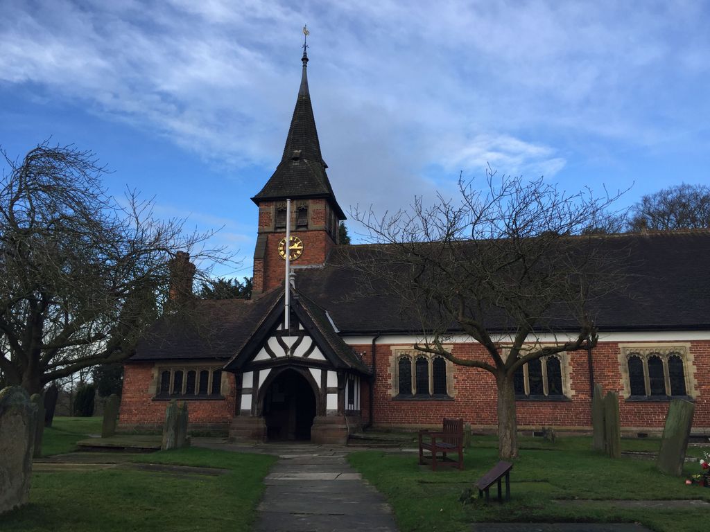
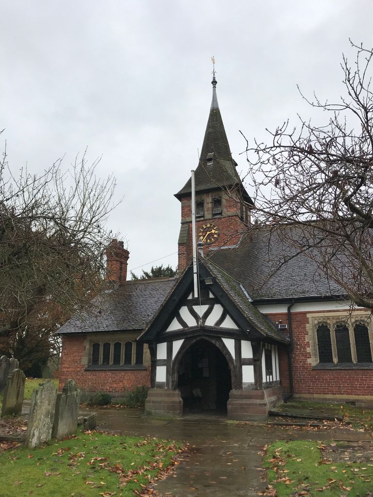
| Description | : | St. Mary's Church is in the village of Whitegate, Cheshire, England. It is an active Anglican parish church in the diocese of Chester, the archdeaconry of Chester and the deanery of Middlewich. A chapel has stood on the site of the present church since the founding of the Cistercian Abbey of Vale Royal in 1277 (the Cistercian were known as the white monks and the name of the village at the gate of the abbey refers to this.) Directly across the road from the church is Vale Royal Drive which led to the former medieval abbey. The abbey was closed... Read More |
frequently asked questions (FAQ):
-
Where is Saint Mary's Churchyard?
Saint Mary's Churchyard is located at Whitegate, Cheshire West and Chester Unitary Authority ,Cheshire ,England.
-
Saint Mary's Churchyard cemetery's updated grave count on graveviews.com?
0 memorials
-
Where are the coordinates of the Saint Mary's Churchyard?
Latitude: 53.2199680
Longitude: -2.5572330
Nearby Cemetories:
1. St John the Evangelist Churchyard
Winsford, Cheshire West and Chester Unitary Authority, England
Coordinate: 53.1922710, -2.5480670
2. United Reform Churchyard
Winsford, Cheshire West and Chester Unitary Authority, England
Coordinate: 53.1887460, -2.5394650
3. Saint Wilfrid's Churchyard
Davenham, Cheshire West and Chester Unitary Authority, England
Coordinate: 53.2372000, -2.5060000
4. Christ Church Churchyard
Winsford, Cheshire West and Chester Unitary Authority, England
Coordinate: 53.1952430, -2.5057500
5. St. Chad's Churchyard
Winsford, Cheshire West and Chester Unitary Authority, England
Coordinate: 53.1816530, -2.5257450
6. St. Peter's Churchyard
Little Budworth, Cheshire West and Chester Unitary Authority, England
Coordinate: 53.1838720, -2.6021830
7. St. Mary's Churchyard
Weaverham, Cheshire West and Chester Unitary Authority, England
Coordinate: 53.2637800, -2.5757800
8. Vale Royal Crematorium
Davenham, Cheshire West and Chester Unitary Authority, England
Coordinate: 53.2432856, -2.4925470
9. Witton Cemetery
Northwich, Cheshire West and Chester Unitary Authority, England
Coordinate: 53.2584600, -2.5052600
10. St. Helen Witton Churchyard
Northwich, Cheshire West and Chester Unitary Authority, England
Coordinate: 53.2602000, -2.5046000
11. St Wilfrid Roman Catholic Churchyard
Northwich, Cheshire West and Chester Unitary Authority, England
Coordinate: 53.2621080, -2.5068050
12. Barnton Cemetery
Barnton, Cheshire West and Chester Unitary Authority, England
Coordinate: 53.2735320, -2.5407780
13. Weaver Methodist Church Cemetery
Winsford, Cheshire West and Chester Unitary Authority, England
Coordinate: 53.1652870, -2.5207080
14. St Peter's Churchyard
Delamere, Cheshire West and Chester Unitary Authority, England
Coordinate: 53.2123300, -2.6602000
15. Christ Church Churchyard
Crowton, Cheshire West and Chester Unitary Authority, England
Coordinate: 53.2663956, -2.6311641
16. Middlewich Cemetery
Middlewich, Cheshire East Unitary Authority, England
Coordinate: 53.1942230, -2.4526240
17. St John the Evangelist Churchyard
Norley, Cheshire West and Chester Unitary Authority, England
Coordinate: 53.2506720, -2.6598870
18. Birches Remembrance Park and Crematorium
Lach Dennis, Cheshire West and Chester Unitary Authority, England
Coordinate: 53.2522730, -2.4510368
19. Little Leigh Baptist Churchyard
Little Leigh, Cheshire West and Chester Unitary Authority, England
Coordinate: 53.2911690, -2.5759770
20. St. Michael and All Angels Churchyard
Middlewich, Cheshire East Unitary Authority, England
Coordinate: 53.1926870, -2.4445600
21. St. Paul's Churchyard
Marston, Cheshire West and Chester Unitary Authority, England
Coordinate: 53.2819250, -2.4899741
22. St John the Evangelist Churchyard
Lostock Gralam, Cheshire West and Chester Unitary Authority, England
Coordinate: 53.2693370, -2.4636730
23. St. Mary and All Saints Churchyard
Great Budworth, Cheshire West and Chester Unitary Authority, England
Coordinate: 53.2936000, -2.5043000
24. St Bartholomew's Churchyard
Church Minshull, Cheshire East Unitary Authority, England
Coordinate: 53.1414200, -2.5007800