
| Memorials | : | 6 |
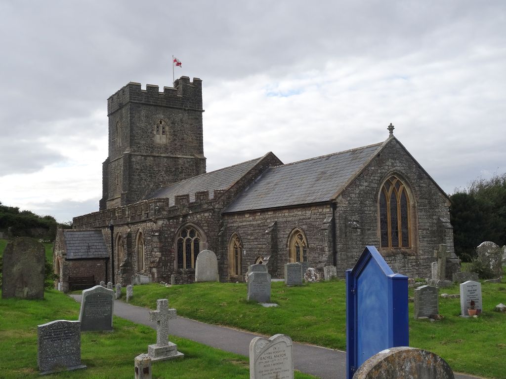
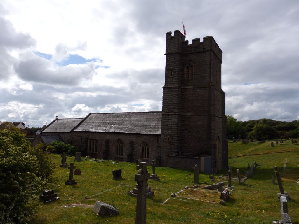
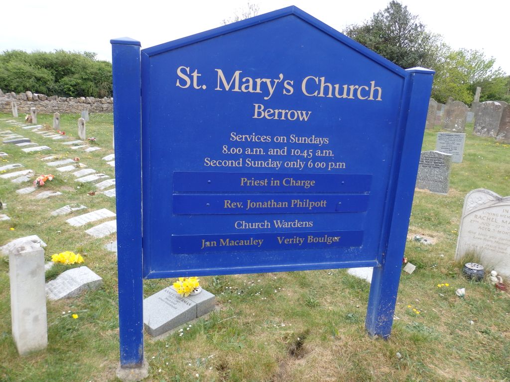
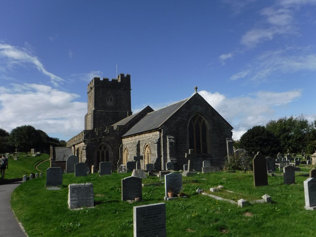
| Location | : | Berrow, Sedgemoor District, England |
| Coordinate | : | 51.2669160, -3.0136980 |
| Description | : | It has been designated by English Heritage as a grade I listed building. |
frequently asked questions (FAQ):
-
Where is Saint Mary Magdalene Churchyard?
Saint Mary Magdalene Churchyard is located at Coast Road Berrow, Sedgemoor District ,Somerset , TA8 2NFEngland.
-
Saint Mary Magdalene Churchyard cemetery's updated grave count on graveviews.com?
6 memorials
-
Where are the coordinates of the Saint Mary Magdalene Churchyard?
Latitude: 51.2669160
Longitude: -3.0136980
Nearby Cemetories:
1. Burnham-on-Sea Cemetery
Burnham-on-Sea, Sedgemoor District, England
Coordinate: 51.2408600, -2.9933900
2. St. Andrew's Churchyard
Burnham-on-Sea, Sedgemoor District, England
Coordinate: 51.2395800, -2.9977870
3. Saint Bridget Churchyard
Brean, Sedgemoor District, England
Coordinate: 51.2983000, -3.0100000
4. Convent of La Retraite
Burnham-on-Sea, Sedgemoor District, England
Coordinate: 51.2346309, -2.9926981
5. St Christopher's Churchyard
Lympsham, Sedgemoor District, England
Coordinate: 51.2826740, -2.9546028
6. St Michael and All Angels Parish Churchyard
Brent Knoll, Sedgemoor District, England
Coordinate: 51.2520000, -2.9539000
7. St. Mary the Virgin Churchyard
East Brent, Sedgemoor District, England
Coordinate: 51.2624370, -2.9418620
8. Highbridge Cemetery
Highbridge, Sedgemoor District, England
Coordinate: 51.2249430, -2.9741730
9. Old St Nicholas Churchyard
Uphill, North Somerset Unitary Authority, England
Coordinate: 51.3203480, -2.9828110
10. Saint Peter and St. Paul Churchyard
Bleadon, North Somerset Unitary Authority, England
Coordinate: 51.3074000, -2.9458300
11. St Nicholas Churchyard (New)
Uphill, North Somerset Unitary Authority, England
Coordinate: 51.3246210, -2.9778420
12. Saint Peter and All Hallows Churchyard
West Huntspill, Sedgemoor District, England
Coordinate: 51.2041900, -2.9966370
13. St Mary the Virgin Churchyard
Hutton, North Somerset Unitary Authority, England
Coordinate: 51.3228030, -2.9306350
14. Sedgemoor Crematorium
Sedgemoor District, England
Coordinate: 51.1909300, -3.0005180
15. St. John the Baptist Churchyard
Biddisham, Sedgemoor District, England
Coordinate: 51.2764090, -2.8878950
16. All Saints Churchyard
East Huntspill, Sedgemoor District, England
Coordinate: 51.2015000, -2.9405700
17. St Andrew's Church
Loxton, North Somerset Unitary Authority, England
Coordinate: 51.2981560, -2.8962140
18. Weston-super-Mare Emmanuel Churchyard
Weston-super-Mare, North Somerset Unitary Authority, England
Coordinate: 51.3458940, -2.9773860
19. Pawlett Methodist (Carter Memorial Wesleyan)
Pawlett, Sedgemoor District, England
Coordinate: 51.1845660, -3.0126480
20. St. John the Baptist Churchyard
Weston-super-Mare, North Somerset Unitary Authority, England
Coordinate: 51.3523010, -2.9813260
21. St. John The Baptist Churchyard
Pawlett, Sedgemoor District, England
Coordinate: 51.1789100, -3.0012650
22. The Blessed Virgin Mary
Axbridge, Sedgemoor District, England
Coordinate: 51.3112017, -2.8913443
23. Holy Cross Churchyard
Mark, Sedgemoor District, England
Coordinate: 51.2269640, -2.8860140
24. St. Augustine's Parish Churchyard
Locking, North Somerset Unitary Authority, England
Coordinate: 51.3322900, -2.9147683