| Memorials | : | 2 |
| Location | : | Winchester, City of Winchester, England |
| Coordinate | : | 51.0621570, -1.3125060 |
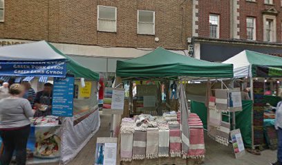
| Description | : | The Church of Saint Mary Wode occupied a small lot on the north side of High Street. It was first recorded in the 12th century. It was also referred to as "Ode Church" (Oade Church, Oode Church, etc.). The church fell into disrepair in the mid 16th century. Between 1545 and 1556, it was annexed to the Church of Saint Maurice, which stood across the street. The church building was pulled down after 1561. |
frequently asked questions (FAQ):
-
Where is Saint Mary Wode?
Saint Mary Wode is located at 138 High Street Winchester, City of Winchester ,Hampshire , SO23 9LBEngland.
-
Saint Mary Wode cemetery's updated grave count on graveviews.com?
2 memorials
-
Where are the coordinates of the Saint Mary Wode?
Latitude: 51.0621570
Longitude: -1.3125060
Nearby Cemetories:
1. St Maurice Churchyard
Winchester, City of Winchester, England
Coordinate: 51.0618360, -1.3126630
2. Winchester Cathedral
Winchester, City of Winchester, England
Coordinate: 51.0608025, -1.3136600
3. St Lawrence in the Square Churchyard
Winchester, City of Winchester, England
Coordinate: 51.0624890, -1.3150200
4. Gray Friar's
Winchester, City of Winchester, England
Coordinate: 51.0642330, -1.3102270
5. Winchester County Gaol Cemetery
Winchester, City of Winchester, England
Coordinate: 51.0640000, -1.3162220
6. St Swithun Upon Kingsgate Churchyard
Winchester, City of Winchester, England
Coordinate: 51.0591580, -1.3143910
7. Winchester College Chapel
Winchester, City of Winchester, England
Coordinate: 51.0583400, -1.3125900
8. St John the Baptist Churchyard
Winchester, City of Winchester, England
Coordinate: 51.0624940, -1.3063070
9. St Michael's Churchyard
Winchester, City of Winchester, England
Coordinate: 51.0576616, -1.3161106
10. Hyde Abbey
Winchester, City of Winchester, England
Coordinate: 51.0685300, -1.3140000
11. St Matthew Churchyard
Winchester, City of Winchester, England
Coordinate: 51.0662120, -1.3210630
12. West Hill Cemetery
Winchester, City of Winchester, England
Coordinate: 51.0609390, -1.3231020
13. St Bartholomew Churchyard
Winchester, City of Winchester, England
Coordinate: 51.0689300, -1.3144000
14. St Giles Hill Cemetery
Winchester, City of Winchester, England
Coordinate: 51.0622020, -1.3007670
15. Winchester Roman Catholic Cemetery
Winchester, City of Winchester, England
Coordinate: 51.0624870, -1.3254080
16. Winchester Prison Cemetery
Winchester, City of Winchester, England
Coordinate: 51.0631550, -1.3281130
17. St Faith Churchyard
Winchester, City of Winchester, England
Coordinate: 51.0523000, -1.3211000
18. St Swithun Churchyard
Headbourne Worthy, City of Winchester, England
Coordinate: 51.0851610, -1.3055710
19. Magdalen Hill Cemetery
Winchester, City of Winchester, England
Coordinate: 51.0617440, -1.2720790
20. St Andrew Churchyard
Chilcomb, City of Winchester, England
Coordinate: 51.0484630, -1.2779550
21. St Mary Churchyard
Kings Worthy, City of Winchester, England
Coordinate: 51.0882590, -1.2977040
22. St Mary Churchyard
Easton, City of Winchester, England
Coordinate: 51.0873090, -1.2743220
23. All Saints Churchyard
Compton, City of Winchester, England
Coordinate: 51.0282700, -1.3342680
24. Lovedon Lane Burial Ground
Kings Worthy, City of Winchester, England
Coordinate: 51.0994120, -1.2958180

