
| Memorials | : | 0 |
| Location | : | Oceda, Georgetown County, USA |
| Coordinate | : | 33.3573800, -79.6473280 |
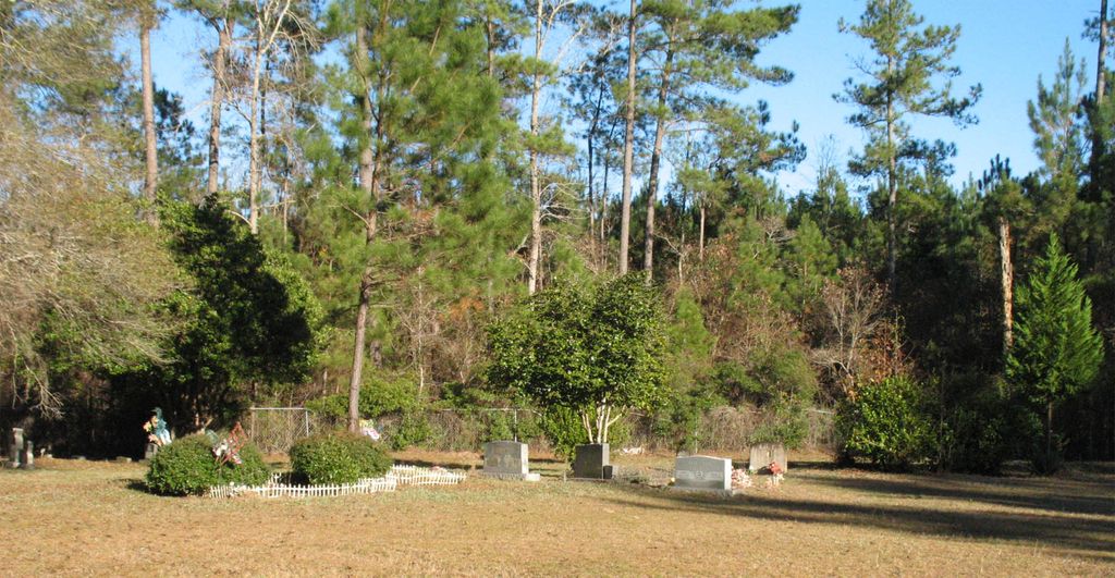
| Description | : | St. Marys Cemetery is near the southwestern corner of Georgetown County. From the junction of highways US 17A and SC 41, it is approximately one half mile toward Georgetown, on the western side of Saints Delight Road (US 17A) between Gourdines Chapel and a CSX Railroad crossing. Until the mid Twentieth Century, Oceda Depot, built by the original Seaboard Airline Railroad, stood beside the crossing. Both St. Marys Cemetery, which is African-American, and Sandridge Cemetery, which is Caucasian and is about a quarter of a mile beyond the railroad crossing, are called Oceda on some early death certificates. Perhaps on such certificates... Read More |
frequently asked questions (FAQ):
-
Where is Saint Marys Cemetery?
Saint Marys Cemetery is located at Saints Delight Road, Andrews, SC Oceda, Georgetown County ,South Carolina , 29510USA.
-
Saint Marys Cemetery cemetery's updated grave count on graveviews.com?
0 memorials
-
Where are the coordinates of the Saint Marys Cemetery?
Latitude: 33.3573800
Longitude: -79.6473280
Nearby Cemetories:
1. Ward Family Cemetery
Georgetown County, USA
Coordinate: 33.3614190, -79.6518970
2. Gourdines Chapel Cemetery
Oceda, Georgetown County, USA
Coordinate: 33.3606200, -79.6529200
3. Sandridge Cemetery
Oceda, Georgetown County, USA
Coordinate: 33.3492940, -79.6316600
4. Brown's Chapel Baptist Church Cemetery
Georgetown County, USA
Coordinate: 33.3487000, -79.6632770
5. Gordon Cemetery
Suttons, Williamsburg County, USA
Coordinate: 33.3534190, -79.6923460
6. Oak Ridge Memorial Cemetery
Williamsburg County, USA
Coordinate: 33.4089012, -79.6307983
7. Old Bethel Church Cemetery
Greeleyville, Williamsburg County, USA
Coordinate: 33.3554380, -79.5733900
8. Elliott Family Cemetery
Oak Ridge, Williamsburg County, USA
Coordinate: 33.4234300, -79.6145660
9. Nazareth AME Church Cemetery
Suttons, Williamsburg County, USA
Coordinate: 33.3855280, -79.7303420
10. Luther L. Lambert Cemetery
Georgetown County, USA
Coordinate: 33.3191120, -79.5686700
11. Sonny's Garden Cemetery
Georgetown County, USA
Coordinate: 33.3146100, -79.5684170
12. Union Baptist
Andrews, Georgetown County, USA
Coordinate: 33.4223960, -79.7039140
13. Jamestown Cemetery
Jamestown, Berkeley County, USA
Coordinate: 33.2861600, -79.6941800
14. Jerusalem Baptist Church Cemetery
Jamestown, Berkeley County, USA
Coordinate: 33.2868300, -79.6962480
15. Stephen Wilson Family Cemetery
Suttons, Williamsburg County, USA
Coordinate: 33.3790890, -79.7449540
16. Ponderosa Pine Memorial Cemetery
Sampit, Georgetown County, USA
Coordinate: 33.3687560, -79.5428950
17. Church of God of Prophecy Cemetery
Andrews, Williamsburg County, USA
Coordinate: 33.4397210, -79.6872270
18. Twin Pines Church of God Cemetery
Andrews, Williamsburg County, USA
Coordinate: 33.4397200, -79.6872300
19. Spring Pond P.H. Church Cemetery
Andrews, Williamsburg County, USA
Coordinate: 33.4385000, -79.6907900
20. Trinity Cemetery at Lambert
Lambert, Georgetown County, USA
Coordinate: 33.3147680, -79.5476790
21. Earles Pentecostal Holiness Church Cemetery
Earle, Williamsburg County, USA
Coordinate: 33.4442990, -79.6034420
22. Lambert Family Cemetery
Lambert, Georgetown County, USA
Coordinate: 33.3155000, -79.5460000
23. New Mount Zion AME Church Cemetery
Jamestown, Berkeley County, USA
Coordinate: 33.2630400, -79.6599790
24. Saint James United Methodist Church Cemetery
Jamestown, Berkeley County, USA
Coordinate: 33.2616997, -79.6596985