
| Memorials | : | 18 |
| Location | : | West Peoria, Peoria County, USA |
| Coordinate | : | 40.6927986, -89.6391983 |
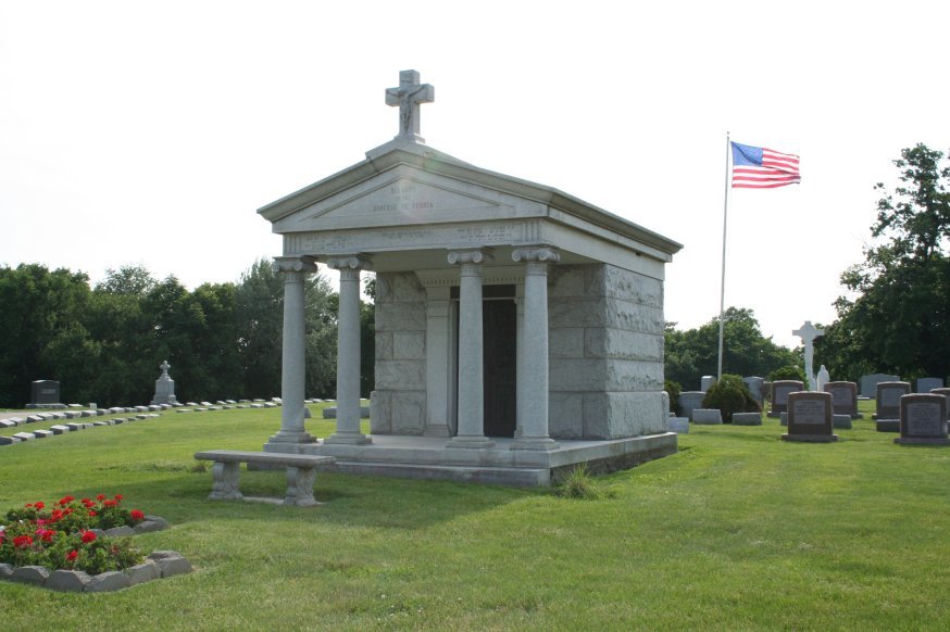
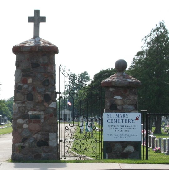
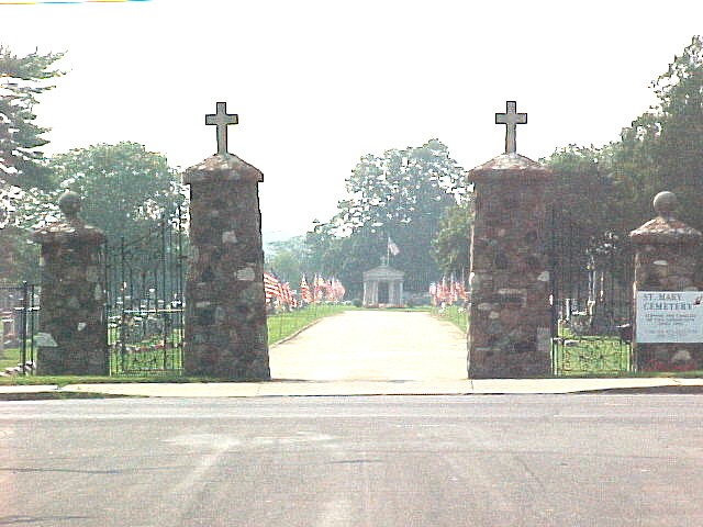
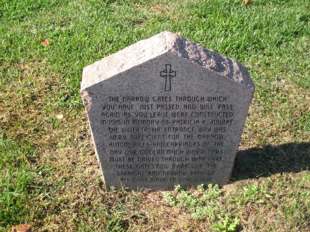
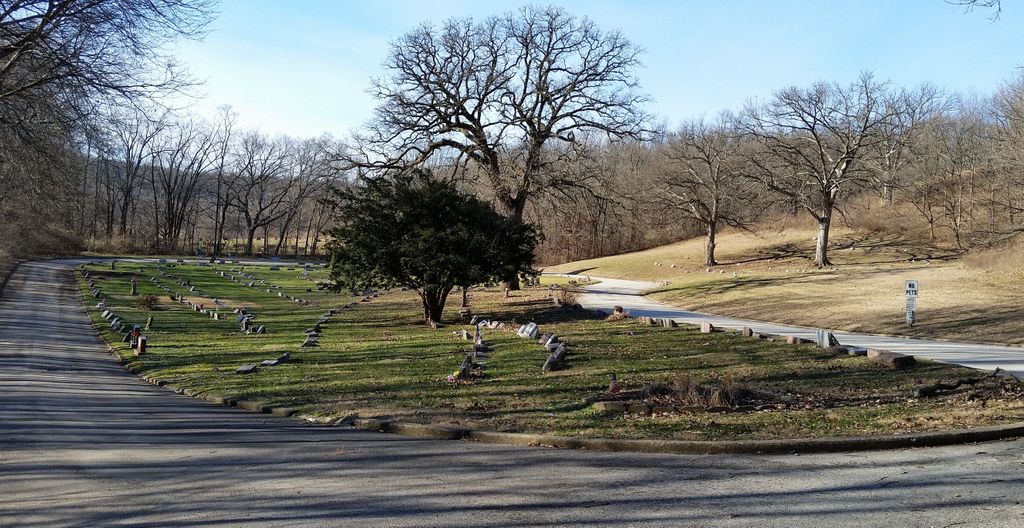
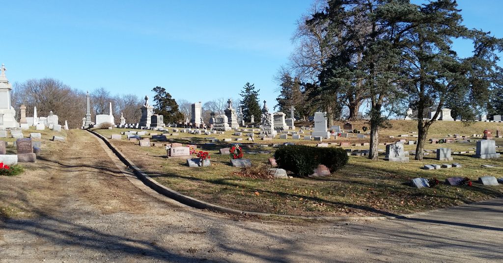
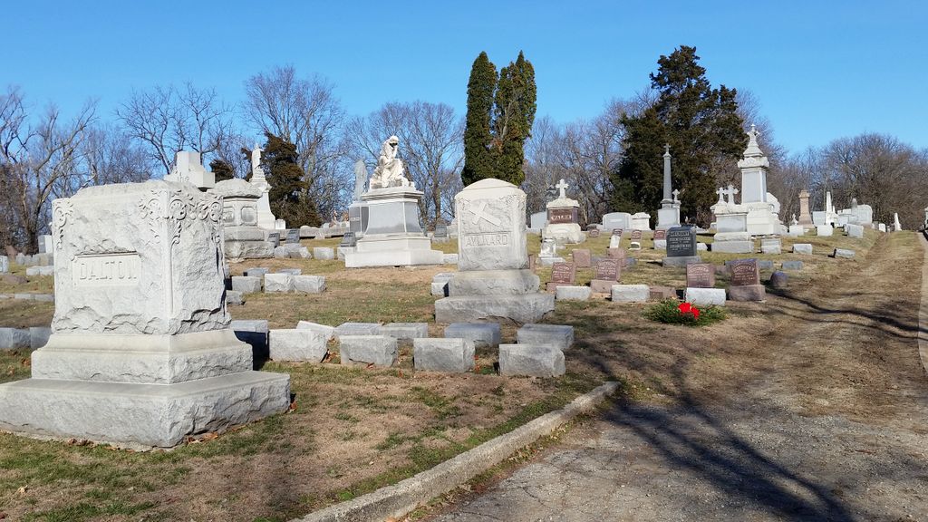
| Description | : | Originally 40 acres In 1881, then the 2nd Catholic Cemetery on what was then the western edge of the city. First lot purchased in 1882, first burial in October 1882. The Bishop's Mausoleum was constructed in 1920. Five Bishops are now* entombed there. The mausoleum is located in what is referred to as the "Heart Section" of the cemetery at the end of the main entrance way. About 1915, stone pillars that form the entrance way where erected. |
frequently asked questions (FAQ):
-
Where is Saint Marys Cemetery?
Saint Marys Cemetery is located at 421 N. Sterling Avenue West Peoria, Peoria County ,Illinois , 61604USA.
-
Saint Marys Cemetery cemetery's updated grave count on graveviews.com?
16 memorials
-
Where are the coordinates of the Saint Marys Cemetery?
Latitude: 40.6927986
Longitude: -89.6391983
Nearby Cemetories:
1. Peoria Hebrew Cemetery
West Peoria, Peoria County, USA
Coordinate: 40.7010994, -89.6374969
2. Saint Josephs Cemetery
West Peoria, Peoria County, USA
Coordinate: 40.7010994, -89.6239014
3. Lutheran Cemetery
Peoria, Peoria County, USA
Coordinate: 40.6768990, -89.6485977
4. City Cemetery
Peoria, Peoria County, USA
Coordinate: 40.6808910, -89.6144130
5. Parkview Cemetery
Peoria, Peoria County, USA
Coordinate: 40.7141991, -89.6181030
6. Moffatt Cemetery
Peoria, Peoria County, USA
Coordinate: 40.6633200, -89.6325400
7. Pottstown Cemetery
Pottstown, Peoria County, USA
Coordinate: 40.7205963, -89.6602631
8. Universalist Unitarian Church Memorial Garden
Peoria, Peoria County, USA
Coordinate: 40.7286670, -89.6408187
9. Cathedral of Saint Mary of the Immaculate Concepti
Peoria, Peoria County, USA
Coordinate: 40.6983089, -89.5849428
10. Peoria County Farm Cemetery
Peoria, Peoria County, USA
Coordinate: 40.6913440, -89.6983910
11. First Federated Columbarium
Peoria, Peoria County, USA
Coordinate: 40.7307396, -89.6036758
12. Saint Pauls Episcopal Cathedral Church Yard
Peoria, Peoria County, USA
Coordinate: 40.7313310, -89.6003720
13. Roelfs Family Cemetery
Bartonville, Peoria County, USA
Coordinate: 40.6473310, -89.6802340
14. Saint Johns Lutheran Cemetery
Bartonville, Peoria County, USA
Coordinate: 40.6564450, -89.6984660
15. Springdale Cemetery and Mausoleum
Peoria, Peoria County, USA
Coordinate: 40.7233400, -89.5744090
16. Peoria State Hospital Cemetery
Bartonville, Peoria County, USA
Coordinate: 40.6338882, -89.6589584
17. Whispering Woods Pet Cemetery
Peoria, Peoria County, USA
Coordinate: 40.7216530, -89.5685730
18. Christ Episcopal Church Cemetery
Norwood, Peoria County, USA
Coordinate: 40.7066994, -89.7173004
19. Saint Michael and All Angels Church Columbarium
Peoria, Peoria County, USA
Coordinate: 40.7471180, -89.5937660
20. United Presbyterian Memorial Gardens
Peoria, Peoria County, USA
Coordinate: 40.7612991, -89.6314621
21. Trial Cemetery
Bartonville, Peoria County, USA
Coordinate: 40.6279373, -89.6713104
22. Fon du Lac Township Cemetery
East Peoria, Tazewell County, USA
Coordinate: 40.6758003, -89.5475006
23. Veterans of Foreign Wars Memorial Park
East Peoria, Tazewell County, USA
Coordinate: 40.6754060, -89.5466640
24. North Limestone Presbyterian Cemetery
Hanna City, Peoria County, USA
Coordinate: 40.6960983, -89.7357025