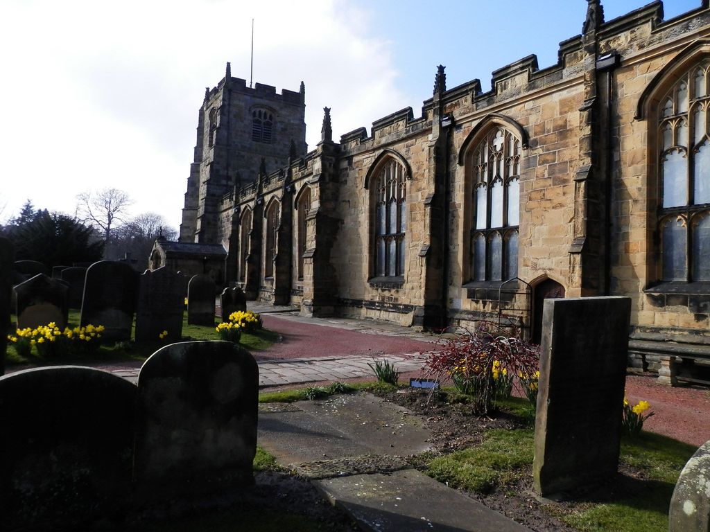
| Memorials | : | 695 |
| Location | : | Alnwick, Northumberland Unitary Authority, England |
| Coordinate | : | 55.4169400, -1.7111000 |
| Description | : | St.Michael's is built in the Perpendicular style and is a great example of this 15th century building development. The former Norman chapel, on whose site the present church is constructed, had fallen into disrepair. Henry VI made monies available for the rebuild, using revenue from the nearby port of Alnmouth. The Dukes of Northumberland added features in 1782 and 1818, the last increasing seating capacity to 1200. A final restoration in 1863 by the 4th Duke's architect, Anthony Salvin while he was working on the castle, corrected any anomalies left over from previous work. It is a Grade I... Read More |
frequently asked questions (FAQ):
-
Where is Saint Michael's Churchyard?
Saint Michael's Churchyard is located at Bailiffgate Alnwick, Northumberland Unitary Authority ,Northumberland , NE66.1LYEngland.
-
Saint Michael's Churchyard cemetery's updated grave count on graveviews.com?
695 memorials
-
Where are the coordinates of the Saint Michael's Churchyard?
Latitude: 55.4169400
Longitude: -1.7111000
Nearby Cemetories:
1. Alnwick Abbey
Alnwick, Northumberland Unitary Authority, England
Coordinate: 55.4198500, -1.7191400
2. Alnwick Cemetery
Alnwick, Northumberland Unitary Authority, England
Coordinate: 55.4037170, -1.6919940
3. Hulne Priory
Alnwick, Northumberland Unitary Authority, England
Coordinate: 55.4350530, -1.7430160
4. St. Mary The Virgin Churchyard
Lesbury, Northumberland Unitary Authority, England
Coordinate: 55.3986820, -1.6277570
5. St Peter's & St Paul's Churchyard
Longhoughton, Northumberland Unitary Authority, England
Coordinate: 55.4289930, -1.6169950
6. Rock Church of St. Philip and St. James
Alnwick, Northumberland Unitary Authority, England
Coordinate: 55.4755200, -1.6817200
7. St John The Baptist Churchyard
Alnmouth, Northumberland Unitary Authority, England
Coordinate: 55.3882090, -1.6124020
8. Alnmouth Cemetery
Alnmouth, Northumberland Unitary Authority, England
Coordinate: 55.3951400, -1.6064100
9. St Michael and All Angels Churchyard
Alnwick, Northumberland Unitary Authority, England
Coordinate: 55.4506080, -1.6096700
10. Bolton Chapel
Edlingham, Northumberland Unitary Authority, England
Coordinate: 55.4168580, -1.8335818
11. St John the Baptist Churchyard
Edlingham, Northumberland Unitary Authority, England
Coordinate: 55.3758250, -1.8212200
12. Embleton Churchyard
Embleton, Northumberland Unitary Authority, England
Coordinate: 55.4884280, -1.6333460
13. St Maurice Churchyard
Eglingham, Northumberland Unitary Authority, England
Coordinate: 55.4689000, -1.8336000
14. Holy Trinity Churchyard
Embleton, Northumberland Unitary Authority, England
Coordinate: 55.4955790, -1.6360190
15. Grey Family Cemetery
Fallodon, Northumberland Unitary Authority, England
Coordinate: 55.5058580, -1.6760530
16. St Maurice's Churchyard
Ellingham, Northumberland Unitary Authority, England
Coordinate: 55.5245000, -1.7245300
17. Amble West Cemetery
Amble, Northumberland Unitary Authority, England
Coordinate: 55.3311820, -1.5922950
18. St. John the Divine Churchyard
Acklington, Northumberland Unitary Authority, England
Coordinate: 55.3106000, -1.6435000
19. Felton Cemetery
Felton, Northumberland Unitary Authority, England
Coordinate: 55.3020920, -1.7118410
20. Amble East Cemetery
Amble, Northumberland Unitary Authority, England
Coordinate: 55.3333190, -1.5696400
21. Longframlington Cemetery
Longframlington, Northumberland Unitary Authority, England
Coordinate: 55.3085440, -1.8003926
22. St Mary the Virgin Churchyard
Longframlington, Northumberland Unitary Authority, England
Coordinate: 55.3028950, -1.7952920
23. Longframlington Church Cemetery Extension
Longframlington, Northumberland Unitary Authority, England
Coordinate: 55.3014700, -1.7950600
24. Chevington Cemetery
Alnwick, Northumberland Unitary Authority, England
Coordinate: 55.2905270, -1.6148670


