
| Memorials | : | 82 |
| Location | : | Alnwick, Northumberland Unitary Authority, England |
| Coordinate | : | 55.4755200, -1.6817200 |
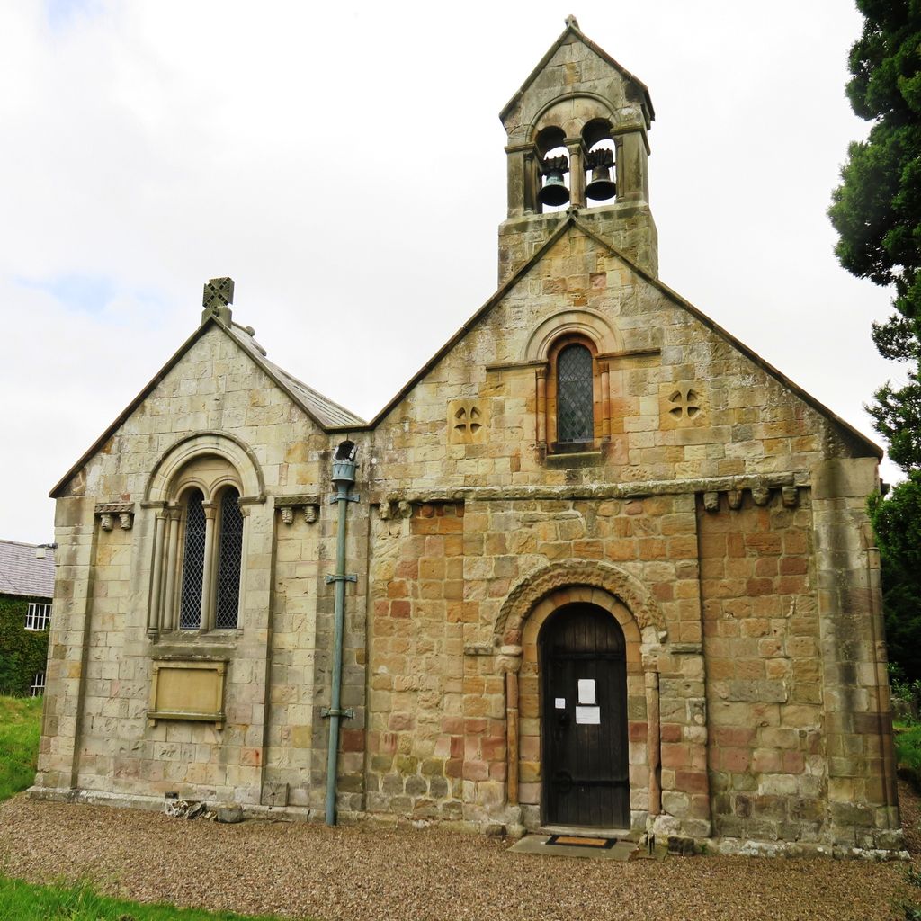
| Description | : | The church lies at the end of an unmade road that leads to Rock Hall at the rear of the village . 'Historians consider that the church was constructed as a Chapel of Ease within the parish of Embleton, about the year 1176. It consisted of a chancel and a nave with a rood screen at their junction. The church was allowed to fall into disrepair and by the end of the eighteenth century was in such a dilapidated condition that no services could be held. The church was rebuilt at Charles Bosanquet's expense in 1806. A timber gallery was constructed in... Read More |
frequently asked questions (FAQ):
-
Where is Rock Church of St. Philip and St. James?
Rock Church of St. Philip and St. James is located at Rock Village Alnwick, Northumberland Unitary Authority ,Northumberland , NE66 3SDEngland.
-
Rock Church of St. Philip and St. James cemetery's updated grave count on graveviews.com?
82 memorials
-
Where are the coordinates of the Rock Church of St. Philip and St. James?
Latitude: 55.4755200
Longitude: -1.6817200


Nearby Cemetories:
1. Embleton Churchyard
Embleton, Northumberland Unitary Authority, England
Coordinate: 55.4884280, -1.6333460
2. Grey Family Cemetery
Fallodon, Northumberland Unitary Authority, England
Coordinate: 55.5058580, -1.6760530
3. Holy Trinity Churchyard
Embleton, Northumberland Unitary Authority, England
Coordinate: 55.4955790, -1.6360190
4. St Michael and All Angels Churchyard
Alnwick, Northumberland Unitary Authority, England
Coordinate: 55.4506080, -1.6096700
5. Hulne Priory
Alnwick, Northumberland Unitary Authority, England
Coordinate: 55.4350530, -1.7430160
6. St Maurice's Churchyard
Ellingham, Northumberland Unitary Authority, England
Coordinate: 55.5245000, -1.7245300
7. St Peter's & St Paul's Churchyard
Longhoughton, Northumberland Unitary Authority, England
Coordinate: 55.4289930, -1.6169950
8. Alnwick Abbey
Alnwick, Northumberland Unitary Authority, England
Coordinate: 55.4198500, -1.7191400
9. Saint Michael's Churchyard
Alnwick, Northumberland Unitary Authority, England
Coordinate: 55.4169400, -1.7111000
10. Alnwick Cemetery
Alnwick, Northumberland Unitary Authority, England
Coordinate: 55.4037170, -1.6919940
11. St. Mary The Virgin Churchyard
Lesbury, Northumberland Unitary Authority, England
Coordinate: 55.3986820, -1.6277570
12. Saint Ebba Churchyard
Beadnell, Northumberland Unitary Authority, England
Coordinate: 55.5566380, -1.6375270
13. Beadnell cemetery
Beadnell, Northumberland Unitary Authority, England
Coordinate: 55.5572940, -1.6398270
14. St Maurice Churchyard
Eglingham, Northumberland Unitary Authority, England
Coordinate: 55.4689000, -1.8336000
15. Alnmouth Cemetery
Alnmouth, Northumberland Unitary Authority, England
Coordinate: 55.3951400, -1.6064100
16. St John The Baptist Churchyard
Alnmouth, Northumberland Unitary Authority, England
Coordinate: 55.3882090, -1.6124020
17. Saint Hilda’s Churchyard
Lucker, Northumberland Unitary Authority, England
Coordinate: 55.5660400, -1.7597400
18. Bolton Chapel
Edlingham, Northumberland Unitary Authority, England
Coordinate: 55.4168580, -1.8335818
19. St John the Baptist Churchyard
Edlingham, Northumberland Unitary Authority, England
Coordinate: 55.3758250, -1.8212200
20. St. Aidan Churchyard
Bamburgh, Northumberland Unitary Authority, England
Coordinate: 55.6079810, -1.7183070
21. St. Peter's Parish Church
Chillingham, Northumberland Unitary Authority, England
Coordinate: 55.5273100, -1.9030830
22. Holy Cross Churchyard
Chatton, Northumberland Unitary Authority, England
Coordinate: 55.5474907, -1.9105738
23. Saint Mary's Churchyard
Belford, Northumberland Unitary Authority, England
Coordinate: 55.5992600, -1.8292900
24. Amble West Cemetery
Amble, Northumberland Unitary Authority, England
Coordinate: 55.3311820, -1.5922950