
| Memorials | : | 1 |
| Location | : | Greensboro, Guilford County, USA |
| Coordinate | : | 36.1174220, -79.8776970 |
frequently asked questions (FAQ):
-
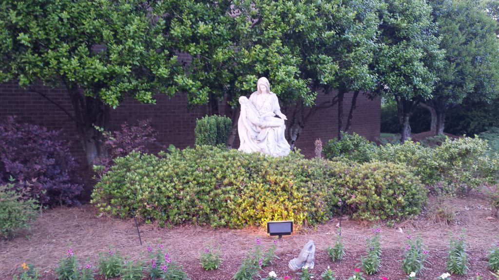
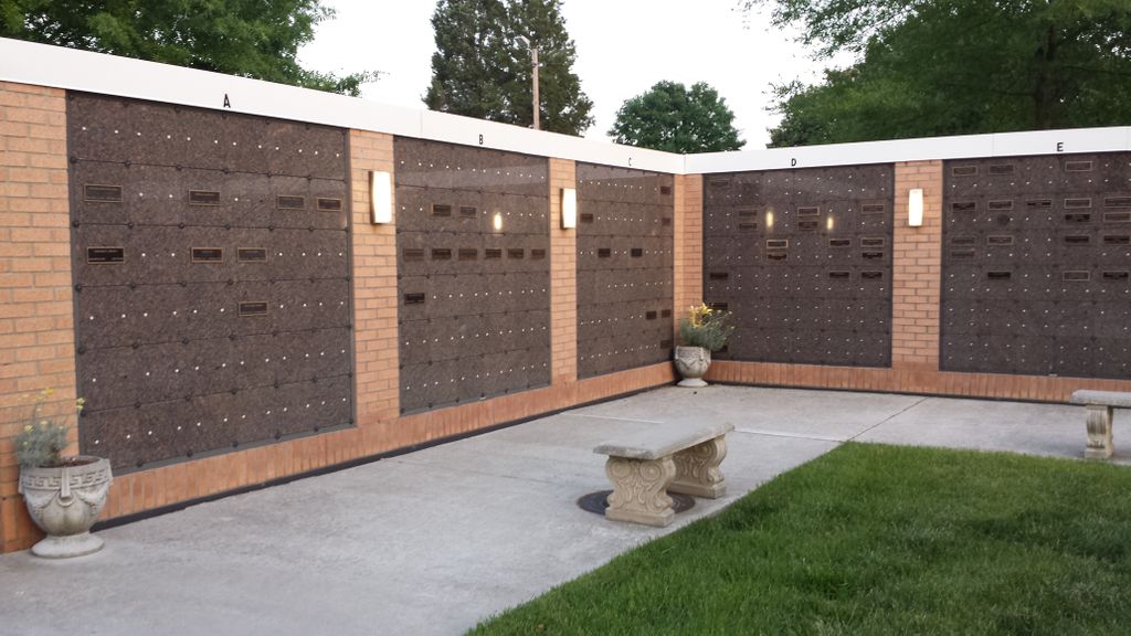
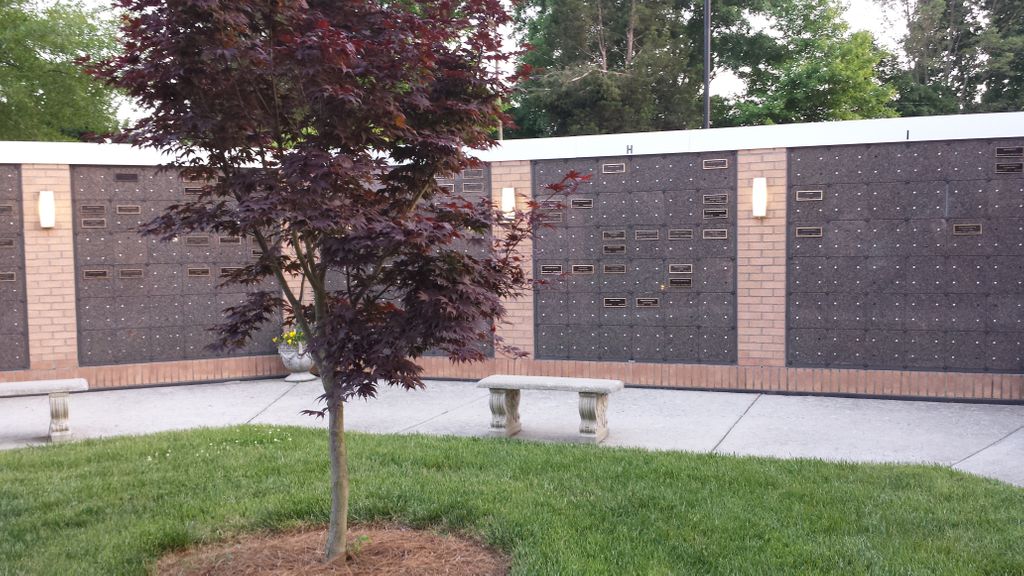
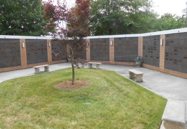
Where is Saint Paul the Apostle Catholic Church Columbarium?
Saint Paul the Apostle Catholic Church Columbarium is located at 2715 Horse Pen Creek Rd Greensboro, Guilford County ,North Carolina , 27410USA.
-
Saint Paul the Apostle Catholic Church Columbarium cemetery's updated grave count on graveviews.com?
1 memorials
-
Where are the coordinates of the Saint Paul the Apostle Catholic Church Columbarium?
Latitude: 36.1174220
Longitude: -79.8776970
Nearby Cemetories:
1. Saint Barnabas Episcopal Church Columbarium
Greensboro, Guilford County, USA
Coordinate: 36.1161450, -79.8698010
2. Collins Grove United Methodist Cemetery
Greensboro, Guilford County, USA
Coordinate: 36.1285800, -79.9051600
3. Jessup Grove Baptist Church Cemetery
Greensboro, Guilford County, USA
Coordinate: 36.1407800, -79.8927930
4. New Garden Friends Cemetery
Greensboro, Guilford County, USA
Coordinate: 36.0912790, -79.8908890
5. Guilford Courthouse National Military Park
Greensboro, Guilford County, USA
Coordinate: 36.1312800, -79.8467500
6. Forest Lawn Cemetery
Greensboro, Guilford County, USA
Coordinate: 36.1272011, -79.8427963
7. Mount Pisgah United Methodist Church Cemetery
Guilford County, USA
Coordinate: 36.1170270, -79.8361040
8. First Lutheran Church Memorial Garden
Greensboro, Guilford County, USA
Coordinate: 36.0882290, -79.8435990
9. Christ United Methodist Church Columbarium
Greensboro, Guilford County, USA
Coordinate: 36.0838680, -79.8448510
10. Muirs Chapel U M C Cemetery
Greensboro, Guilford County, USA
Coordinate: 36.0744820, -79.8711090
11. Saint Francis Episcopal Church Memorial Garden
Greensboro, Guilford County, USA
Coordinate: 36.1157060, -79.8234040
12. Hopewell Wesleyan Church Cemetery
Summerfield, Guilford County, USA
Coordinate: 36.1630330, -79.9046850
13. Guilford Park Presbyterian Columbarium
Greensboro, Guilford County, USA
Coordinate: 36.1006200, -79.8176700
14. Starmount Presbyterian Church Columbarium
Greensboro, Guilford County, USA
Coordinate: 36.0741530, -79.8412840
15. Persimmon Grove A.M.E. Cemetery
Guilford County, USA
Coordinate: 36.0747190, -79.9153200
16. Centenary United Methodist Church Columbarium
Greensboro, Guilford County, USA
Coordinate: 36.0806270, -79.8258440
17. Pilgrims Rest Cemetery
Guilford County, USA
Coordinate: 36.0609330, -79.8891810
18. Masonic Home Cemetery
Greensboro, Guilford County, USA
Coordinate: 36.0636820, -79.8507290
19. Reynolds Chapel Baptist Church Cemetery
Greensboro, Guilford County, USA
Coordinate: 36.0642690, -79.9078590
20. Pleasant Ridge Christian Church Cemetery
Greensboro, Guilford County, USA
Coordinate: 36.1484860, -79.9391910
21. Raleighs Crossroads UMC Cemetery
Greensboro, Guilford County, USA
Coordinate: 36.0608420, -79.9095370
22. Bass Chapel Cemetery
Greensboro, Guilford County, USA
Coordinate: 36.1565880, -79.8163310
23. Saint Andrews Urn Garden
Greensboro, Guilford County, USA
Coordinate: 36.0737120, -79.8203330
24. Pomona Cemetery
Greensboro, Guilford County, USA
Coordinate: 36.0544586, -79.8588715