
| Memorials | : | 0 |
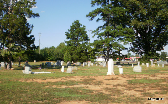
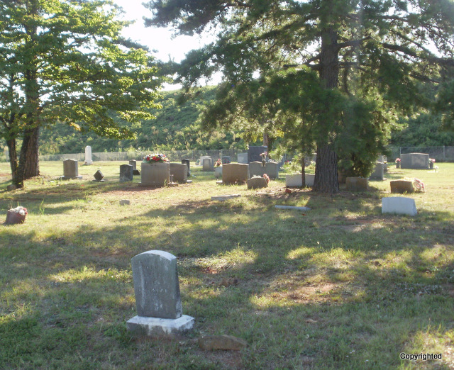
| Location | : | Guilford County, USA |
| Coordinate | : | 36.0747190, -79.9153200 |
| Description | : | Although the offical address is Market St, there is no access from Market. This cemetery can only be accessed from Burnt Poplar Rd. If you are on Market St-turn onto Swing Rd go @ 1/2 mile turn right onto Burnt Poplar Rd. The un-named service rd is off to the right -right at the bridge for the elevated highway-if you go under the bridge-too far. Go about 240 ft ,take the small rd to the left-cemetery is at the end of the road. Second way. Off of I40 -take Gallimore Dairy Rd- eastbound-(Greensboro) take a right turn at the top, coming... Read More |
frequently asked questions (FAQ):
-
Where is Persimmon Grove A.M.E. Cemetery?
Persimmon Grove A.M.E. Cemetery is located at Guilford County ,North Carolina ,USA.
-
Persimmon Grove A.M.E. Cemetery cemetery's updated grave count on graveviews.com?
0 memorials
-
Where are the coordinates of the Persimmon Grove A.M.E. Cemetery?
Latitude: 36.0747190
Longitude: -79.9153200
Nearby Cemetories:
1. Reynolds Chapel Baptist Church Cemetery
Greensboro, Guilford County, USA
Coordinate: 36.0642690, -79.9078590
2. Raleighs Crossroads UMC Cemetery
Greensboro, Guilford County, USA
Coordinate: 36.0608420, -79.9095370
3. Shining Light Baptist Church Cemetery
Greensboro, Guilford County, USA
Coordinate: 36.0528500, -79.9115420
4. Pilgrims Rest Cemetery
Guilford County, USA
Coordinate: 36.0609330, -79.8891810
5. New Garden Friends Cemetery
Greensboro, Guilford County, USA
Coordinate: 36.0912790, -79.8908890
6. Hickory Grove United Methodist Church Cemetery
Guilford County, USA
Coordinate: 36.0474970, -79.9265630
7. Muirs Chapel U M C Cemetery
Greensboro, Guilford County, USA
Coordinate: 36.0744820, -79.8711090
8. Friendship United Methodist Church Cemetery
Friendship, Guilford County, USA
Coordinate: 36.0958140, -79.9534400
9. Midway Baptist Church Cemetery
Jamestown, Guilford County, USA
Coordinate: 36.0303860, -79.9223720
10. Grace Baptist Church Cemetery
Greensboro, Guilford County, USA
Coordinate: 36.0415800, -79.8752760
11. Pomona Cemetery
Greensboro, Guilford County, USA
Coordinate: 36.0544586, -79.8588715
12. Saint Paul the Apostle Catholic Church Columbarium
Greensboro, Guilford County, USA
Coordinate: 36.1174220, -79.8776970
13. Masonic Home Cemetery
Greensboro, Guilford County, USA
Coordinate: 36.0636820, -79.8507290
14. Saint Johns Church Cemetery
Greensboro, Guilford County, USA
Coordinate: 36.0835810, -79.9814340
15. Collins Grove United Methodist Cemetery
Greensboro, Guilford County, USA
Coordinate: 36.1285800, -79.9051600
16. Saint Barnabas Episcopal Church Columbarium
Greensboro, Guilford County, USA
Coordinate: 36.1161450, -79.8698010
17. Walnut Grove Primitive Baptist Church Cemetery
Guilford County, USA
Coordinate: 36.0212400, -79.8974150
18. Christ United Methodist Church Columbarium
Greensboro, Guilford County, USA
Coordinate: 36.0838680, -79.8448510
19. Deep River Friends Meeting Cemetery
High Point, Guilford County, USA
Coordinate: 36.0307770, -79.9640808
20. First Lutheran Church Memorial Garden
Greensboro, Guilford County, USA
Coordinate: 36.0882290, -79.8435990
21. Starmount Presbyterian Church Columbarium
Greensboro, Guilford County, USA
Coordinate: 36.0741530, -79.8412840
22. Turners Chapel AME Church Cemetery
Friendship, Guilford County, USA
Coordinate: 36.0239300, -79.9566830
23. Smith Grove Baptist Church Cemetery
Colfax, Guilford County, USA
Coordinate: 36.0856700, -79.9937170
24. Guilford Memorial Park
Greensboro, Guilford County, USA
Coordinate: 36.0106010, -79.9032974