
| Memorials | : | 4 |
| Location | : | Antioch, Monroe County, USA |
| Coordinate | : | 39.6145200, -81.0359400 |
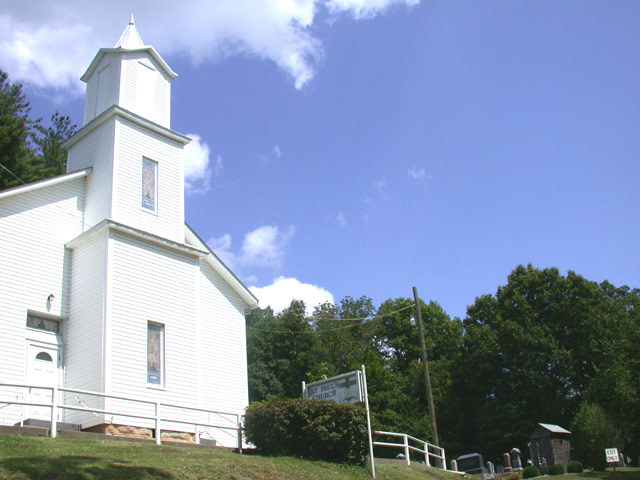
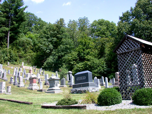
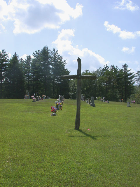
| Description | : | The cemetery is located on the east side of the church building and in an area about 350 feet behind the church building on the north side of Frobish Road (County Road 115) and north of Little Trail Run Creek, which runs parallel to Frobish Road on its south side. The cemetery is about 0.8 miles east of the junction of Frobish Road with Ohio State Route 800. The cemetery was established in 1830 and is 0.4 acres in size. The cemetery is located in Benten Township, Monroe County, Ohio, and is # 8041 (Saint Pauls Evangelical Cemetery / United Church... Read More |
frequently asked questions (FAQ):
-
Where is Saint Pauls Evangelical Church Cemetery?
Saint Pauls Evangelical Church Cemetery is located at 44320 Frobish Road (County Road 115) Antioch, Monroe County ,Ohio , 45767USA.
-
Saint Pauls Evangelical Church Cemetery cemetery's updated grave count on graveviews.com?
4 memorials
-
Where are the coordinates of the Saint Pauls Evangelical Church Cemetery?
Latitude: 39.6145200
Longitude: -81.0359400
Nearby Cemetories:
1. Haythorn Cemetery
Monroe County, USA
Coordinate: 39.6314011, -81.0233002
2. Frobish Cemetery
Antioch, Monroe County, USA
Coordinate: 39.6106450, -81.0085940
3. Unity Baptist Cemetery
Antioch, Monroe County, USA
Coordinate: 39.6428520, -81.0506619
4. Elliott Cemetery
Wittens, Monroe County, USA
Coordinate: 39.5869575, -81.0093058
5. Locust Grove Cemetery
Sardis, Monroe County, USA
Coordinate: 39.6112000, -80.9906200
6. Lentz Cemetery
Antioch, Monroe County, USA
Coordinate: 39.6492004, -81.0472031
7. German Lutheran Cemetery
Brownsville, Monroe County, USA
Coordinate: 39.5911102, -81.0858307
8. Brownsville Methodist Cemetery
Brownsville, Monroe County, USA
Coordinate: 39.5884094, -81.0837173
9. Hensel Cemetery
Brownsville, Monroe County, USA
Coordinate: 39.5919456, -81.0866699
10. Brownsville United Presbyterian Church Cemetery
Brownsville, Monroe County, USA
Coordinate: 39.5900002, -81.0866699
11. Mehrley Cemetery
Monroe County, USA
Coordinate: 39.5708008, -81.0117035
12. West Union Cemetery
Green Township, Monroe County, USA
Coordinate: 39.6606300, -81.0123300
13. Witten Cemetery
Monroe County, USA
Coordinate: 39.5882988, -80.9757996
14. Little Cemetery
New Matamoras, Washington County, USA
Coordinate: 39.5611038, -81.0526657
15. Jericho Methodist Cemetery
Jericho, Monroe County, USA
Coordinate: 39.6150742, -81.1087189
16. Antioch Cemetery
Antioch, Monroe County, USA
Coordinate: 39.6647949, -81.0692749
17. Parker Cemetery
Sardis, Monroe County, USA
Coordinate: 39.6519012, -80.9764023
18. Wells Family Cemetery
Sistersville, Tyler County, USA
Coordinate: 39.5584908, -81.0064011
19. Oakwood Cemetery
Sistersville, Tyler County, USA
Coordinate: 39.5639000, -80.9897003
20. Wells Slave Cemetery
Sistersville, Tyler County, USA
Coordinate: 39.5533400, -81.0046800
21. Rings Mill Cemetery
Poulton, Monroe County, USA
Coordinate: 39.6117407, -81.1212206
22. Carson Cemetery
New Matamoras, Washington County, USA
Coordinate: 39.5466995, -81.0420990
23. Greenbrier Cemetery
Greenbrier, Monroe County, USA
Coordinate: 39.6406000, -81.1186400
24. Black Mary Cemetery
New Matamoras, Washington County, USA
Coordinate: 39.5723180, -81.1073010