
| Memorials | : | 74 |
| Location | : | Baltimore County, USA |
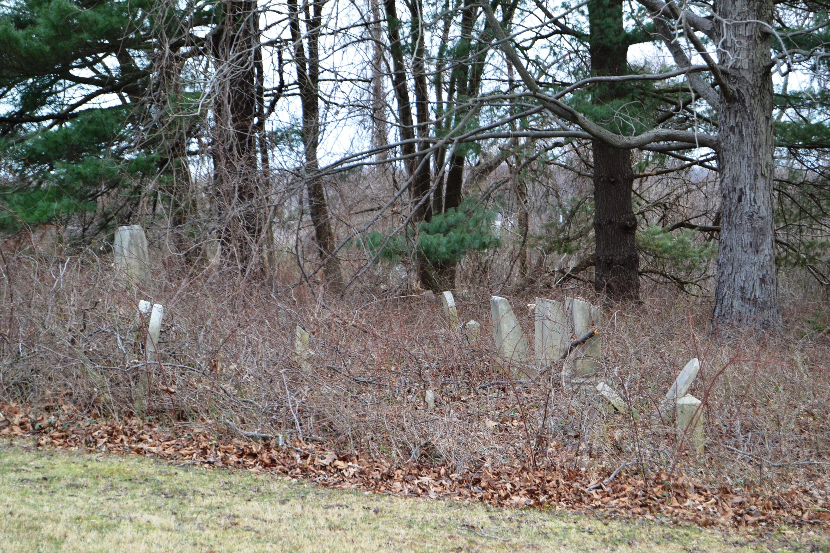
| Description | : | The cemetery is located on the south side of Ridge Road between Falls Road and Greenspring Avenue, Cockesyville Quadrant. The church was shown on 1877 map but has since been razed..there appears some remnant stones. The street address is 1935 Ridge Road. The location is very overgrown and covered with brush and sticker bushes. There is no access other than crossing on private property. You must also go up a small hill. The cemetery has been totally abandoned. |
frequently asked questions (FAQ):
-
Where is Saint Pauls Evangelical Lutheran Cemetery?
Saint Pauls Evangelical Lutheran Cemetery is located at No GPS information available Add GPS1935 Ridge Road off Falls Road Baltimore County ,Maryland ,USA.
-
Saint Pauls Evangelical Lutheran Cemetery cemetery's updated grave count on graveviews.com?
0 memorials
Nearby Cemetories:
1. Saint Abraham's Lutheran Church Cemetery
Beckleysville, Baltimore County, USA
Coordinate: 39.3868700, -76.4971300
2. Saint Stanislaus Kostka Catholic Church Cemetery
Daniels, Baltimore County, USA
Coordinate: 39.3728600, -76.5113100
3. Fitch Family Cemetery
Fullerton, Baltimore County, USA
Coordinate: 39.4625100, -76.8233200
4. Jesuit Cemetery
Baltimore County, USA
Coordinate: 39.4507828, -76.8328094
5. Fork Christian Church Cemetery
Kingsville, Baltimore County, USA
Coordinate: 39.4336600, -76.8801620
6. Saint Johns Episcopal Church Cemetery
Kingsville, Baltimore County, USA
7. Saint Pauls Lutheran Church Cemetery
Kingsville, Baltimore County, USA
Coordinate: 39.4714170, -76.8326930
8. Saint Stephens Catholic Church Cemetery
Kingsville, Baltimore County, USA
Coordinate: 39.4302711, -76.8606873
9. Salem United Methodist Church Cemetery
Kingsville, Baltimore County, USA
Coordinate: 39.4771300, -76.7081700
10. Martin Rothe Cemetery
Baltimore County, USA
Coordinate: 39.4480700, -76.8657200
11. Methodist Protestant Cemetery
Maryland Line, Baltimore County, USA
Coordinate: 39.4993550, -76.8478630
12. Dowden Chapel Cemetery
Nottingham, Baltimore County, USA
Coordinate: 39.4490013, -76.8368073
13. Saint Joseph Church, Fullerton Cemetery
Nottingham, Baltimore County, USA
Coordinate: 39.3868700, -76.4971300
14. Saint Peters Lutheran Church Cemetery
Nottingham, Baltimore County, USA
Coordinate: 39.3728600, -76.5113100
15. All Saints Episcopal Church Cemetery
Reisterstown, Baltimore County, USA
Coordinate: 39.4625100, -76.8233200
16. Baltimore Hebrew Cemetery
Reisterstown, Baltimore County, USA
Coordinate: 39.4507828, -76.8328094
17. Baseman Family Cemetery
Reisterstown, Baltimore County, USA
Coordinate: 39.4336600, -76.8801620
18. Blizard, Blizzard Family Cemetery
Reisterstown, Baltimore County, USA
19. Conrad Uhler Family Cemetery
Reisterstown, Baltimore County, USA
Coordinate: 39.4714170, -76.8326930
20. Deer Park Cemetery
Reisterstown, Baltimore County, USA
Coordinate: 39.4302711, -76.8606873
21. Grace Falls Road United Methodist Church Cemetery
Reisterstown, Baltimore County, USA
Coordinate: 39.4771300, -76.7081700
22. Nicodemus Memorial Park
Reisterstown, Baltimore County, USA
Coordinate: 39.4480700, -76.8657200
23. O'Grady Chapel Cemetery
Reisterstown, Baltimore County, USA
Coordinate: 39.4993550, -76.8478630
24. Oheb Shalom Memorial Park
Reisterstown, Baltimore County, USA
Coordinate: 39.4490013, -76.8368073