
| Memorials | : | 4 |
| Location | : | Bolivar, Polk County, USA |
| Coordinate | : | 37.5540504, -93.4125137 |
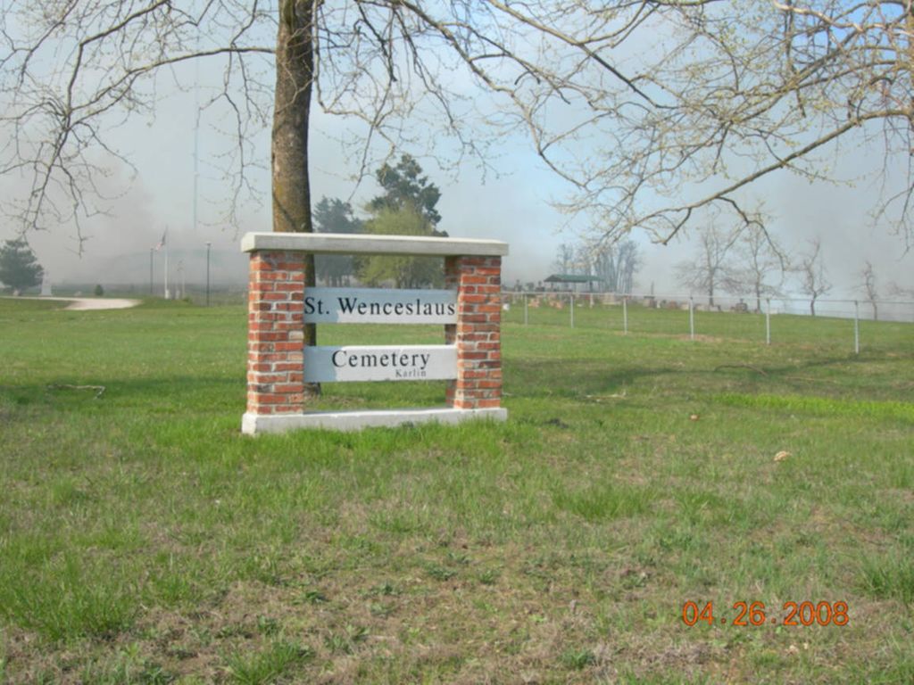
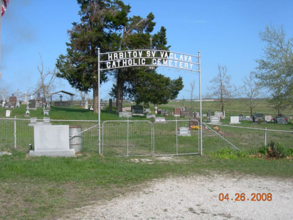
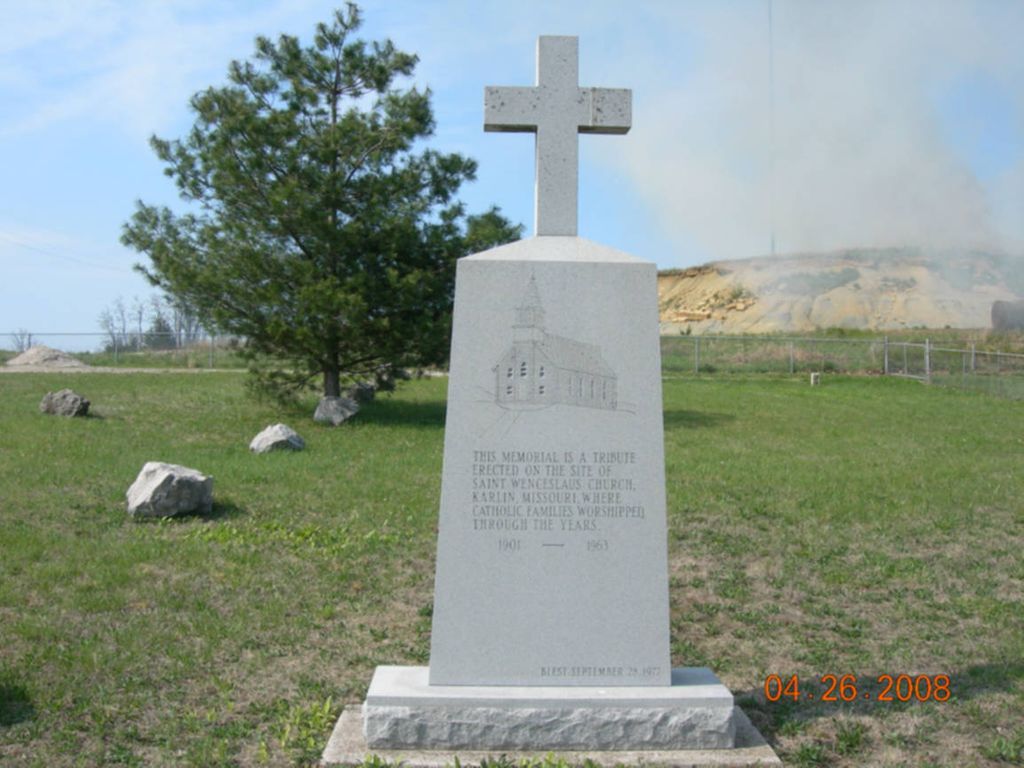
| Description | : | History of Mt. Wenceslaus... Karlin is a small railroad town in a Bohemian settlement. It was originally called Treemont, but when the seven sons of Francka arrived, 1890-95, they changed the name to Karlin in honor of a city in extreme northern part of Borhemia. St. Wenceslaus in Karlin, was established in 1904 and was placed on the inactive list in May of 1965 because of a shortage of priests to staff all the churches and missions in the Diocese. |
frequently asked questions (FAQ):
-
Where is Saint Wenceslaus Cemetery?
Saint Wenceslaus Cemetery is located at Bolivar, Polk County ,Missouri ,USA.
-
Saint Wenceslaus Cemetery cemetery's updated grave count on graveviews.com?
4 memorials
-
Where are the coordinates of the Saint Wenceslaus Cemetery?
Latitude: 37.5540504
Longitude: -93.4125137
Nearby Cemetories:
1. Hensley Cemetery
Polk County, USA
Coordinate: 37.5433006, -93.4356003
2. Mount Gilead Cemetery
Bolivar, Polk County, USA
Coordinate: 37.5805511, -93.3686218
3. Hendrickson Cemetery
Bolivar, Polk County, USA
Coordinate: 37.5999900, -93.4151000
4. Enon Cemetery
Wishart, Polk County, USA
Coordinate: 37.5201111, -93.4528503
5. Campbell Grove Cemetery
Bolivar, Polk County, USA
Coordinate: 37.5741700, -93.4688900
6. Slagle Cemetery
Slagle, Polk County, USA
Coordinate: 37.5123596, -93.3707504
7. Greenwood Cemetery
Bolivar, Polk County, USA
Coordinate: 37.6072006, -93.4246979
8. Saint Albans Episcopal Church Columbarium
Bolivar, Polk County, USA
Coordinate: 37.6098823, -93.4358491
9. Spencer Cemetery
Polk County, USA
Coordinate: 37.5774994, -93.4867020
10. Bolivar City Cemetery
Bolivar, Polk County, USA
Coordinate: 37.6192589, -93.4162216
11. Morrisville Cemetery
Morrisville, Polk County, USA
Coordinate: 37.4852486, -93.4263763
12. Crestview Memorial Gardens Cemetery
Bolivar, Polk County, USA
Coordinate: 37.6070290, -93.3534470
13. Mitchell Campground Cemetery
Bolivar, Polk County, USA
Coordinate: 37.5361595, -93.5024033
14. Appleby Cemetery
Brighton, Polk County, USA
Coordinate: 37.4719970, -93.4117700
15. Graveyard Hill
Pleasant Hope, Polk County, USA
Coordinate: 37.5149800, -93.3203700
16. Welsh Cemetery
Union Township, Polk County, USA
Coordinate: 37.5790500, -93.5134000
17. Heydon-Williams-Devin Cemetery
Bolivar, Polk County, USA
Coordinate: 37.6294300, -93.4679900
18. Stockton Cemetery
Aldrich, Polk County, USA
Coordinate: 37.5744470, -93.5206680
19. Mount Olive Cemetery
Bolivar, Polk County, USA
Coordinate: 37.6403008, -93.3799973
20. Oakville Cemetery
Morrisville, Polk County, USA
Coordinate: 37.4752007, -93.4706879
21. Pleasant Hill Cemetery
Burns, Polk County, USA
Coordinate: 37.6111794, -93.3186722
22. Willard Cemetery
Aldrich, Polk County, USA
Coordinate: 37.5757310, -93.5290250
23. Wollard Cemetery
Aldrich, Polk County, USA
Coordinate: 37.5757220, -93.5290680
24. White Cemetery
Polk County, USA
Coordinate: 37.6465900, -93.4411700