
| Memorials | : | 1 |
| Location | : | Pearson, Atkinson County, USA |
| Coordinate | : | 31.1966550, -82.9091460 |
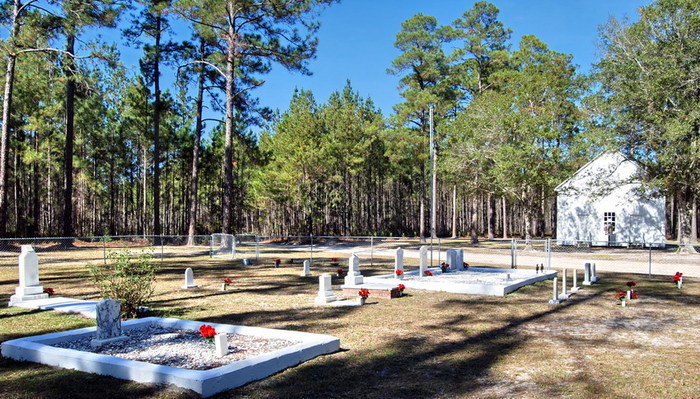
| Description | : | Salem Church Cemetery is located on Salem Church Road, south of Pearson, Georgia in the southwest corner of Atkinson County, Georgia. At the intersections of GA Hwy 64 and US Hwy 221, and County Road 29 (Salem Church Road), the church and cemetery is about 1 mile down Salem Church Road with the church on the left side and the cemetery on the right side. Salem Church was built in 1889 on an old Indian pathway, the Kinnaird Trail. It later became a stagecoach relay station when the stagecoach route followed the old Kinnaird Trail. The first person... Read More |
frequently asked questions (FAQ):
-
Where is Salem Church Cemetery?
Salem Church Cemetery is located at Pearson, Atkinson County ,Georgia ,USA.
-
Salem Church Cemetery cemetery's updated grave count on graveviews.com?
1 memorials
-
Where are the coordinates of the Salem Church Cemetery?
Latitude: 31.1966550
Longitude: -82.9091460
Nearby Cemetories:
1. Ozias FreeWill Baptist Cemetery
Pearson, Atkinson County, USA
Coordinate: 31.2163157, -82.8909786
2. Langs Church Cemetery
Homerville, Clinch County, USA
Coordinate: 31.1796494, -82.8526459
3. New Bethel Missionary Baptist Church Cemetery
Atkinson County, USA
Coordinate: 31.2650780, -82.9089070
4. Mud Creek Primitive Baptist Church Cemetery
Lakeland, Lanier County, USA
Coordinate: 31.1701040, -83.0011200
5. Arabia Cemetery
Homerville, Clinch County, USA
Coordinate: 31.1124992, -82.8863983
6. Live Oak Methodist Church Cemetery
Atkinson County, USA
Coordinate: 31.2114960, -83.0107420
7. Camp Creek Cemetery
Clinch County, USA
Coordinate: 31.0946300, -82.9428000
8. Springhead Methodist Church Cemetery
Willacoochee, Atkinson County, USA
Coordinate: 31.2623230, -83.0071710
9. Union Hill Cemetery
Axson, Atkinson County, USA
Coordinate: 31.2572250, -82.8017020
10. Red Bluff Cemetery
Pearson, Atkinson County, USA
Coordinate: 31.2272960, -82.7846790
11. Giddens Family Cemetery
Kirkland, Atkinson County, USA
Coordinate: 31.3102050, -82.9100740
12. Kirkland United Methodist Church Cemetery
Kirkland, Atkinson County, USA
Coordinate: 31.3101970, -82.9112240
13. Pearson Cemetery
Pearson, Atkinson County, USA
Coordinate: 31.3028400, -82.8558690
14. Riverside Missionary Baptist Church Cemetery
Berrien County, USA
Coordinate: 31.2397000, -83.0514000
15. Ricketson Cemetery
Axson, Atkinson County, USA
Coordinate: 31.2943000, -82.8091000
16. Guthrie Cemetery
Nashville, Berrien County, USA
Coordinate: 31.1474380, -83.0538080
17. Sirmans Rest Cemetery
Homerville, Clinch County, USA
Coordinate: 31.0830800, -82.8243100
18. Sirmans Cemetery #2
Lanier County, USA
Coordinate: 31.1137560, -83.0398090
19. Sweetwater United Methodist Church Cemetery
Pearson, Atkinson County, USA
Coordinate: 31.3275250, -82.8456800
20. Antioch Baptist Church Cemetery
Kirkland, Atkinson County, USA
Coordinate: 31.3374600, -82.9475730
21. Holmes Chapel Cemetery
Clinch County, USA
Coordinate: 31.0767002, -82.8003006
22. White Cemetery
Axson, Atkinson County, USA
Coordinate: 31.2528000, -82.7433014
23. Sunnyside Cemetery
Pearson, Atkinson County, USA
Coordinate: 31.3553480, -82.9041560
24. Prospect Church Cemetery
Du Pont, Clinch County, USA
Coordinate: 31.0377950, -82.8859880