
| Memorials | : | 0 |
| Location | : | Pearson, Atkinson County, USA |
| Coordinate | : | 31.2272960, -82.7846790 |
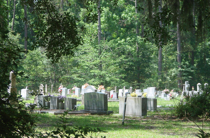
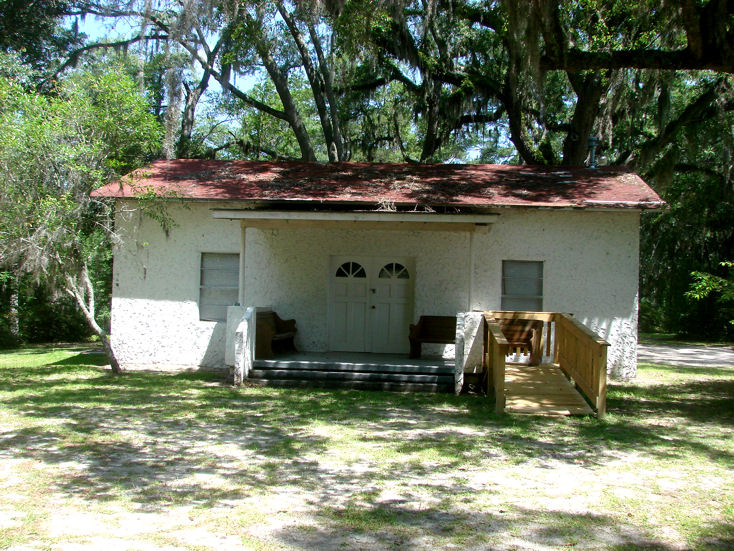
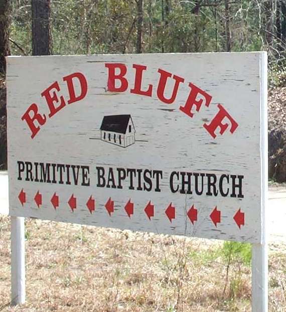
| Description | : | RED BLUFF CEMETERY and church is in the deep woods of Atkinson County Georgia, between the towns of Pearson and Cogdell. A few of the huge majestic old oak trees, hanging heavy with spanish moss, still remain close around the church and cemetery and they are a sight to see. This land and all the land surrounding this church was owned by John Williams in the 1800's. John Williams was an early settler here. He moved his family from Liberty County to what was then Ware County and settled there on Red Bluff Creek. He... Read More |
frequently asked questions (FAQ):
-
Where is Red Bluff Cemetery?
Red Bluff Cemetery is located at Pearson, Atkinson County ,Georgia ,USA.
-
Red Bluff Cemetery cemetery's updated grave count on graveviews.com?
0 memorials
-
Where are the coordinates of the Red Bluff Cemetery?
Latitude: 31.2272960
Longitude: -82.7846790
Nearby Cemetories:
1. Union Hill Cemetery
Axson, Atkinson County, USA
Coordinate: 31.2572250, -82.8017020
2. White Cemetery
Axson, Atkinson County, USA
Coordinate: 31.2528000, -82.7433014
3. Axson Community Cemetery
Axson, Atkinson County, USA
Coordinate: 31.2678000, -82.7358000
4. Axson Evangelist Church Cemetery
Axson, Atkinson County, USA
Coordinate: 31.2677059, -82.7295837
5. Ricketson Cemetery
Axson, Atkinson County, USA
Coordinate: 31.2943000, -82.8091000
6. Langs Church Cemetery
Homerville, Clinch County, USA
Coordinate: 31.1796494, -82.8526459
7. Ozias FreeWill Baptist Cemetery
Pearson, Atkinson County, USA
Coordinate: 31.2163157, -82.8909786
8. Mount Zion Cemetery
Axson, Atkinson County, USA
Coordinate: 31.3214090, -82.7581020
9. Little Utah Cemetery
Axson, Atkinson County, USA
Coordinate: 31.3013992, -82.7117004
10. Pearson Cemetery
Pearson, Atkinson County, USA
Coordinate: 31.3028400, -82.8558690
11. Salem Church Cemetery
Pearson, Atkinson County, USA
Coordinate: 31.1966550, -82.9091460
12. New Bethel Missionary Baptist Church Cemetery
Atkinson County, USA
Coordinate: 31.2650780, -82.9089070
13. Sweetwater United Methodist Church Cemetery
Pearson, Atkinson County, USA
Coordinate: 31.3275250, -82.8456800
14. Jowers Chapel Cemetery
Atkinson County, USA
Coordinate: 31.3502998, -82.7647018
15. Giddens Family Cemetery
Kirkland, Atkinson County, USA
Coordinate: 31.3102050, -82.9100740
16. New Pine Grove Church Cemetery
Homerville, Clinch County, USA
Coordinate: 31.1086200, -82.7080070
17. Kirkland United Methodist Church Cemetery
Kirkland, Atkinson County, USA
Coordinate: 31.3101970, -82.9112240
18. Mount Pleasant Missionary Baptist Church Cemetery
Atkinson County, USA
Coordinate: 31.3617510, -82.8372570
19. Stokesville Church Cemetery
Axson, Atkinson County, USA
Coordinate: 31.3549252, -82.7112503
20. Arabia Cemetery
Homerville, Clinch County, USA
Coordinate: 31.1124992, -82.8863983
21. Sirmans Rest Cemetery
Homerville, Clinch County, USA
Coordinate: 31.0830800, -82.8243100
22. Holmes Chapel Cemetery
Clinch County, USA
Coordinate: 31.0767002, -82.8003006
23. Tison Cemetery
Atkinson County, USA
Coordinate: 31.3764000, -82.8324966
24. Sunnyside Cemetery
Pearson, Atkinson County, USA
Coordinate: 31.3553480, -82.9041560