
| Memorials | : | 0 |
| Location | : | Abo, Torrance County, USA |
| Coordinate | : | 34.4565470, -106.3281240 |
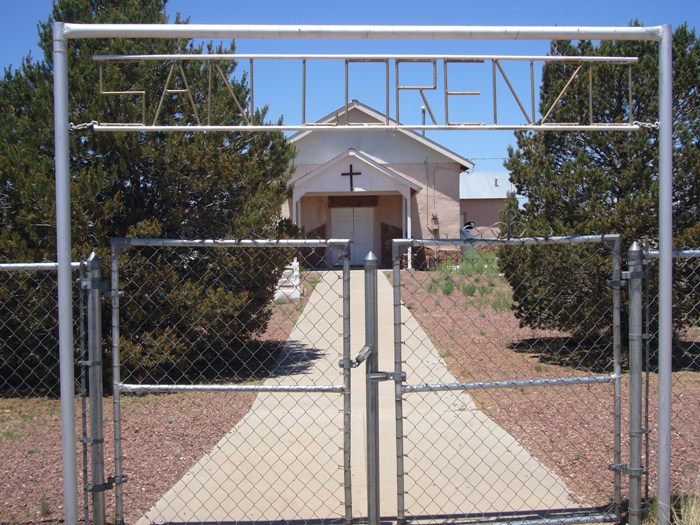
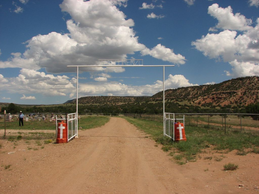
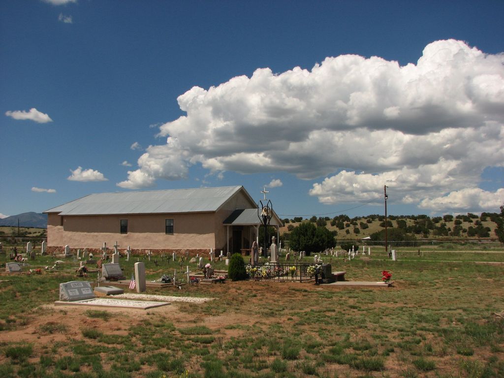
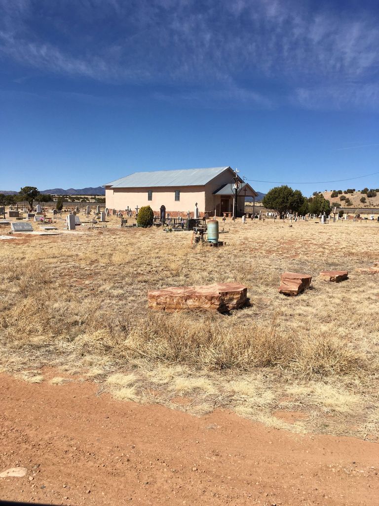
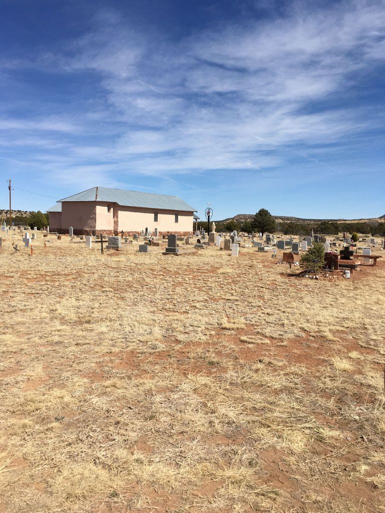
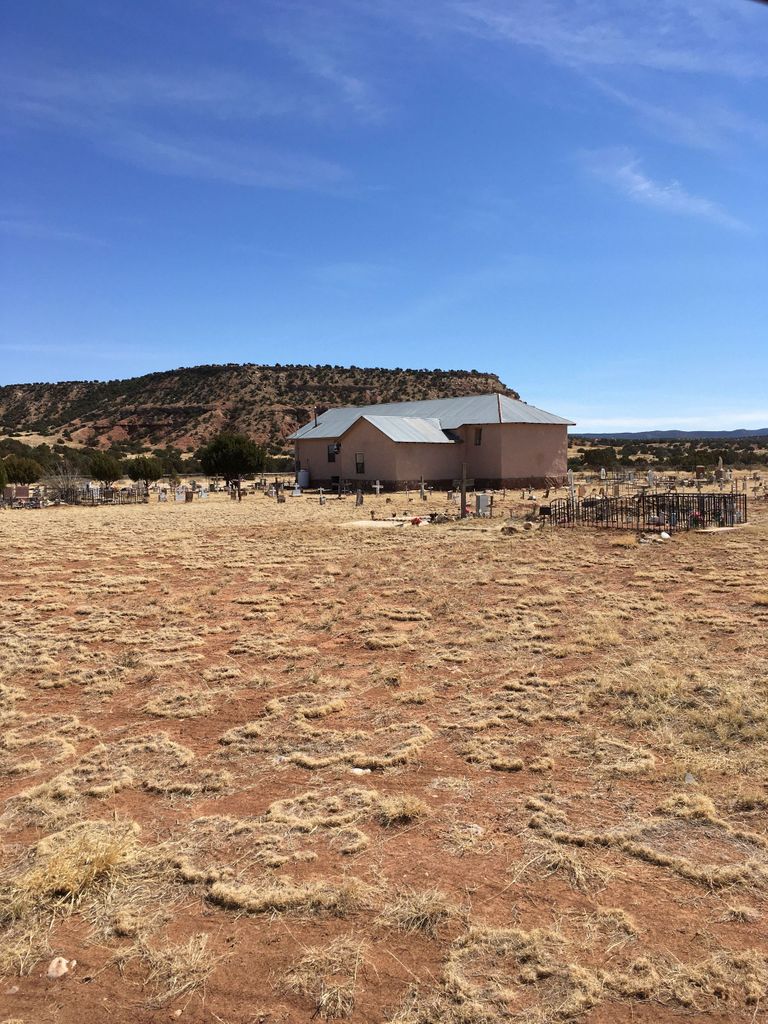
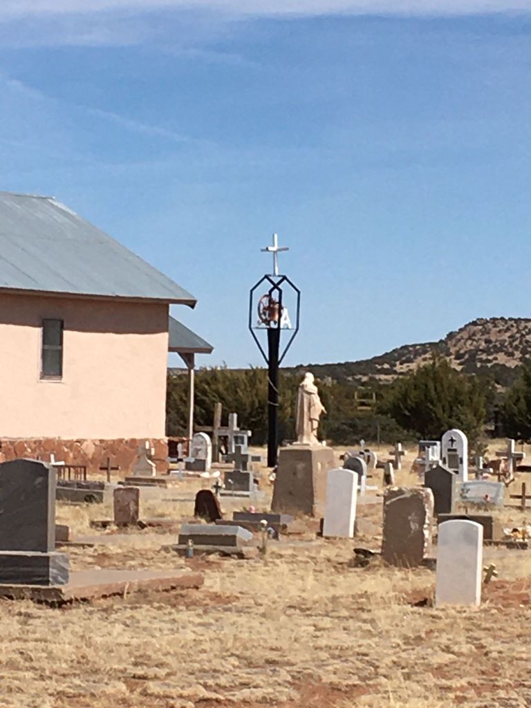
| Description | : | The cemetery is a church yard cemetery. It's located approximately 7 miles SW of Mountainaire, NM, on the SE side of US Highway 60, across the highway from what is known as Abo, NM. Unless you know what to look for and when, you won't see the church roof from US 60. There is no steeple. To find the cemetery, use the GPS coordinates, which will direct you to turn North off US 60 onto Barranca RD. The road turns back the South and proceeds underneath US 60 and the railroad. It's only about... Read More |
frequently asked questions (FAQ):
-
Where is San Lorenzo Cemetery?
San Lorenzo Cemetery is located at Abo, Torrance County ,New Mexico ,USA.
-
San Lorenzo Cemetery cemetery's updated grave count on graveviews.com?
0 memorials
-
Where are the coordinates of the San Lorenzo Cemetery?
Latitude: 34.4565470
Longitude: -106.3281240
Nearby Cemetories:
1. Mission San Gregorio de Abo
Torrance County, USA
Coordinate: 34.4508230, -106.3752560
2. Mountainair Cemetery
Mountainair, Torrance County, USA
Coordinate: 34.5153008, -106.2758026
3. Saint Alice Catholic Cemetery
Mountainair, Torrance County, USA
Coordinate: 34.5164600, -106.2758400
4. Mathews Cemetery
Mountainair, Torrance County, USA
Coordinate: 34.5398070, -106.3110930
5. Scholle Cemetery
Socorro County, USA
Coordinate: 34.4340200, -106.4298300
6. Abo Ruins Salinas Pueblo Missions Cemetery
Abo, Torrance County, USA
Coordinate: 34.5189760, -106.2417100
7. Purcella Eastview Cemetery
Torrance County, USA
Coordinate: 34.5783005, -106.3460999
8. Kayser-Eastview Cemetery
Torrance County, USA
Coordinate: 34.5783005, -106.3460999
9. Spencer Eastview Cemetery
Torrance County, USA
Coordinate: 34.5759830, -106.3639390
10. Pinon Cemetery
Mountainair, Torrance County, USA
Coordinate: 34.3766510, -106.2129400
11. La Cienega Mission Cemetery
Torrance County, USA
Coordinate: 34.5830994, -106.3313980
12. Cedar Grove Cemetery
Torrance County, USA
Coordinate: 34.4791985, -106.1738968
13. Punta de Agua Community Cemetery
Punta de Agua, Torrance County, USA
Coordinate: 34.5978080, -106.2794970
14. Saint Vincent De Paul Catholic Church Cemetery
Mountainair, Torrance County, USA
Coordinate: 34.5999985, -106.2833023
15. La Puerta Natural Burial
Belen, Valencia County, USA
Coordinate: 34.4669390, -106.5282730
16. Round Top Cemetery
Torrance County, USA
Coordinate: 34.4928017, -106.1061020
17. Manzano Hills Cemetery
Torrance County, USA
Coordinate: 34.6467018, -106.3443985
18. Our Lady of Sorrows Catholic Cemetery
Manzano, Torrance County, USA
Coordinate: 34.6467018, -106.3443985
19. Mount Calvary Cemetery
Torrance County, USA
Coordinate: 34.6343994, -106.2358017
20. Campo Santo Cemetery
Manzano, Torrance County, USA
Coordinate: 34.6507000, -106.3492000
21. Torreon Cemetery
Torreon, Torrance County, USA
Coordinate: 34.7211900, -106.2997140
22. Torreon Catholic Cemetery
Torreon, Torrance County, USA
Coordinate: 34.7213210, -106.2997510
23. CLL Ranch Cemetery
Torreon, Torrance County, USA
Coordinate: 34.7207494, -106.2703326
24. Farmer Cemetery
Willard, Torrance County, USA
Coordinate: 34.5745440, -106.0268070