
| Memorials | : | 0 |
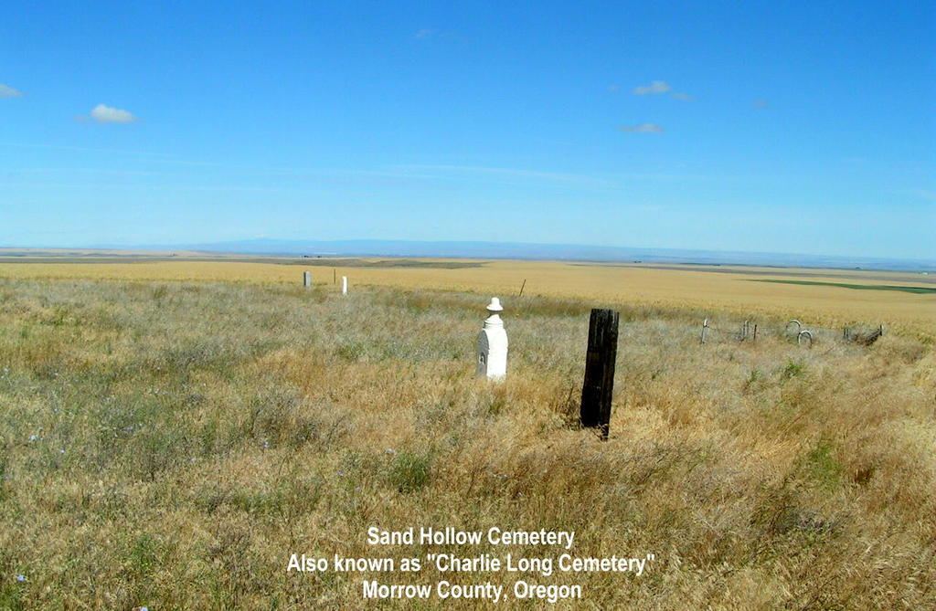
| Location | : | Lexington, Morrow County, USA |
| Coordinate | : | 45.5597115, -119.5014572 |
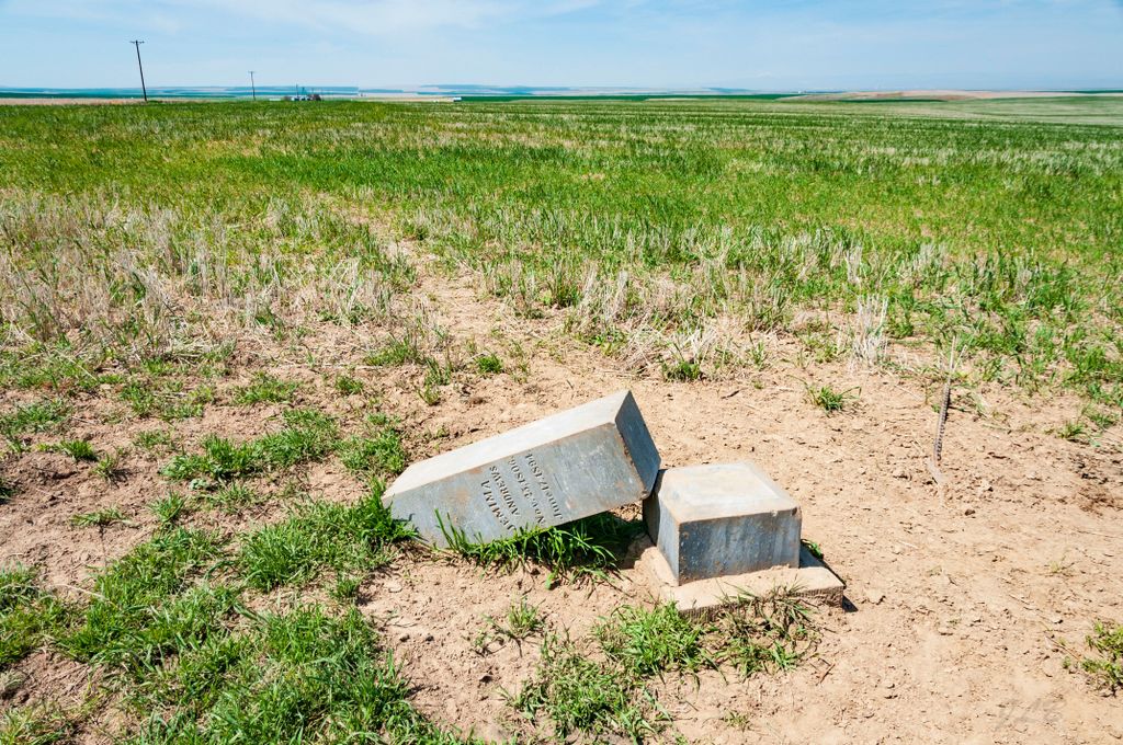
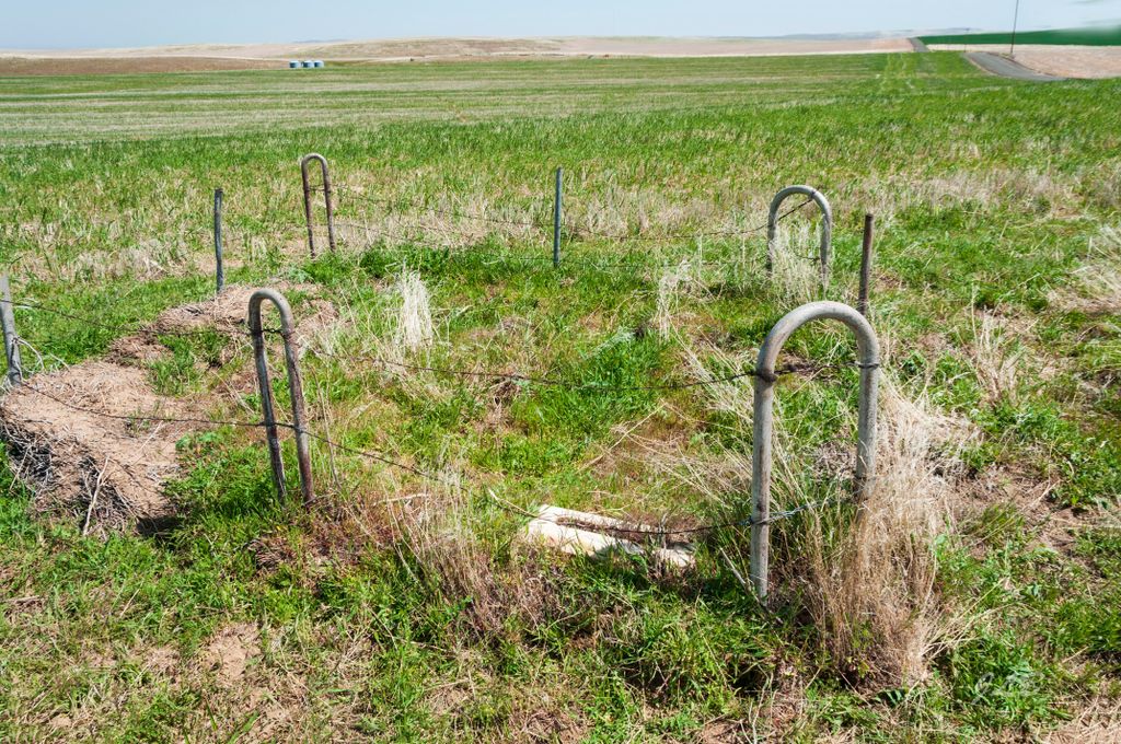
| Description | : | Also known as "Charlie Long Cemetery" after the son of Charlie Long who is believed to be the first burial in this cemetery in the Fall of 1886. Some old timers indicate that there are up to 95 graves located here of early pioneers to Morrow County. In 1967 there were just 9 markers that could be read. As of June 23, 2007, only 7 graves could be identified. Located about 15 miles northeast of Lexington, Oregon, on Barclay Road between Sand Hollow Road and Campbell Road. |
frequently asked questions (FAQ):
-
Where is Sand Hollow Cemetery?
Sand Hollow Cemetery is located at Lexington, Morrow County ,Oregon ,USA.
-
Sand Hollow Cemetery cemetery's updated grave count on graveviews.com?
0 memorials
-
Where are the coordinates of the Sand Hollow Cemetery?
Latitude: 45.5597115
Longitude: -119.5014572
Nearby Cemetories:
1. Yarlett Cemetery
Pine City, Morrow County, USA
Coordinate: 45.6077919, -119.4255066
2. Wells Springs Cemetery
Morrow County, USA
Coordinate: 45.6323395, -119.7066269
3. Pleasant Point Cemetery
Morrow County, USA
Coordinate: 45.4474983, -119.3341980
4. Penland Cemetery
Lexington, Morrow County, USA
Coordinate: 45.4331017, -119.6860962
5. Petteys Cemetery
Morrow County, USA
Coordinate: 45.5166206, -119.7587738
6. Masonic Cemetery
Heppner, Morrow County, USA
Coordinate: 45.3460999, -119.5488968
7. High View Cemetery
Ione, Morrow County, USA
Coordinate: 45.5052986, -119.8264008
8. Baumgardner Cemetery
Umatilla County, USA
Coordinate: 45.7625008, -119.2332993
9. Fort Henrietta Burial Site
Echo, Umatilla County, USA
Coordinate: 45.7419300, -119.1975500
10. Koontz Gravesite
Umatilla County, USA
Coordinate: 45.7365700, -119.1880000
11. Morgan Cemetery
Morgan, Morrow County, USA
Coordinate: 45.5491600, -119.9051285
12. Echo Memorial Cemetery
Echo, Umatilla County, USA
Coordinate: 45.7472000, -119.1931000
13. Foster Cemetery
Stanfield Junction, Umatilla County, USA
Coordinate: 45.7672005, -119.2114029
14. Baker Cemetery
Morrow County, USA
Coordinate: 45.4295387, -119.8717270
15. Clark Tippitt Cemetery
Morrow County, USA
Coordinate: 45.3424950, -119.2265472
16. Vinson Cemetery
Vinson, Umatilla County, USA
Coordinate: 45.4627991, -119.0927963
17. Nolin Cemetery
Umatilla County, USA
Coordinate: 45.6833000, -119.1027985
18. Hermiston Cemetery
Hermiston, Umatilla County, USA
Coordinate: 45.8236008, -119.2806015
19. Pleasant View Cemetery
Stanfield, Umatilla County, USA
Coordinate: 45.7943993, -119.2022018
20. Riverview Cemetery
Boardman, Morrow County, USA
Coordinate: 45.8493996, -119.6939011
21. Cecil Cemetery
Cecil, Morrow County, USA
Coordinate: 45.6242447, -119.9560699
22. Desert Lawn Memorial Cemetery
Irrigon, Morrow County, USA
Coordinate: 45.8972015, -119.4721985
23. Junkins Cemetery
Morrow County, USA
Coordinate: 45.3060989, -119.8206024
24. Rhea Creek Cemetery
Morrow County, USA
Coordinate: 45.2219009, -119.5410995