
| Memorials | : | 0 |
| Location | : | Spring Garden, Cherokee County, USA |
| Coordinate | : | 34.0209109, -85.5719098 |
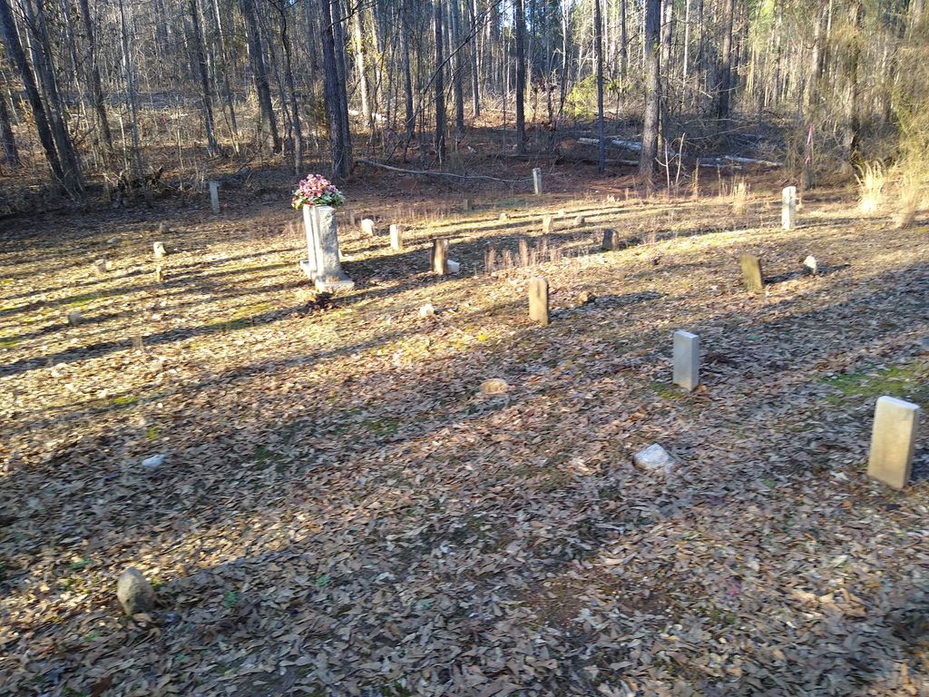
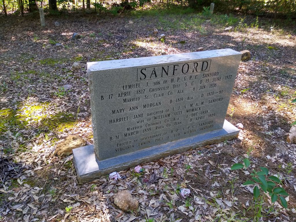
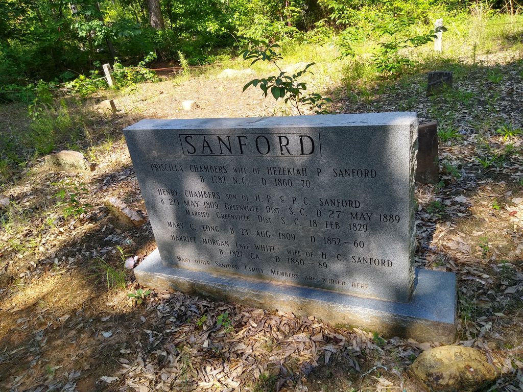
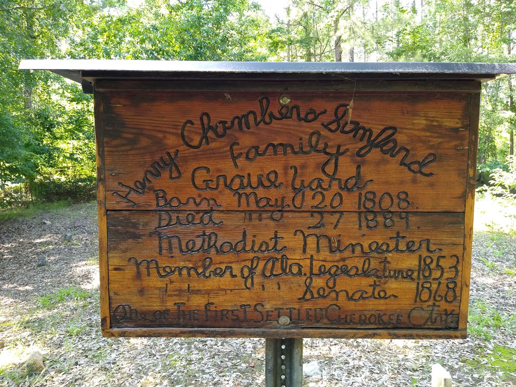
| Description | : | The Sanford Family Cemetery is a small Cemetery located right below the Cherokee water plan between Spring Garden and Centre, AL. There is mostly rocks marking the graves of the family.Legend has stated that some Cherokee Indians were buried there that was killed during a battle with the Creeks and Cherokee Indians near Terrapin Creek in the early 1800s. |
frequently asked questions (FAQ):
-
Where is Sanford Family Cemetery?
Sanford Family Cemetery is located at Spring Garden, Cherokee County ,Alabama ,USA.
-
Sanford Family Cemetery cemetery's updated grave count on graveviews.com?
0 memorials
-
Where are the coordinates of the Sanford Family Cemetery?
Latitude: 34.0209109
Longitude: -85.5719098
Nearby Cemetories:
1. Lebanon United Methodist Church Cemetery
Pleasant Gap, Cherokee County, USA
Coordinate: 34.0060997, -85.5528030
2. Mount Zion Cemetery
Spring Garden, Cherokee County, USA
Coordinate: 34.0480010, -85.5656430
3. Sheepskin Cemetery
Cherokee County, USA
Coordinate: 34.0505981, -85.5447006
4. Republican Baptist Church Cemetery
Ellisville, Cherokee County, USA
Coordinate: 34.0568120, -85.5918910
5. Pleasant Gap Cemetery
Pleasant Gap, Cherokee County, USA
Coordinate: 33.9916992, -85.5216980
6. Mountain Springs Cemetery
Tecumseh, Cherokee County, USA
Coordinate: 34.0396996, -85.6299973
7. Graham Cemetery
Spring Garden, Cherokee County, USA
Coordinate: 33.9694140, -85.5616508
8. Farmer Cemetery
Cherokee County, USA
Coordinate: 33.9716988, -85.5935974
9. Faith Baptist Church Cemetery
Piedmont, Calhoun County, USA
Coordinate: 33.9649620, -85.5547270
10. Mount Pleasant Cemetery
Pleasant Gap, Cherokee County, USA
Coordinate: 33.9783470, -85.5242420
11. Carmel Presbyterian Church Cemetery
Spring Garden, Cherokee County, USA
Coordinate: 33.9597015, -85.5753021
12. Union Grove Cemetery
Rock Run, Cherokee County, USA
Coordinate: 34.0158005, -85.4972000
13. Goshen Valley Cemetery
Cherokee County, USA
Coordinate: 33.9622002, -85.6172028
14. Ladiga Cemetery
Ladiga, Calhoun County, USA
Coordinate: 33.9399986, -85.5746994
15. Philadelphia Baptist Church Cemetery
Vigo, Calhoun County, USA
Coordinate: 33.9413986, -85.5466995
16. Hebron United Methodist Church Cemetery
Howells Crossroads, Cherokee County, USA
Coordinate: 34.1082993, -85.5556030
17. Pisgah Cemetery
Cherokee County, USA
Coordinate: 33.9958000, -85.6781006
18. Gnatville Cemetery
Gnatville, Cherokee County, USA
Coordinate: 33.9954000, -85.6781400
19. Providence Baptist Cemetery
Centre, Cherokee County, USA
Coordinate: 34.0950012, -85.6386032
20. Highland Cemetery
Piedmont, Calhoun County, USA
Coordinate: 33.9331017, -85.6153030
21. Jenning's Chapel Cemetery
Cherokee County, USA
Coordinate: 34.1019500, -85.5054410
22. Piedmont Memory Gardens
Piedmont, Calhoun County, USA
Coordinate: 33.9241900, -85.5926400
23. Old Piedmont Cemetery
Piedmont, Calhoun County, USA
Coordinate: 33.9260063, -85.6131363
24. Mount Olive FCM Church Cemetery
Cherokee County, USA
Coordinate: 34.0508003, -85.6911011