
| Memorials | : | 2634 |
| Location | : | Borås, Borås kommun, Sweden |
| Website | : | www.svenskakyrkan.se/boras/sta-birgitta-griftegard |
| Coordinate | : | 57.7142538, 12.9332699 |
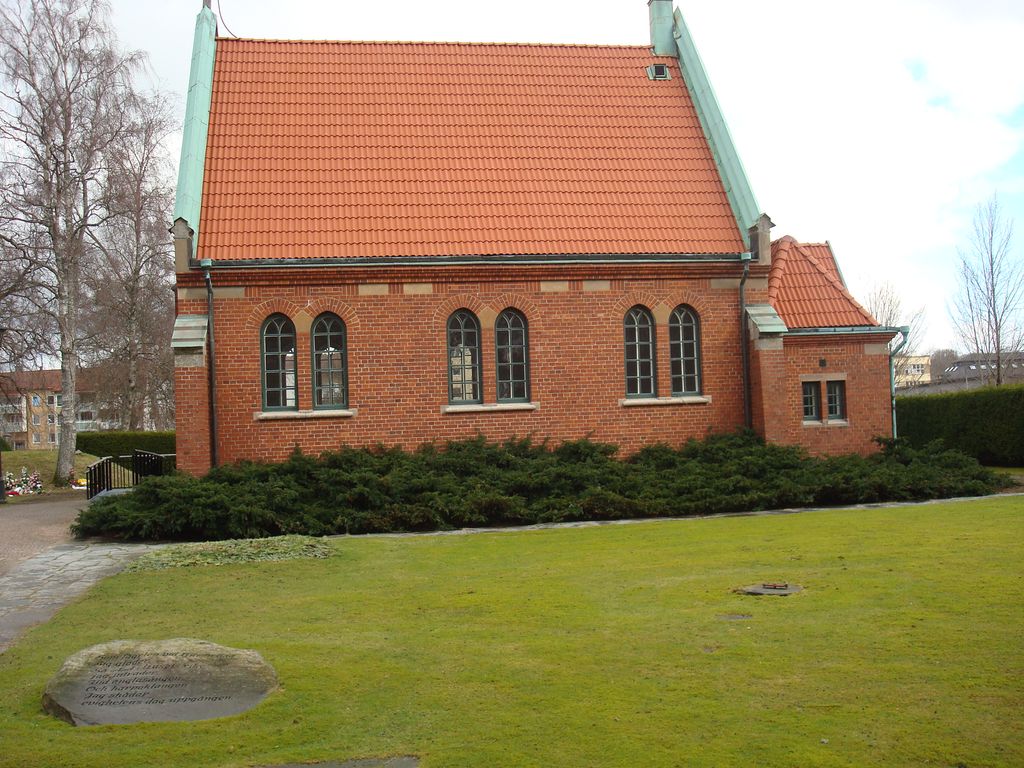
| Description | : | St. Birgitta's burial ground or as it was originally called, the New Cemetery, came into being at the end of the 19th century. The older part of the burial ground has the same style as St. Ansgar's burial ground; burial sites surrounded by frame, fence or hedge. In the newer part, there are burial sites in public grassland in a similar way as in St. Sigfrid's burial ground. One of the older burial quarters has been re-leased for burial of urns. In other respects, burials take place in existing coffin and urn graves. |
frequently asked questions (FAQ):
-
Where is Sankta Birgittas griftegård?
Sankta Birgittas griftegård is located at Götagatan 14 Borås, Borås kommun ,Västra Götalands län , 504 30Sweden.
-
Sankta Birgittas griftegård cemetery's updated grave count on graveviews.com?
2633 memorials
-
Where are the coordinates of the Sankta Birgittas griftegård?
Latitude: 57.7142538
Longitude: 12.9332699
Nearby Cemetories:
1. Sankt Ansgars griftegård
Borås, Borås kommun, Sweden
Coordinate: 57.7182057, 12.9351487
2. Caroli kyrkogård
Borås kommun, Sweden
Coordinate: 57.7219569, 12.9391612
3. Sankt Sigfrids griftegård
Borås, Borås kommun, Sweden
Coordinate: 57.7049706, 12.9184835
4. Brämhults kyrkogård
Borås, Borås kommun, Sweden
Coordinate: 57.7356940, 13.0276110
5. Sandhults kyrkogård
Borås, Borås kommun, Sweden
Coordinate: 57.7696917, 12.8221206
6. Toarp nya kyrkogård
Dalsjofors, Borås kommun, Sweden
Coordinate: 57.7360900, 13.1036900
7. Toarp Church Cemetery
Dalsjofors, Borås kommun, Sweden
Coordinate: 57.7377500, 13.1068330
8. Fristad Church Cemetery
Borås, Borås kommun, Sweden
Coordinate: 57.8181000, 13.0091000
9. Ljushults Kyrkogård
Borås, Borås kommun, Sweden
Coordinate: 57.6174795, 13.0432013
10. Rångedala kyrkogård
Rangedala, Borås kommun, Sweden
Coordinate: 57.7904470, 13.1219796
11. Äspered kyrkogård
Aspered, Borås kommun, Sweden
Coordinate: 57.7551211, 13.1835097
12. Vänga Kyrkogården
Fristad, Borås kommun, Sweden
Coordinate: 57.8588920, 12.9315350
13. Dannike kyrkogård
Dannike, Borås kommun, Sweden
Coordinate: 57.6833902, 13.2280893
14. Fritsla gamla kyrkogård
Fritsla, Marks kommun, Sweden
Coordinate: 57.5574232, 12.7928255
15. Skephult kyrkogård
Skepphult, Marks kommun, Sweden
Coordinate: 57.5361110, 12.8811110
16. Tvärred kyrkogård
Ulricehamn, Ulricehamns kommun, Sweden
Coordinate: 57.7258320, 13.3139710
17. Bollebygd Cemetery
Bollebygd, Bollebygds kommun, Sweden
Coordinate: 57.6666679, 12.5500002
18. Finnekumla kyrkogård
Finnekumla, Borås kommun, Sweden
Coordinate: 57.6562600, 13.3456100
19. Svenska Kyrkan
Svenljunga, Svenljunga kommun, Sweden
Coordinate: 57.4951300, 13.1159100
20. Orby Kyrkogard
Örby, Marks kommun, Sweden
Coordinate: 57.4818140, 12.7005510
21. Ornunga gamla kyrkogård
Ornunga, Vårgårda kommun, Sweden
Coordinate: 57.9795830, 12.9132220
22. Od Church Cemetery
Od, Herrljunga kommun, Sweden
Coordinate: 57.9432060, 13.1874130
23. Kapellkyrkogården Ulricehamn
Ulricehamn, Ulricehamns kommun, Sweden
Coordinate: 57.8045724, 13.4054033
24. Gällstad och Södra Säms kyrkogård
Gällstad, Ulricehamns kommun, Sweden
Coordinate: 57.6646110, 13.4307780