
| Memorials | : | 1 |
| Location | : | Camp Grove, Marshall County, USA |
| Coordinate | : | 41.0878590, -89.5733360 |
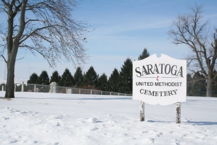
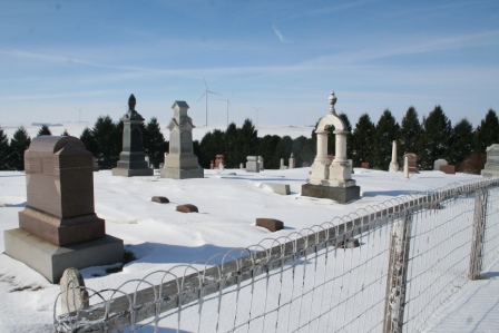
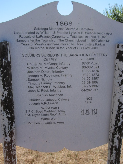
| Description | : | The cemetery is closer to Camp Grove, but the actual church building and congregation is in Henry; it was moved from the cemetery site years ago. |
frequently asked questions (FAQ):
-
Where is Saratoga United Methodist Cemetery?
Saratoga United Methodist Cemetery is located at Camp Grove, Marshall County ,Illinois ,USA.
-
Saratoga United Methodist Cemetery cemetery's updated grave count on graveviews.com?
1 memorials
-
Where are the coordinates of the Saratoga United Methodist Cemetery?
Latitude: 41.0878590
Longitude: -89.5733360
Nearby Cemetories:
1. Saint Patrick Cemetery
Marshall County, USA
Coordinate: 41.0616989, -89.6205978
2. Apostolic Christian Faith Cemetery
Camp Grove, Marshall County, USA
Coordinate: 41.0744667, -89.6330719
3. Mansfield Cemetery
Marshall County, USA
Coordinate: 41.0894012, -89.5108032
4. Whitefield Cemetery
Henry, Marshall County, USA
Coordinate: 41.1100121, -89.5033875
5. Camp Grove Prairie Preserve
Camp Grove, Marshall County, USA
Coordinate: 41.0468480, -89.6304450
6. Mead Cemetery
Camp Grove, Marshall County, USA
Coordinate: 41.0520750, -89.5054860
7. Grant Cemetery
Stark County, USA
Coordinate: 41.0772480, -89.6573000
8. LaPrairie United Presbyterian Cemetery
Sparland, Marshall County, USA
Coordinate: 41.0238630, -89.5634230
9. LaPrairie Methodist Cemetery
Sparland, Marshall County, USA
Coordinate: 41.0247550, -89.5911920
10. Mead Cemetery
Marshall County, USA
Coordinate: 41.0475680, -89.5047140
11. Eagleston Cemetery
Castleton, Stark County, USA
Coordinate: 41.0978012, -89.6866989
12. Mound Cemetery
Bureau, Bureau County, USA
Coordinate: 41.1741590, -89.5823280
13. Nighswonger Cemetery
Sparland, Marshall County, USA
Coordinate: 41.0628014, -89.4524994
14. Marshall County Poor Farm Cemetery
Sparland, Marshall County, USA
Coordinate: 41.0168200, -89.4760080
15. Sparland Cemetery
Sparland, Marshall County, USA
Coordinate: 41.0353410, -89.4553830
16. Sugar Grove Cemetery
Henry, Marshall County, USA
Coordinate: 41.1268997, -89.4460983
17. Milo Cemetery
Milo, Bureau County, USA
Coordinate: 41.1930618, -89.5827789
18. Bradford Apostolic Church Cemetery
Bradford, Stark County, USA
Coordinate: 41.1788300, -89.6476800
19. Pleasant Valley Cemetery
Stark County, USA
Coordinate: 41.0750008, -89.7164001
20. Saint John Cemetery
Bradford, Stark County, USA
Coordinate: 41.1631012, -89.6774979
21. Lawn Ridge Cemetery
Marshall County, USA
Coordinate: 40.9880981, -89.6314011
22. Champion Cemetery
Stark County, USA
Coordinate: 41.1481018, -89.6956024
23. Bonham Cemetery
Sparland, Marshall County, USA
Coordinate: 41.0607986, -89.4289017
24. Hunter Cemetery
Bureau County, USA
Coordinate: 41.1958360, -89.5196490