
| Memorials | : | 0 |
| Location | : | Bullock County, USA |
| Coordinate | : | 32.0881004, -85.7617035 |
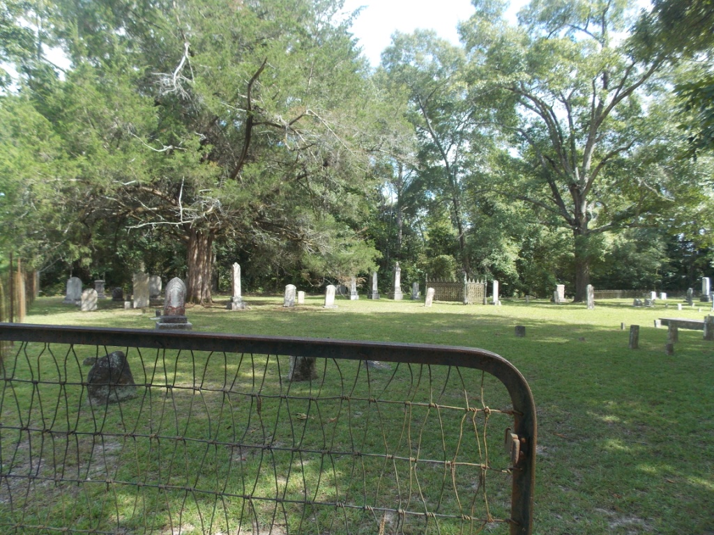
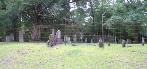
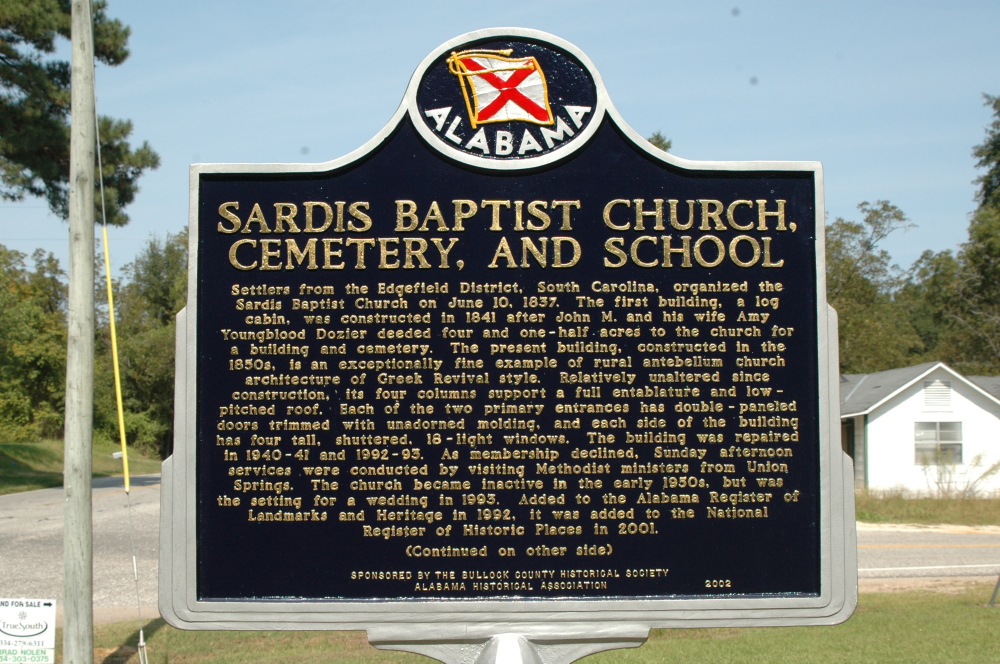
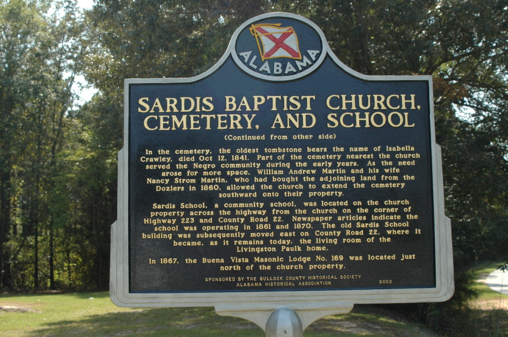
| Description | : | The Sardis Baptist Church is located on the southwest corner of the intersection of Alabama highway 223 and Bullock County Road 22, approximately 5 miles south of Union Springs. The cemetery is just east of the church on County Rd 22. The land for the Sardis Baptist Church and cemetery was deeded to the church on June 12, 1841, by John M. & Amy Youngblood Dozier. The Doziers are buried in the cemetery. The oldest headstone date in the cemetery is that of Isabella Crawley, who died October 12, 1841. Until about 1920, the area between... Read More |
frequently asked questions (FAQ):
-
Where is Sardis Baptist Church Cemetery?
Sardis Baptist Church Cemetery is located at Bullock County ,Alabama ,USA.
-
Sardis Baptist Church Cemetery cemetery's updated grave count on graveviews.com?
0 memorials
-
Where are the coordinates of the Sardis Baptist Church Cemetery?
Latitude: 32.0881004
Longitude: -85.7617035


Nearby Cemetories:
1. Old Sardis Baptist Church Cemetery
Union Springs, Bullock County, USA
Coordinate: 32.0917015, -85.7600021
2. Young Sardis Cemetery
Bullock County, USA
Coordinate: 32.1078120, -85.7957240
3. Micajah Stinson Cemetery
Union Springs, Bullock County, USA
Coordinate: 32.0934900, -85.8141750
4. Paulk Cemetery
Bullock County, USA
Coordinate: 32.1300011, -85.7827988
5. Lowfield Baptist Church Cemetery
Union Springs, Bullock County, USA
Coordinate: 32.1444630, -85.7685870
6. Mason Cemetery
Union Springs, Bullock County, USA
Coordinate: 32.1349983, -85.7230988
7. Walton Chapel Methodist Church Cemetery
Bullock County, USA
Coordinate: 32.0668983, -85.6892014
8. Aberfoil Community Cemetery
Bullock County, USA
Coordinate: 32.0682110, -85.6880380
9. High Ridge Cemetery
Bullock County, USA
Coordinate: 32.0231018, -85.7724991
10. Elizabeth Cemetery
Bullock County, USA
Coordinate: 32.0724983, -85.6849976
11. Old City Cemetery
Union Springs, Bullock County, USA
Coordinate: 32.1434402, -85.7173233
12. Inverness Cemetery
Bullock County, USA
Coordinate: 32.0214005, -85.7542038
13. Lydia Baptist Cemetery
Union Springs, Bullock County, USA
Coordinate: 32.0740890, -85.6838870
14. Trinity Episcopal Church Cemetery
Union Springs, Bullock County, USA
Coordinate: 32.1436060, -85.7164880
15. Bethlehem Missionary Baptist Church Cemetery
Union Springs, Bullock County, USA
Coordinate: 32.0978610, -85.8422620
16. Oak Hill Cemetery
Union Springs, Bullock County, USA
Coordinate: 32.1492004, -85.7221985
17. Hubbard Cemetery
Bullock County, USA
Coordinate: 32.0325012, -85.8167038
18. Strom Family Cemetery
Bullock County, USA
Coordinate: 32.0505981, -85.8395004
19. Bethel Presbyterian Church Cemetery
Bullock County, USA
Coordinate: 32.0236015, -85.7082977
20. Perpetual Care Cemetery
Union Springs, Bullock County, USA
Coordinate: 32.1469002, -85.6885986
21. Postoak Cemetery
Postoak, Bullock County, USA
Coordinate: 32.0130997, -85.8110962
22. Macedonia Baptist Church Cemetery
Union Springs, Bullock County, USA
Coordinate: 32.0419006, -85.8497009
23. Cornerstone Cemetery
Bullock County, USA
Coordinate: 32.1450005, -85.8432999
24. Williams Cemetery
Union Springs, Bullock County, USA
Coordinate: 32.1556015, -85.6908035