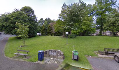
| Memorials | : | 0 |
| Location | : | Marsden, Metropolitan Borough of Kirklees, England |
| Coordinate | : | 53.6010690, -1.9290030 |
| Description | : | Originally the villagers of Marsden would have had to travel to Huddersfield or Almondbury to attend worship. Due to the distance, and the condition of the roads, an Anglican Chapel-of-Ease was built in Marsden in the 15th Century. On the same site, the Second Anglican Chapel was opened in 1758, seated 648, had three galleries, and was across the road from the present St Bartholomew's (the Third Anglican Church in Marsden). In 1798 Black Fever killed 15% of the population, there wasn't enough room in the churchyard for the bodies, so its level was raised by 3 feet by carting... Read More |
frequently asked questions (FAQ):
-
Where is Second Anglican Chapel in Marsden?
Second Anglican Chapel in Marsden is located at Marsden, Metropolitan Borough of Kirklees ,West Yorkshire ,England.
-
Second Anglican Chapel in Marsden cemetery's updated grave count on graveviews.com?
0 memorials
-
Where are the coordinates of the Second Anglican Chapel in Marsden?
Latitude: 53.6010690
Longitude: -1.9290030
Nearby Cemetories:
1. St Bartholomew Churchyard
Marsden, Metropolitan Borough of Kirklees, England
Coordinate: 53.6010890, -1.9294800
2. Buckley Hill Chapel
Marsden, Metropolitan Borough of Kirklees, England
Coordinate: 53.6019430, -1.9274970
3. Slaithwaite Cemetery
Slaithwaite, Metropolitan Borough of Kirklees, England
Coordinate: 53.6173740, -1.8930700
4. St. James's Churchyard
Slaithwaite, Metropolitan Borough of Kirklees, England
Coordinate: 53.6225530, -1.8828880
5. Providence Baptist Chapelyard
Slaithwaite, Metropolitan Borough of Kirklees, England
Coordinate: 53.6206749, -1.8783838
6. St. Bartholomew's Churchyard
Scammonden, Metropolitan Borough of Kirklees, England
Coordinate: 53.6405370, -1.9311750
7. Pole Moor Chapel Graveyard
Pole Moor, Metropolitan Borough of Kirklees, England
Coordinate: 53.6392030, -1.8996510
8. Meltham Methodist Burial Ground
Meltham, Metropolitan Borough of Kirklees, England
Coordinate: 53.5926860, -1.8535554
9. Meltham Methodist Church
Meltham, Metropolitan Borough of Kirklees, England
Coordinate: 53.5930087, -1.8530680
10. St Bartholomew Churchyard
Meltham, Metropolitan Borough of Kirklees, England
Coordinate: 53.5920720, -1.8513500
11. Linthwaite Methodist Church
Linthwaite, Metropolitan Borough of Kirklees, England
Coordinate: 53.6221298, -1.8572562
12. Christ Church Churchyard
Helme, Metropolitan Borough of Kirklees, England
Coordinate: 53.6031000, -1.8487000
13. Calmlands Cemetery
Meltham, Metropolitan Borough of Kirklees, England
Coordinate: 53.5874570, -1.8518656
14. St James Churchyard
Meltham, Metropolitan Borough of Kirklees, England
Coordinate: 53.5947200, -1.8388200
15. Wellhouse Methodist Graveyard
Metropolitan Borough of Kirklees, England
Coordinate: 53.6342600, -1.8571000
16. Christ Church Cemetery and Churchyard
Linthwaite, Metropolitan Borough of Kirklees, England
Coordinate: 53.6260200, -1.8462000
17. Golcar Baptist Church
Golcar, Metropolitan Borough of Kirklees, England
Coordinate: 53.6357784, -1.8525264
18. Scapegoat Hill Baptist Church Cemetery
Metropolitan Borough of Kirklees, England
Coordinate: 53.6436000, -1.8644800
19. Krumlin Methodist Graveyard
Barkisland, Metropolitan Borough of Calderdale, England
Coordinate: 53.6582489, -1.9250975
20. St. John the Evangelist Churchyard
Golcar, Metropolitan Borough of Kirklees, England
Coordinate: 53.6391300, -1.8551400
21. St. John's Church
Rishworth, Metropolitan Borough of Calderdale, England
Coordinate: 53.6574800, -1.9520000
22. St. Chad Churchyard
Uppermill, Metropolitan Borough of Oldham, England
Coordinate: 53.5542570, -1.9901190
23. Rishworth Baptist Churchyard
Rishworth, Metropolitan Borough of Calderdale, England
Coordinate: 53.6595480, -1.9494070
24. Outlane Methodist Church Graveyard
Outlane, Metropolitan Borough of Kirklees, England
Coordinate: 53.6553950, -1.8778920

