
| Memorials | : | 0 |
| Location | : | Panola, Sumter County, USA |
| Coordinate | : | 32.9361300, -88.2495800 |
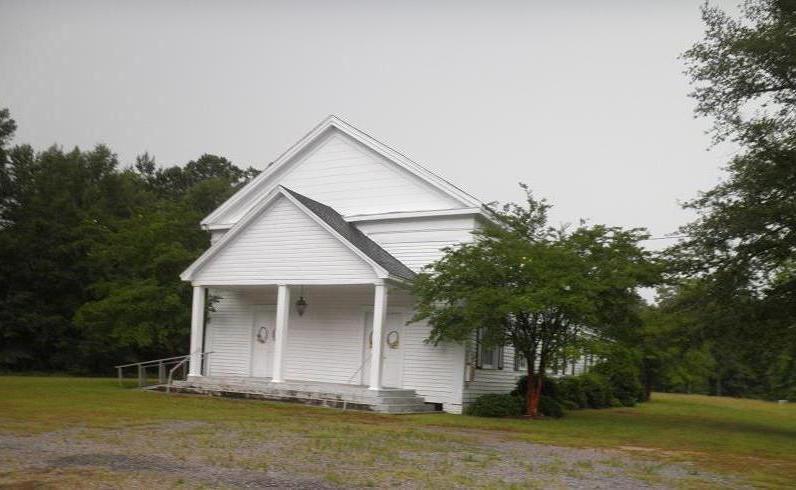
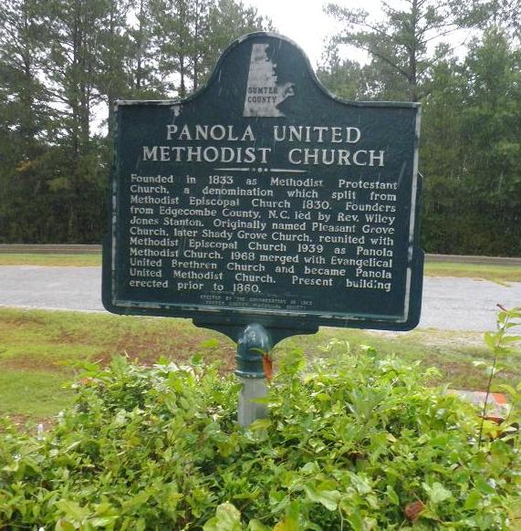
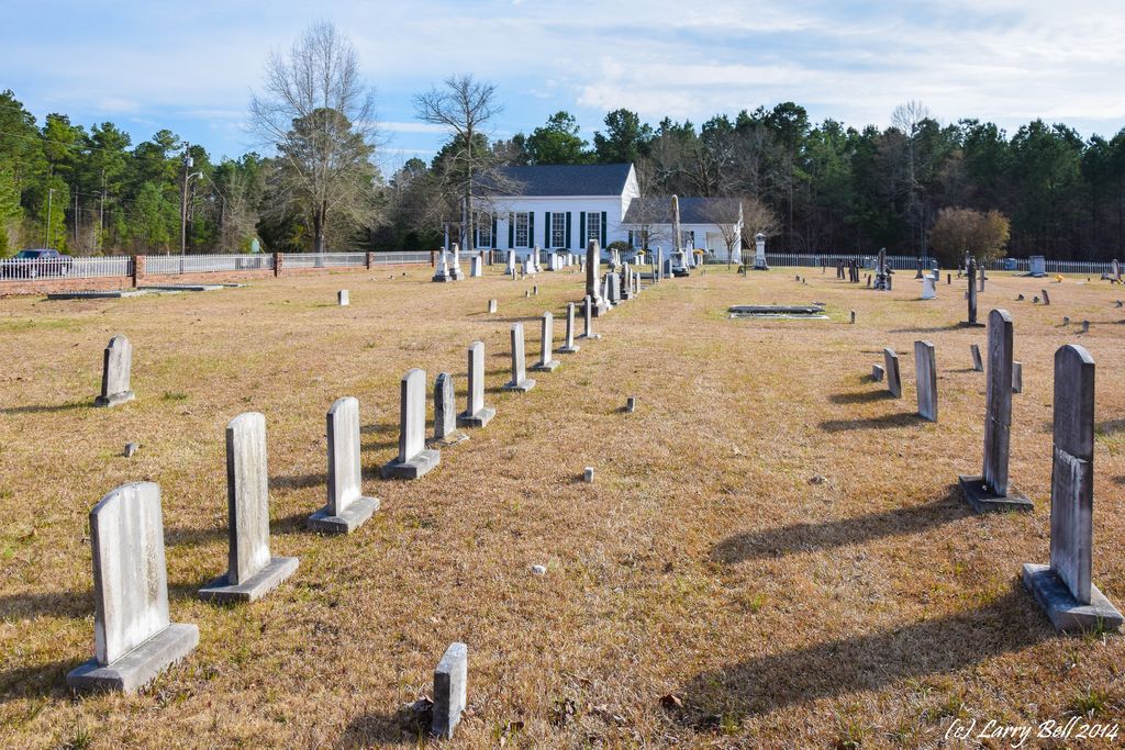
| Description | : | Founded in 1833 as Methodist Protestant Church, a denomination which split from Methodist Episcopal Church in 1830. Founders from Edgecomb County, N.C. led by Rev. Wiley Jones Stanton. Originally named Pleasant Grove Church, later Shady Grove Church, reunited with Methodist Episcopal Church 1939 as Panola Methodist Church. 1968 merged with Evangelical United Brethren Church and became Panola United Methodist Church. Present building erected prior to 1860.+ This Cemetery is locally known as Shady Grove Cemetery, but is often referred to as Panola United Methodist Church Cemetery in obituaries. It is also listed on some maps as... Read More |
frequently asked questions (FAQ):
-
Where is Shady Grove Cemetery?
Shady Grove Cemetery is located at Sumter CR 35 (Claude Jackson Highway) Panola, Sumter County ,Alabama ,USA.
-
Shady Grove Cemetery cemetery's updated grave count on graveviews.com?
0 memorials
-
Where are the coordinates of the Shady Grove Cemetery?
Latitude: 32.9361300
Longitude: -88.2495800

Nearby Cemetories:
1. Zion Valley Baptist Church Cemetery
Panola, Sumter County, USA
Coordinate: 32.9426000, -88.2450000
2. Salem AME Zion Church Cemetery
Sumter County, USA
Coordinate: 32.9167360, -88.2516250
3. Galilee Baptist Church Cemetery
Panola, Sumter County, USA
Coordinate: 32.9394500, -88.2823300
4. Jamestown Cemetery
Sumter County, USA
Coordinate: 32.9399986, -88.2099991
5. Hargrove Cemetery
Sumter County, USA
Coordinate: 32.9713800, -88.2458200
6. Geiger Family Cemetery
Panola, Sumter County, USA
Coordinate: 32.9591900, -88.2968000
7. Taylor-Watkins Cemetery
Warsaw, Sumter County, USA
Coordinate: 32.9130700, -88.1977300
8. Mount Pleasant Baptist Church Cemetery
Panola, Sumter County, USA
Coordinate: 32.9809400, -88.1999800
9. Mount Tabor Cemetery
Panola, Sumter County, USA
Coordinate: 32.9511500, -88.3231100
10. Saint John Baptist Church Cemetery
Panola, Sumter County, USA
Coordinate: 32.8852060, -88.2028010
11. Antioch Cemetery
Pickens County, USA
Coordinate: 33.0014000, -88.2466965
12. Adams Cemetery
Pickens County, USA
Coordinate: 33.0005989, -88.2677994
13. Jones-Aust Cemetery
Geiger, Sumter County, USA
Coordinate: 32.9154770, -88.3314940
14. Dancy First Baptist Cemetery
Dancy, Pickens County, USA
Coordinate: 33.0038986, -88.2930984
15. Watts Cemetery
Sumter County, USA
Coordinate: 32.9261017, -88.3427963
16. Dancy Family Cemetery
Dancy, Pickens County, USA
Coordinate: 33.0147100, -88.2944400
17. Coleman Cemetery
Greene County, USA
Coordinate: 32.9407997, -88.1453018
18. Pleasant Valley Cemetery
Greene County, USA
Coordinate: 32.9235992, -88.1397018
19. Green Chapel Baptist Church Cemetery
Cooksville, Noxubee County, USA
Coordinate: 32.9330100, -88.3665400
20. Vienna Cemetery
Vienna, Pickens County, USA
Coordinate: 33.0243600, -88.1953000
21. Craig Cemetery
Greene County, USA
Coordinate: 32.9155998, -88.1333008
22. Hill Cemetery
Greene County, USA
Coordinate: 32.9743996, -88.1382980
23. Souls Chapel Cemetery
Geiger, Sumter County, USA
Coordinate: 32.8424988, -88.2996979
24. Spencer Family Cemetery
Dancy, Pickens County, USA
Coordinate: 33.0329000, -88.2966000