
| Memorials | : | 0 |
| Location | : | Clarendon, Monroe County, USA |
| Coordinate | : | 34.7152300, -91.2875900 |
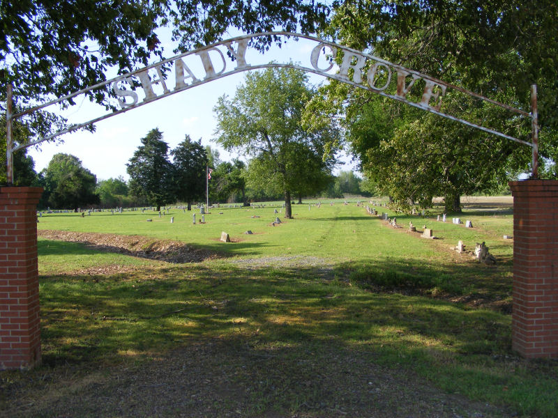
| Description | : | Shady Grove North Cemetery is a very old African American Cemetery. It is located at the end of State Hwy 86, north of US Hwy 79, east of Clarendon, Monroe, Arkansas (north of and across the road from Shady Grove South Cemetery). |
frequently asked questions (FAQ):
-
Where is Shady Grove Cemetery North?
Shady Grove Cemetery North is located at Clarendon, Monroe County ,Arkansas , 72029USA.
-
Shady Grove Cemetery North cemetery's updated grave count on graveviews.com?
0 memorials
-
Where are the coordinates of the Shady Grove Cemetery North?
Latitude: 34.7152300
Longitude: -91.2875900
Nearby Cemetories:
1. Shady Grove Cemetery
Clarendon, Monroe County, USA
Coordinate: 34.7135900, -91.2873100
2. Bateman Cemetery
Clarendon, Monroe County, USA
Coordinate: 34.7022018, -91.2817001
3. Mount Zion Cemetery
Clarendon, Monroe County, USA
Coordinate: 34.6933899, -91.2543716
4. New Hope Cemetery
Monroe County, USA
Coordinate: 34.7616090, -91.2356670
5. Josephs Cemetery
Clarendon, Monroe County, USA
Coordinate: 34.6780000, -91.2196500
6. Choctaw Cemetery
Monroe County, USA
Coordinate: 34.8025017, -91.2703018
7. Shiloh Cemetery
Holly Grove, Monroe County, USA
Coordinate: 34.6699982, -91.1763992
8. Roc Roe Cemetery
Monroe County, USA
Coordinate: 34.6232986, -91.3480988
9. Peppers Lake Cemetery
Peppers Lake, Prairie County, USA
Coordinate: 34.7386093, -91.4155579
10. Pleasant Home Cemetery
Prairie County, USA
Coordinate: 34.7386017, -91.4163971
11. Philadelphia Cemetery
Monroe County, USA
Coordinate: 34.8236008, -91.2538986
12. Roe Cemetery
Roe, Monroe County, USA
Coordinate: 34.6354000, -91.3829500
13. Jordan Cemetery
Monroe County, USA
Coordinate: 34.7980995, -91.1900024
14. Upper Cemetery
Rich, Monroe County, USA
Coordinate: 34.7574997, -91.1541977
15. Saint Paul Cemetery
Roe, Monroe County, USA
Coordinate: 34.6218987, -91.3839035
16. Saint Paul Upper Hill Cemetery
Prairie County, USA
Coordinate: 34.6219300, -91.3840690
17. White Church Cemetery
Monroe, Monroe County, USA
Coordinate: 34.7452200, -91.1379920
18. Travelers Rest Cemetery
Holly Grove, Monroe County, USA
Coordinate: 34.5922012, -91.2249985
19. Hayes Cemetery
Holly Grove, Monroe County, USA
Coordinate: 34.5919300, -91.2256800
20. Saint John Cemetery
Monroe County, USA
Coordinate: 34.8236008, -91.1856003
21. Bonds Cemetery
Monroe County, USA
Coordinate: 34.7207985, -91.1196976
22. Dyer Cemetery
Monroe County, USA
Coordinate: 34.6472015, -91.1410980
23. Harris Cemetery
Biscoe, Prairie County, USA
Coordinate: 34.8119011, -91.4169006
24. Harrison Cemetery
Biscoe, Prairie County, USA
Coordinate: 34.8120320, -91.4171690