
| Memorials | : | 0 |
| Location | : | Lawrence County, USA |
| Coordinate | : | 31.6553700, -90.0827400 |
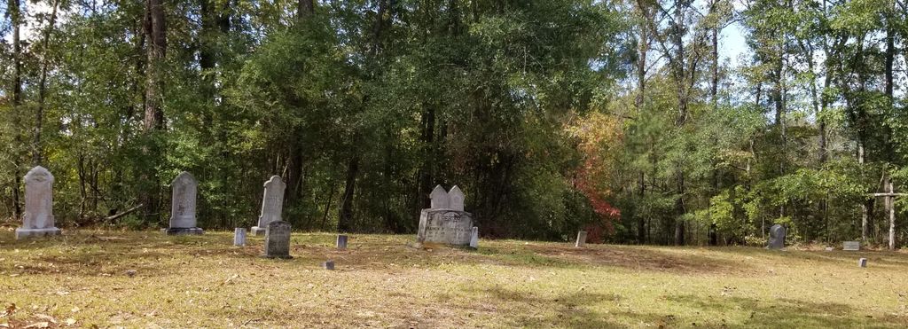
| Description | : | Location: S23 T8N R21W, northeast of Monticello Directions: Leave Hwy. 84, east of Monticello, on Mill Road north for 4.8 miles. Take a left off Mill Road approximately .5 mile, turn right or about 1.5 miles, take a left onto a dead end road about .3 mile. There are several infant graves; several wooden markers; and approximately 30 graves not marked. Information for this cemetery taken from the Cemetery Records of Lawrence County, Mississippi, 1810-1988. |
frequently asked questions (FAQ):
-
Where is Sharp Cemetery?
Sharp Cemetery is located at Lawrence County ,Mississippi ,USA.
-
Sharp Cemetery cemetery's updated grave count on graveviews.com?
0 memorials
-
Where are the coordinates of the Sharp Cemetery?
Latitude: 31.6553700
Longitude: -90.0827400
Nearby Cemetories:
1. Pleasant Grove Cemetery
Lawrence County, USA
Coordinate: 31.6411500, -90.0727600
2. Crooked Creek Baptist Church Cemetery
New Hebron, Lawrence County, USA
Coordinate: 31.6641693, -90.0555573
3. Faith Baptist Church Cemetery
Ferguson, Lawrence County, USA
Coordinate: 31.6576500, -90.0486700
4. Saint James Baptist Church Cemetery
Oma, Lawrence County, USA
Coordinate: 31.6514080, -90.1264080
5. Wanilla Cemetery
Lawrence County, USA
Coordinate: 31.6559020, -90.1284460
6. Scarborough Cemetery
Lawrence County, USA
Coordinate: 31.6653004, -90.0382996
7. Wanilla Baptist Church Cemetery
Wanilla, Lawrence County, USA
Coordinate: 31.6432705, -90.1284332
8. Wilson Cemetery
Lawrence County, USA
Coordinate: 31.6161003, -90.1044006
9. Spurlock Old Slave Cemetery
Silver Creek, Lawrence County, USA
Coordinate: 31.6672100, -90.0332700
10. Stephens Cemetery
Lawrence County, USA
Coordinate: 31.6518993, -90.0246964
11. Friendship Missionary Baptist Church Cemetery
Lawrence County, USA
Coordinate: 31.6198700, -90.1236500
12. Saint James Cemetery Old
Lawrence County, USA
Coordinate: 31.6965500, -90.1196300
13. Stringer Cemetery
Lawrence County, USA
Coordinate: 31.6982994, -90.0464020
14. Bible Church Cemetery
Silver Creek, Lawrence County, USA
Coordinate: 31.6148470, -90.0286986
15. Shalom Baptist Church Cemetery
Silver Creek, Lawrence County, USA
Coordinate: 31.6938600, -90.0169340
16. W.W. Scarborough Family Cemetery
Silver Creek, Lawrence County, USA
Coordinate: 31.6413800, -90.0039600
17. Cliburn Cemetery
New Hebron, Lawrence County, USA
Coordinate: 31.7068996, -90.0278015
18. Coleman Chapel Church Of God In Christ Cemetery
Silver Creek, Lawrence County, USA
Coordinate: 31.6551400, -89.9968900
19. North Pleasant Hill Cemetery
Lawrence County, USA
Coordinate: 31.7275009, -90.0485992
20. Armstrong Cemetery
Silver Creek, Lawrence County, USA
Coordinate: 31.6114006, -90.0030975
21. Longino Cemetery
Silver Creek, Lawrence County, USA
Coordinate: 31.6824400, -89.9928100
22. Pen Oak Cemetery
Lawrence County, USA
Coordinate: 31.5818300, -90.0350600
23. Calvary Baptist Church Cemetery
Silver Creek, Lawrence County, USA
Coordinate: 31.6008200, -90.0060400
24. Benson Cemetery
New Hebron, Lawrence County, USA
Coordinate: 31.6935997, -89.9925003