
| Memorials | : | 0 |
| Location | : | Leeds, Jefferson County, USA |
| Coordinate | : | 33.5538729, -86.5453079 |
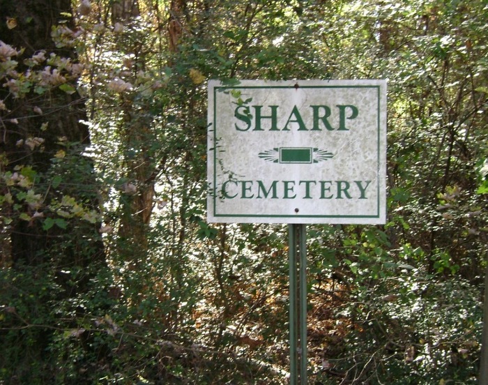
| Description | : | Sharp cemetery is located inside the city limits of Leeds, Jefferson County, Alabama. It is badly overgrown in most areas due to lack of continued maintenance. To reach the cemetery, turn left, down Lane Drive, from Highway 411 if coming from the South (red light at the old City park) approx. 1/2 mile, turn left on Hardy Street and the road dead ends after 2 blocks, into Sharp cemetery. The Cemetery was established about 1910 and was formerly known as Maple Grove or Farley Cemetery. There are supposed to be several hundred graves here but only those listed are free... Read More |
frequently asked questions (FAQ):
-
Where is Sharp Cemetery?
Sharp Cemetery is located at Leeds, Jefferson County ,Alabama ,USA.
-
Sharp Cemetery cemetery's updated grave count on graveviews.com?
0 memorials
-
Where are the coordinates of the Sharp Cemetery?
Latitude: 33.5538729
Longitude: -86.5453079
Nearby Cemetories:
1. Shiloh Cemetery
Leeds, Jefferson County, USA
Coordinate: 33.5503100, -86.5417100
2. Moton Hill Cemetery
Leeds, Jefferson County, USA
Coordinate: 33.5598100, -86.5558400
3. Cedar Grove Cemetery
Leeds, St. Clair County, USA
Coordinate: 33.5583000, -86.5263977
4. Parkway Apartments Cemetery
Leeds, Jefferson County, USA
Coordinate: 33.5420140, -86.5629890
5. Scott City Cemetery
Leeds, Jefferson County, USA
Coordinate: 33.5462330, -86.5773690
6. Fairview Freewill Baptist Church Cemetery
Moody, St. Clair County, USA
Coordinate: 33.5921490, -86.5223230
7. Sand Ridge Cemetery
Shelby County, USA
Coordinate: 33.5194016, -86.5117035
8. Little Family Cemetery
Jefferson County, USA
Coordinate: 33.5138480, -86.5825650
9. Dunnavant Community Cemetery
Dunavant, Shelby County, USA
Coordinate: 33.4988500, -86.5439590
10. Harmony Church Cemetery
Dunavant, Shelby County, USA
Coordinate: 33.5260100, -86.4876400
11. Moody Cemetery
Moody, St. Clair County, USA
Coordinate: 33.5863991, -86.4852982
12. Pool Cemetery
Jefferson County, USA
Coordinate: 33.5066500, -86.5936370
13. Mount Olive Cemetery
Shelby County, USA
Coordinate: 33.4902992, -86.5436020
14. McCombs Cemetery
Irondale, Jefferson County, USA
Coordinate: 33.5592003, -86.6267014
15. Stewarts Cemetery
St. Clair County, USA
Coordinate: 33.5335999, -86.4649963
16. Forest Crest Cemetery
Birmingham, Jefferson County, USA
Coordinate: 33.5505524, -86.6313629
17. Hollis Cemetery
St. Clair County, USA
Coordinate: 33.5382996, -86.4606018
18. Mount Hebron Cemetery
Leeds, Jefferson County, USA
Coordinate: 33.4989014, -86.6031036
19. Pleasant Ridge Cemetery
Dunavant, Shelby County, USA
Coordinate: 33.4796982, -86.5717010
20. Lee Cemetery
Pell City, St. Clair County, USA
Coordinate: 33.5667870, -86.4516740
21. Alton Cemetery
Birmingham, Jefferson County, USA
Coordinate: 33.5801470, -86.6357270
22. Kendrick Family Cemetery
Dunavant, Shelby County, USA
Coordinate: 33.4718050, -86.5733010
23. Ellard Family Cemetery
Jefferson County, USA
Coordinate: 33.6054780, -86.6331570
24. Hollis Cemetery
Shelby County, USA
Coordinate: 33.4639015, -86.5278015