
| Memorials | : | 22 |
| Location | : | Washington Township, Darke County, USA |
| Coordinate | : | 40.1064360, -84.7441260 |
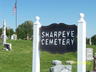
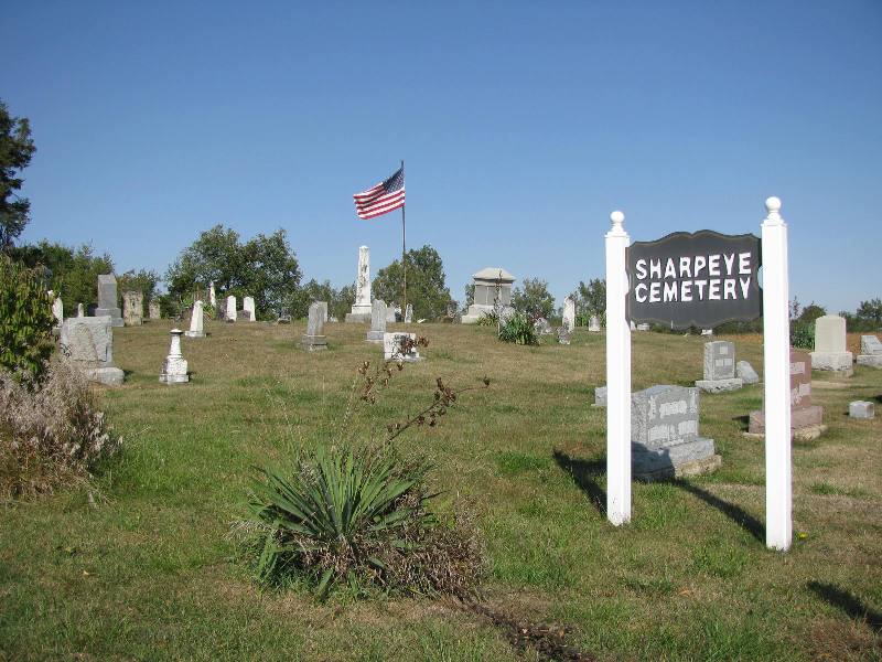
| Description | : | The cemetery is located on the north side of Ohio State Route 502 about 0.15 miles east of its intersection with Palestine-Union City Road (County Road 30). The cemetery is located in Washington Township, Darke County, Ohio, and is # 2782 (Sharpeye Cemetery) in “Ohio Cemeteries 1803-2003”, compiled by the Ohio Genealogical Society. The cemetery is registered with the Ohio Division of Real Estate and Professional Licensing (ODRE) as Sharpeye Cemetery with registration license number CGR.0000981237. The U.S. Geological Survey (USGS) Geographic Names Information System (GNIS) feature ID for the cemetery is 1806195 (Sharpeye Cemetery). |
frequently asked questions (FAQ):
-
Where is Sharpeye Cemetery?
Sharpeye Cemetery is located at Ohio State Route 502 Washington Township, Darke County ,Ohio , 45331USA.
-
Sharpeye Cemetery cemetery's updated grave count on graveviews.com?
22 memorials
-
Where are the coordinates of the Sharpeye Cemetery?
Latitude: 40.1064360
Longitude: -84.7441260
Nearby Cemetories:
1. Nashville Cemetery
Nashville, Darke County, USA
Coordinate: 40.0924630, -84.7429060
2. Chenoweth Cemetery
Sharpeye, Darke County, USA
Coordinate: 40.1036100, -84.7809700
3. Hiller Cemetery
Washington Township, Darke County, USA
Coordinate: 40.0995310, -84.7077570
4. Dininger Cemetery
Coletown, Darke County, USA
Coordinate: 40.0918999, -84.7069016
5. Emanuel Cemetery
Coletown, Darke County, USA
Coordinate: 40.1293983, -84.7069016
6. Crickbaum Cemetery
Greenville, Darke County, USA
Coordinate: 40.1288850, -84.6937660
7. Spring Hill Cemetery
Darke County, USA
Coordinate: 40.1383018, -84.7900009
8. Kaucher Family Cemetery
Hill Grove, Darke County, USA
Coordinate: 40.1511110, -84.7658330
9. Clemens Cemetery
Long, Darke County, USA
Coordinate: 40.0814056, -84.8006897
10. Rush Station Cemetery
Greenville, Darke County, USA
Coordinate: 40.1413890, -84.6966670
11. Griffis Cemetery (Defunct)
South Salem, Randolph County, USA
Coordinate: 40.1113000, -84.8113000
12. Palestine Cemetery
Palestine, Darke County, USA
Coordinate: 40.0539690, -84.7424930
13. Miller Grove German Baptist Church Cemetery
Palestine, Darke County, USA
Coordinate: 40.0554700, -84.7269280
14. Bass Cemetery
Long, Darke County, USA
Coordinate: 40.0638510, -84.7990330
15. Snell Cemetery
Hill Grove, Darke County, USA
Coordinate: 40.1685982, -84.7564011
16. Alexander Graveyard
Spartanburg, Randolph County, USA
Coordinate: 40.0811310, -84.8207779
17. West Branch Cemetery
New Madison, Darke County, USA
Coordinate: 40.0503006, -84.7039032
18. West Zion Cemetery
Palestine, Darke County, USA
Coordinate: 40.0411590, -84.7063460
19. Saint John's Cemetery
Palestine, Darke County, USA
Coordinate: 40.0350000, -84.7447000
20. Bethel Cemetery
Greenville Township, Darke County, USA
Coordinate: 40.1657982, -84.6919022
21. Hillgrove Cemetery
Hill Grove, Darke County, USA
Coordinate: 40.1793890, -84.7709680
22. Greenville Union Cemetery
Greenville, Darke County, USA
Coordinate: 40.1082993, -84.6436005
23. Hoover Cemetery
Union City, Randolph County, USA
Coordinate: 40.1585999, -84.8193970
24. Mount Zion Cemetery
Darke County, USA
Coordinate: 40.0417000, -84.6839000