
| Memorials | : | 0 |
| Location | : | Sindersdorf, Landkreis Roth, Germany |
| Coordinate | : | 49.1634500, 11.2733700 |
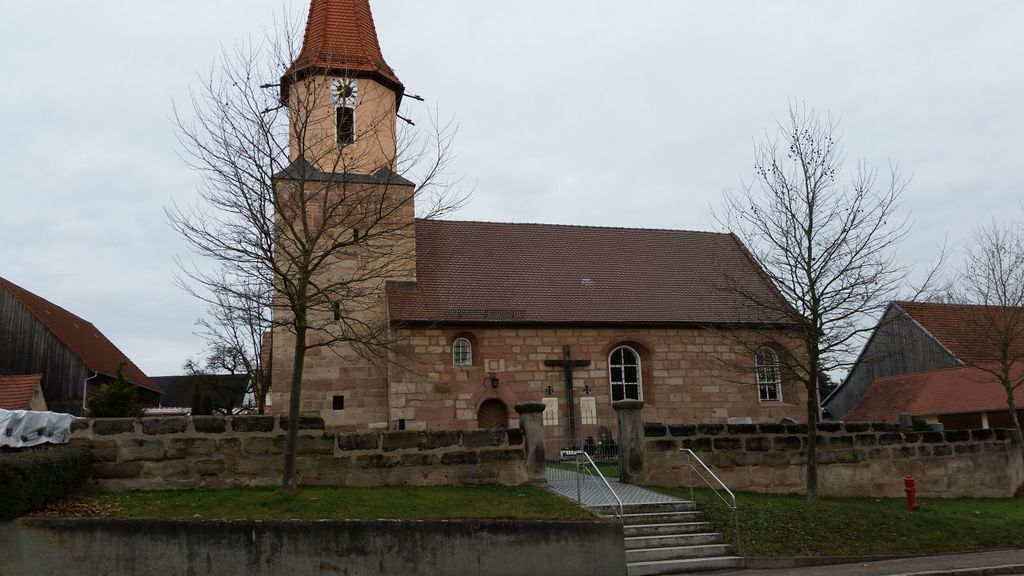
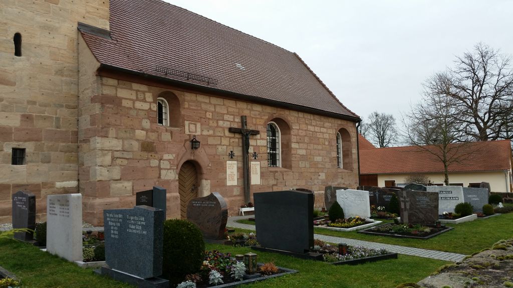
| Description | : | The cemetery is situated around the St. Walburga church. other cemeteries in the county of Roth (Landkreis Roth CScnty=4898): ► Cemeteries in Roth County |
frequently asked questions (FAQ):
-
Where is Sindersdorf?
Sindersdorf is located at Sindersdorf 22 Sindersdorf, Landkreis Roth ,Bavaria (Bayern) , 91161Germany.
-
Sindersdorf cemetery's updated grave count on graveviews.com?
0 memorials
-
Where are the coordinates of the Sindersdorf?
Latitude: 49.1634500
Longitude: 11.2733700
Nearby Cemetories:
1. Pfarrkirche Sankt Georg
Sulzkirchen, Landkreis Neumarkt in der Oberpfalz, Germany
Coordinate: 49.1670680, 11.3577990
2. Friedhof Hilpoltstein
Hilpoltstein, Landkreis Roth, Germany
Coordinate: 49.1923294, 11.1879009
3. Friedhof St. Michael
Thalmassing, Landkreis Roth, Germany
Coordinate: 49.0845630, 11.2118376
4. Schlosskirche Sankt Michael
Sulzburg, Landkreis Neumarkt in der Oberpfalz, Germany
Coordinate: 49.1824359, 11.4098132
5. Friedhof Greding
Greding, Landkreis Roth, Germany
Coordinate: 49.0478900, 11.3518400
6. Friedhofskirche St. Ulrich
Röttenbach, Landkreis Roth, Germany
Coordinate: 49.1516760, 11.0354160
7. Friedhof Georgensgmünd
Georgensgmund, Landkreis Roth, Germany
Coordinate: 49.1878500, 11.0113370
8. Neuer Friedhof Enkering
Enkering, Landkreis Eichstätt, Germany
Coordinate: 48.9971671, 11.3587933
9. Neumarkt Ausländerfriedhof
Neumarkt in der Oberpfalz, Landkreis Neumarkt in der Oberpfalz, Germany
Coordinate: 49.2842780, 11.4804560
10. Kriegsgräberstätte Neumarkt in der Oberpfalz
Neumarkt in der Oberpfalz, Landkreis Neumarkt in der Oberpfalz, Germany
Coordinate: 49.2842032, 11.4810424
11. Alter Friedhof Enkering
Enkering, Landkreis Eichstätt, Germany
Coordinate: 48.9913051, 11.3648874
12. Friedhof Deining
Deining, Landkreis Neumarkt in der Oberpfalz, Germany
Coordinate: 49.2276500, 11.5457400
13. Gemeindefriedhof
Schwarzenbruck, Nürnberger Land, Germany
Coordinate: 49.3586173, 11.2447236
14. Saint Martin's Church
Oberhochstatt, Landkreis Weißenburg-Gunzenhausen, Germany
Coordinate: 49.0330600, 11.0422900
15. Friedhof Sperbersloher Straße (Evang.-Luth.)
Wendelstein, Landkreis Roth, Germany
Coordinate: 49.3501010, 11.1572540
16. St. Johannes der Täufer
Pfahldorf, Landkreis Eichstätt, Germany
Coordinate: 48.9600022, 11.3322031
17. Neuer Friedhof Feucht
Feucht, Nürnberger Land, Germany
Coordinate: 49.3682460, 11.2058060
18. Friedhof Wendelstein
Wendelstein, Landkreis Roth, Germany
Coordinate: 49.3561100, 11.1447730
19. Waldfriedhof Wendelstein
Wendelstein, Landkreis Roth, Germany
Coordinate: 49.3560640, 11.1388390
20. Alter Friedhof Feucht
Feucht, Nürnberger Land, Germany
Coordinate: 49.3732266, 11.2131881
21. Friedhof Batzhausen
Batzhausen, Landkreis Neumarkt in der Oberpfalz, Germany
Coordinate: 49.1892345, 11.6031218
22. Sornhüll
Pollenfeld, Landkreis Eichstätt, Germany
Coordinate: 48.9458702, 11.2743813
23. Friedhof Pilsach
Pilsach, Landkreis Neumarkt in der Oberpfalz, Germany
Coordinate: 49.3210521, 11.5063779
24. Friedhof Kornburg
Kornburg, Stadtkreis Nürnberg, Germany
Coordinate: 49.3532070, 11.0988770