
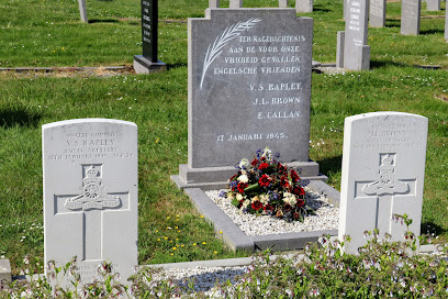
| Memorials | : | 0 |
| Location | : | Sint Annaland, Tholen Municipality, Netherlands |
| Coordinate | : | 51.6011400, 4.1004100 |
| Description | : | Sint Annaland is a town on the former island of Tholen. It is part of the Tholen municipality, located in the province of Zeeland in the south-western Netherlands. It lies approx 18km north west of Bergen op Zoom. |
frequently asked questions (FAQ):
-
Where is Sint-Annaland Old General Cemetery?
Sint-Annaland Old General Cemetery is located at Weststraat Sint Annaland, Tholen Municipality ,Zeeland ,Netherlands.
-
Sint-Annaland Old General Cemetery cemetery's updated grave count on graveviews.com?
0 memorials
-
Where are the coordinates of the Sint-Annaland Old General Cemetery?
Latitude: 51.6011400
Longitude: 4.1004100
Nearby Cemetories:
1. Algemene Begraafplaats Sint Annaland
Sint Annaland, Tholen Municipality, Netherlands
Coordinate: 51.6000003, 4.0949592
2. Algemene Begraafplaats
Anna Jacobapolder, Tholen Municipality, Netherlands
Coordinate: 51.6403178, 4.1252910
3. Nieuwe Begraafplaats
Sint Philipsland, Tholen Municipality, Netherlands
Coordinate: 51.6202420, 4.1645785
4. Oude begraafplaats Sint Philipsland
Sint Philipsland, Tholen Municipality, Netherlands
Coordinate: 51.6196092, 4.1670848
5. Oude Begraafplaats
Sint Maartensdijk, Tholen Municipality, Netherlands
Coordinate: 51.5510907, 4.0775650
6. Begraafplaats Molenhof
Bruinisse, Schouwen-Duiveland Municipality, Netherlands
Coordinate: 51.6578111, 4.0906111
7. Algemene Begraafplaats Stavenisse
Stavenisse, Tholen Municipality, Netherlands
Coordinate: 51.5880304, 4.0098963
8. Bruinisse Oude Begraafplaats
Bruinisse, Schouwen-Duiveland Municipality, Netherlands
Coordinate: 51.6589700, 4.0913900
9. Algemene Begraafplaats Oosterland
Oosterland, Schouwen-Duiveland Municipality, Netherlands
Coordinate: 51.6449918, 4.0360346
10. Jodocuskerk
Oosterland, Schouwen-Duiveland Municipality, Netherlands
Coordinate: 51.6478787, 4.0355074
11. Kerkhof Rooms Katholieke kerk Nieuw-Vossemeer
Nieuw-Vossemeer, Steenbergen Municipality, Netherlands
Coordinate: 51.5874280, 4.2160028
12. Nieuwerkerk
Nieuwerkerk, Schouwen-Duiveland Municipality, Netherlands
Coordinate: 51.6508253, 4.0097262
13. Begraafplaats Ouwerkerk
Ouwerkerk, Schouwen-Duiveland Municipality, Netherlands
Coordinate: 51.6243089, 3.9826324
14. Begraafplaats Nieuwerkerk
Nieuwerkerk, Schouwen-Duiveland Municipality, Netherlands
Coordinate: 51.6476363, 4.0005802
15. Sirjansland Cemetery
Sirjansland, Schouwen-Duiveland Municipality, Netherlands
Coordinate: 51.6753300, 4.0347700
16. Begraafplaats Capelle
Nieuwerkerk, Schouwen-Duiveland Municipality, Netherlands
Coordinate: 51.6455209, 3.9684963
17. Algemene Begraafplaats
Tholen Municipality, Netherlands
Coordinate: 51.5379869, 4.2241721
18. Rooms Katholieke Begraafplaats de Heen
De Heen, Steenbergen Municipality, Netherlands
Coordinate: 51.6027879, 4.2729201
19. Begraafplaats De Boschburg
Yerseke, Reimerswaal Municipality, Netherlands
Coordinate: 51.4970586, 4.0475950
20. Herkingen General Cemetery
Herkingen, Goeree-Overflakkee Municipality, Netherlands
Coordinate: 51.7118100, 4.0919500
21. Oude-Tonge Nieuwe Begraafplaats
Oude-Tonge, Goeree-Overflakkee Municipality, Netherlands
Coordinate: 51.6921500, 4.2026800
22. Rooms-Katholieke Begraafplaats
Oude-Tonge, Goeree-Overflakkee Municipality, Netherlands
Coordinate: 51.6920597, 4.2035094
23. Yerseke General Cemetery
Yerseke, Reimerswaal Municipality, Netherlands
Coordinate: 51.4949200, 4.0455800
24. Oude-Tonge Begraafplaats Waternood 1953
Oude-Tonge, Goeree-Overflakkee Municipality, Netherlands
Coordinate: 51.6884600, 4.2146300