
| Memorials | : | 1 |
| Location | : | Jackson County, USA |
| Coordinate | : | 38.8656500, -94.1731500 |
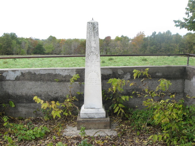
| Description | : | Also known as Confederate Cemetery. To visit the cemetery, inquire at the Lone Jack Battlefield Museum for directions and information on getting permission as it's located on private land. On September 6, 1863, Union troops arrested six men from the Lone Jack area who were suspected of aiding Confederate bushwhackers in the area. They took them away from their families into a nearby field and shot them. Their families, who were preparing to leave the county in obedience to Gen. Ewing's General Order No. 11, only had time to wrap them in quilts and bury them where they fell. All six of... Read More |
frequently asked questions (FAQ):
-
Where is Six Man Cemetery?
Six Man Cemetery is located at Jackson County ,Missouri ,USA.
-
Six Man Cemetery cemetery's updated grave count on graveviews.com?
1 memorials
-
Where are the coordinates of the Six Man Cemetery?
Latitude: 38.8656500
Longitude: -94.1731500
Nearby Cemetories:
1. Lone Jack Battlefield Cemetery
Lone Jack, Jackson County, USA
Coordinate: 38.8652992, -94.1722031
2. Lone Jack Cemetery
Lone Jack, Jackson County, USA
Coordinate: 38.8679695, -94.1600723
3. Pleasant Gardens Cemetery
Lone Jack, Jackson County, USA
Coordinate: 38.8547800, -94.1903000
4. Yankee Cemetery
Lone Jack, Jackson County, USA
Coordinate: 38.8645200, -94.1406400
5. Underwood Cemetery
Lone Jack, Jackson County, USA
Coordinate: 38.8630981, -94.1222000
6. Adams Cemetery
Lone Jack, Jackson County, USA
Coordinate: 38.9068985, -94.2230988
7. Reed Cemetery
Pleasant Hill, Cass County, USA
Coordinate: 38.8080286, -94.1732597
8. Basin Knob Cemetery
Kingsville, Johnson County, USA
Coordinate: 38.8460999, -94.0892029
9. Gosney Cemetery
Lone Jack, Jackson County, USA
Coordinate: 38.9333000, -94.1928024
10. Gosney Cemetery
Clay County, USA
Coordinate: 38.9332900, -94.1931600
11. Corn Cemetery
Lee's Summit, Jackson County, USA
Coordinate: 38.9352989, -94.1744003
12. Hill Cemetery
Johnson County, USA
Coordinate: 38.9035988, -94.0963974
13. Perdue Cemetery
Oak Grove, Jackson County, USA
Coordinate: 38.9340800, -94.2029400
14. Alley Cemetery
Lake Lotawana, Jackson County, USA
Coordinate: 38.9261017, -94.2249985
15. Sni-Mills Holiness Cemetery
Lone Jack, Jackson County, USA
Coordinate: 38.9369400, -94.1374300
16. Sloan Cemetery
Baldwin Park, Cass County, USA
Coordinate: 38.7980995, -94.2247009
17. Koger Cemetery
Oak Grove, Jackson County, USA
Coordinate: 38.9494019, -94.1913986
18. Cummins Cemetery
Oak Grove, Jackson County, USA
Coordinate: 38.9506700, -94.1516100
19. Lundy Cemetery
Johnson County, USA
Coordinate: 38.8278008, -94.0727997
20. Shore Cemetery
Lafayette County, USA
Coordinate: 38.9244003, -94.0817032
21. Pleasant Hill Cemetery
Pleasant Hill, Cass County, USA
Coordinate: 38.8046989, -94.2658005
22. Floral Hills East Memorial Gardens
Lee's Summit, Jackson County, USA
Coordinate: 38.8967094, -94.2924805
23. Corn Cemetery
Oak Grove, Jackson County, USA
Coordinate: 38.9614100, -94.1357500
24. Elm Spring Baptist Church Cemetery
Kingsville, Johnson County, USA
Coordinate: 38.8559952, -94.0429993