
| Memorials | : | 3 |
| Location | : | Kingsville, Johnson County, USA |
| Phone | : | (816) 697-2698 |
| Coordinate | : | 38.8559952, -94.0429993 |
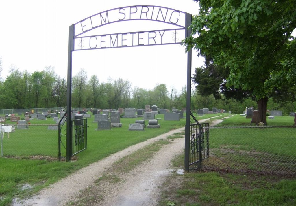
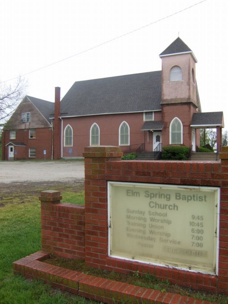
| Description | : | On the west side of town driving east on Hwy NW 50, turn south onto NW 1601 St and continue for a few blocks. The cemetery will be on your right or the west side of the street behind the Elm Springs Baptist Church. This cemetery is owned and maintained by the Elm Springs Baptist Church, which dates back to the late 1800s. The church records were destroyed in 1920 due to a fire, thus if there is not a stone there is no record |
frequently asked questions (FAQ):
-
Where is Elm Spring Baptist Church Cemetery?
Elm Spring Baptist Church Cemetery is located at 570 NW 1601 Street Kingsville, Johnson County ,Missouri ,USA.
-
Elm Spring Baptist Church Cemetery cemetery's updated grave count on graveviews.com?
3 memorials
-
Where are the coordinates of the Elm Spring Baptist Church Cemetery?
Latitude: 38.8559952
Longitude: -94.0429993
Nearby Cemetories:
1. Lundy Cemetery
Johnson County, USA
Coordinate: 38.8278008, -94.0727997
2. Basin Knob Cemetery
Kingsville, Johnson County, USA
Coordinate: 38.8460999, -94.0892029
3. Pittsville Cemetery
Pittsville, Johnson County, USA
Coordinate: 38.8507150, -93.9853590
4. Wesley Chapel Cemetery
Kingsville, Johnson County, USA
Coordinate: 38.8011470, -94.0465880
5. Wesley Chapel Cemetery
Kingsville, Johnson County, USA
Coordinate: 38.8011300, -94.0466200
6. Cobb Cemetery
Odessa, Lafayette County, USA
Coordinate: 38.9115500, -94.0126800
7. Cobb Cemetery
Johnson County, USA
Coordinate: 38.9117012, -94.0128021
8. Underwood Cemetery
Lone Jack, Jackson County, USA
Coordinate: 38.8630981, -94.1222000
9. Hill Cemetery
Johnson County, USA
Coordinate: 38.9035988, -94.0963974
10. Woods Chapel Cemetery
Odessa, Lafayette County, USA
Coordinate: 38.8883530, -93.9694710
11. Wood's Chapel Cemetery
Johnson County, USA
Coordinate: 38.8884100, -93.9684700
12. McKendree Cemetery
Chapel Hill, Lafayette County, USA
Coordinate: 38.9217110, -93.9972610
13. Shore Cemetery
Lafayette County, USA
Coordinate: 38.9244003, -94.0817032
14. Blackwater Cemetery
Holden, Johnson County, USA
Coordinate: 38.8282900, -93.9533500
15. Yankee Cemetery
Lone Jack, Jackson County, USA
Coordinate: 38.8645200, -94.1406400
16. Rock Springs Cemetery
Holden, Johnson County, USA
Coordinate: 38.7754517, -93.9978867
17. Bluff Springs Cemetery
Kingsville, Johnson County, USA
Coordinate: 38.7703018, -94.0768967
18. Lone Jack Cemetery
Lone Jack, Jackson County, USA
Coordinate: 38.8679695, -94.1600723
19. Countryside Community Cemetery
Johnson County, USA
Coordinate: 38.9051690, -93.9377540
20. Old Concord Baptist Cemetery
Chapel Hill, Lafayette County, USA
Coordinate: 38.9520656, -94.0683365
21. Lone Jack Battlefield Cemetery
Lone Jack, Jackson County, USA
Coordinate: 38.8652992, -94.1722031
22. Six Man Cemetery
Jackson County, USA
Coordinate: 38.8656500, -94.1731500
23. Concord Cemetery
Bates City, Lafayette County, USA
Coordinate: 38.9586182, -94.0532761
24. Sni-Mills Holiness Cemetery
Lone Jack, Jackson County, USA
Coordinate: 38.9369400, -94.1374300